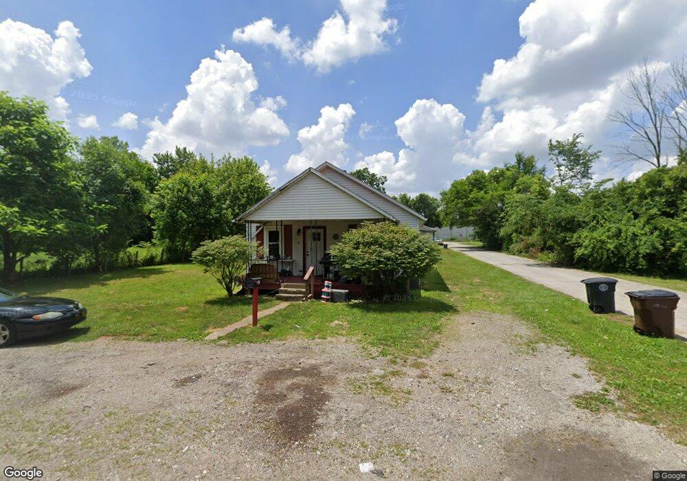
283 Lensdale Ave Dayton, OH 45417
Estimated Value: $41,000 - $89,000
2
Beds
1
Bath
872
Sq Ft
$74/Sq Ft
Est. Value
About This Home
This home is located at 283 Lensdale Ave, Dayton, OH 45417 and is currently estimated at $64,675, approximately $74 per square foot. 283 Lensdale Ave is a home located in Montgomery County with nearby schools including International School at Residence Park, Westwood Elementary, and Louise Troy Elementary.
Ownership History
Date
Name
Owned For
Owner Type
Purchase Details
Closed on
Oct 21, 2016
Sold by
Smith Bill and Smith Iris
Bought by
Swisher Tom and Swisher Julie A
Current Estimated Value
Purchase Details
Closed on
Jul 14, 2016
Sold by
Dillon Mary A
Bought by
Smith Bill and Smith Iris G
Purchase Details
Closed on
Mar 27, 2008
Sold by
Estate Of Donnie Ray Goff
Bought by
Dillon Mary A
Purchase Details
Closed on
Feb 6, 2004
Sold by
Northern Ronald W
Bought by
Goff Donnie R
Purchase Details
Closed on
Nov 16, 1999
Sold by
Northern Cordelia K
Bought by
Northern Ronald W
Home Financials for this Owner
Home Financials are based on the most recent Mortgage that was taken out on this home.
Original Mortgage
$13,742
Interest Rate
9%
Mortgage Type
Seller Take Back
Create a Home Valuation Report for This Property
The Home Valuation Report is an in-depth analysis detailing your home's value as well as a comparison with similar homes in the area
Home Values in the Area
Average Home Value in this Area
Purchase History
| Date | Buyer | Sale Price | Title Company |
|---|---|---|---|
| Swisher Tom | $5,000 | None Available | |
| Smith Bill | $5,000 | None Available | |
| Dillon Mary A | -- | None Available | |
| Goff Donnie R | $32,500 | -- | |
| Northern Ronald W | $23,800 | -- | |
| Northern Ronald W | $23,742 | -- |
Source: Public Records
Mortgage History
| Date | Status | Borrower | Loan Amount |
|---|---|---|---|
| Previous Owner | Northern Ronald W | $13,742 |
Source: Public Records
Tax History Compared to Growth
Tax History
| Year | Tax Paid | Tax Assessment Tax Assessment Total Assessment is a certain percentage of the fair market value that is determined by local assessors to be the total taxable value of land and additions on the property. | Land | Improvement |
|---|---|---|---|---|
| 2024 | $703 | $7,380 | $760 | $6,620 |
| 2023 | $703 | $7,380 | $760 | $6,620 |
| 2022 | $836 | $6,990 | $720 | $6,270 |
| 2021 | $834 | $6,990 | $720 | $6,270 |
| 2020 | $816 | $6,990 | $720 | $6,270 |
| 2019 | $636 | $6,820 | $650 | $6,170 |
| 2018 | $836 | $6,820 | $650 | $6,170 |
| 2017 | $632 | $6,820 | $650 | $6,170 |
| 2016 | $689 | $6,940 | $720 | $6,220 |
| 2015 | $325 | $6,940 | $720 | $6,220 |
| 2014 | $325 | $6,940 | $720 | $6,220 |
| 2012 | -- | $16,070 | $3,050 | $13,020 |
Source: Public Records
Map
Nearby Homes
- 175 N Northampton Ave
- 51 N Northampton Ave
- 764 Miller Ave
- 6236 Carmin Ave
- 71 Elkins Ave
- 6925 W Third St
- 0 Meeker Woods Unit 884863
- 201 Parsons Ave
- 72 Patton Ave
- 217 Parsons Ave
- 5328 Whaley Dr
- 773 Goodlow Ave
- 775 Goodlow Ave
- 5357 Dushore Dr
- 5116 Rucks Rd
- 5396 Dushore Dr
- 720 Mia Ave
- 4643 Laurel Dr
- 1303 Graystone Dr
- 4615 Dayview Ave
- 269 Lensdale Ave
- 280 Norfolk Ave
- 284 Lensdale Ave
- 264 Norfolk Ave
- 270 Lensdale Ave
- 246 Norfolk Ave
- 6521 Nathaniel St
- 229 Lensdale Ave
- 240 Lensdale Ave
- 300 Lensdale Ave
- 238 Lensdale Ave
- 271 Penrod Ave
- 214 Norfolk Ave
- 263 Penrod Ave
- 255 Penrod Ave
- 208 Lensdale Ave
- 197 Lensdale Ave
- 320 Norfolk Ave
- 6401 Nathaniel St
- 237 Penrod Ave