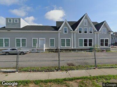
283 Melrose St Auburndale, MA 02466
Auburndale NeighborhoodEstimated Value: $3,701,607
4
Beds
2
Baths
10,746
Sq Ft
$344/Sq Ft
Est. Value
About This Home
This home is located at 283 Melrose St, Auburndale, MA 02466 and is currently priced at $3,701,607, approximately $344 per square foot. 283 Melrose St is a home located in Middlesex County with nearby schools including C.C. Burr, F.A. Day Middle School, and Newton North High School.
Ownership History
Date
Name
Owned For
Owner Type
Purchase Details
Closed on
Feb 21, 2018
Sold by
Zeles Barbara T and Zeles Marian A
Bought by
Turtle Lane Llc
Current Estimated Value
Home Financials for this Owner
Home Financials are based on the most recent Mortgage that was taken out on this home.
Original Mortgage
$9,430,000
Outstanding Balance
$8,113,538
Interest Rate
3.99%
Mortgage Type
Purchase Money Mortgage
Create a Home Valuation Report for This Property
The Home Valuation Report is an in-depth analysis detailing your home's value as well as a comparison with similar homes in the area
Home Values in the Area
Average Home Value in this Area
Purchase History
| Date | Buyer | Sale Price | Title Company |
|---|---|---|---|
| Turtle Lane Llc | -- | -- |
Source: Public Records
Mortgage History
| Date | Status | Borrower | Loan Amount |
|---|---|---|---|
| Open | Turtle Lane Llc | $700,000 | |
| Open | Turtle Lane Llc | $9,430,000 | |
| Previous Owner | Turtle Lane Llc | $300,000 | |
| Previous Owner | Turtle Lane Llc | $2,900,000 | |
| Previous Owner | Turtle Lane Llc | $300,000 | |
| Previous Owner | Turtle Lane Llc | $1,600,000 |
Source: Public Records
Tax History Compared to Growth
Tax History
| Year | Tax Paid | Tax Assessment Tax Assessment Total Assessment is a certain percentage of the fair market value that is determined by local assessors to be the total taxable value of land and additions on the property. | Land | Improvement |
|---|---|---|---|---|
| 2025 | $0 | $2,669,900 | $1,569,200 | $1,100,700 |
| 2024 | $44,989 | $3,588,800 | $1,569,200 | $2,019,600 |
| 2023 | $0 | $3,484,200 | $1,508,800 | $1,975,400 |
| 2022 | $44,989 | $2,255,100 | $1,335,400 | $919,700 |
| 2021 | $45,373 | $2,255,100 | $1,335,400 | $919,700 |
| 2020 | $11,160 | $2,255,100 | $1,335,400 | $919,700 |
| 2019 | $11,402 | $2,255,100 | $1,335,400 | $919,700 |
| 2018 | $41,910 | $2,032,500 | $1,214,100 | $818,400 |
| 2017 | $8,679 | $1,974,700 | $1,156,300 | $818,400 |
| 2016 | $32,307 | $1,472,500 | $578,400 | $894,100 |
| 2015 | $32,955 | $1,472,500 | $578,400 | $894,100 |
Source: Public Records
Map
Nearby Homes
- 2171 Commonwealth Ave
- 271 Auburn St
- 217 Melrose St Unit 217
- 219 Melrose St Unit 1
- 2202 Commonwealth Ave Unit 4
- 218 Melrose St
- 27 Central Terrace
- 47 Woodland Rd
- 2031 Commonwealth Ave
- 226 Auburn St Unit 226
- 18 Groveland St
- 17-19 Maple St
- 31 Chaske Ave
- 5 Ionia St
- 7 Johnson Place Unit 7
- 194 Auburn St Unit 2
- 194 Auburn St
- 25-27 Johnson Place
- 27 Johnson Place Unit 27
- 25 Johnson Place
- 283 Melrose St
- 23 Ash St
- 23 Ash St Unit 2
- 23 Ash St Unit 1
- 267 Melrose St
- 27 Ash St Unit 1
- 280 Melrose St Unit 282
- 280 Melrose St Unit A
- 280 Melrose St Unit B
- 278 Melrose St
- 286 Melrose St Unit 2
- 20 Ash St
- 27 Melrose Ave Unit 29
- 27 Melrose Ave Unit 27
- 29 Melrose Ave
- 261 Melrose St Unit 2
- 261 Melrose St Unit 1
- 261 Melrose St
- 268 Melrose St
- 268 Melrose St Unit 2