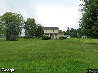
2830 S Main St Princeton, IL 61356
Estimated Value: $192,625 - $232,000
3
Beds
2
Baths
1,648
Sq Ft
$125/Sq Ft
Est. Value
About This Home
This home is located at 2830 S Main St, Princeton, IL 61356 and is currently estimated at $205,906, approximately $124 per square foot. 2830 S Main St is a home located in Bureau County with nearby schools including Lincoln Elementary School, Jefferson Elementary School, and Logan Junior High School.
Ownership History
Date
Name
Owned For
Owner Type
Purchase Details
Closed on
Apr 13, 2018
Sold by
Roth Marie K and Purkey Marie K
Bought by
Youman Daniel R and Youman Terri L
Current Estimated Value
Home Financials for this Owner
Home Financials are based on the most recent Mortgage that was taken out on this home.
Original Mortgage
$93,750
Outstanding Balance
$81,854
Interest Rate
4.46%
Mortgage Type
New Conventional
Estimated Equity
$111,344
Create a Home Valuation Report for This Property
The Home Valuation Report is an in-depth analysis detailing your home's value as well as a comparison with similar homes in the area
Home Values in the Area
Average Home Value in this Area
Purchase History
| Date | Buyer | Sale Price | Title Company |
|---|---|---|---|
| Youman Daniel R | -- | None Available |
Source: Public Records
Mortgage History
| Date | Status | Borrower | Loan Amount |
|---|---|---|---|
| Open | Youman Daniel R | $93,750 | |
| Previous Owner | Roth Mark K | $15,000 |
Source: Public Records
Tax History Compared to Growth
Tax History
| Year | Tax Paid | Tax Assessment Tax Assessment Total Assessment is a certain percentage of the fair market value that is determined by local assessors to be the total taxable value of land and additions on the property. | Land | Improvement |
|---|---|---|---|---|
| 2024 | $3,268 | $53,742 | $4,230 | $49,512 |
| 2023 | $3,268 | $49,496 | $3,896 | $45,600 |
| 2022 | $3,073 | $46,406 | $3,653 | $42,753 |
| 2021 | $3,000 | $43,928 | $3,458 | $40,470 |
| 2020 | $2,938 | $42,319 | $3,331 | $38,988 |
| 2019 | $2,938 | $41,813 | $3,291 | $38,522 |
| 2018 | $2,117 | $41,098 | $3,235 | $37,863 |
| 2017 | $1,012 | $26,081 | $3,247 | $22,834 |
| 2016 | $1,016 | $25,400 | $3,162 | $22,238 |
| 2015 | -- | $21,849 | $0 | $21,849 |
| 2014 | -- | $24,955 | $3,106 | $21,849 |
| 2013 | -- | $25,091 | $3,123 | $21,968 |
Source: Public Records
Map
Nearby Homes
- 703 Bryant Circle Dr
- 1428 S Euclid Ave
- 1217 S Church St
- 933 S 5th St
- 0 Park Ave W
- 1017 S 6th St Unit 1
- 423 S Randolph St
- 940 Sunshine Dr
- 920 Sunshine Dr
- 545 S 5th St
- 719 Park Ave E
- 520 W Crown St
- 305 S Chestnut St
- 504 Harvey Dr
- 426 W Putnam St
- 324 N 1st St
- 232 N Euclid Ave
- 314 N Euclid Ave
- 509 N Main St
- 320 Cedarhaven Dr