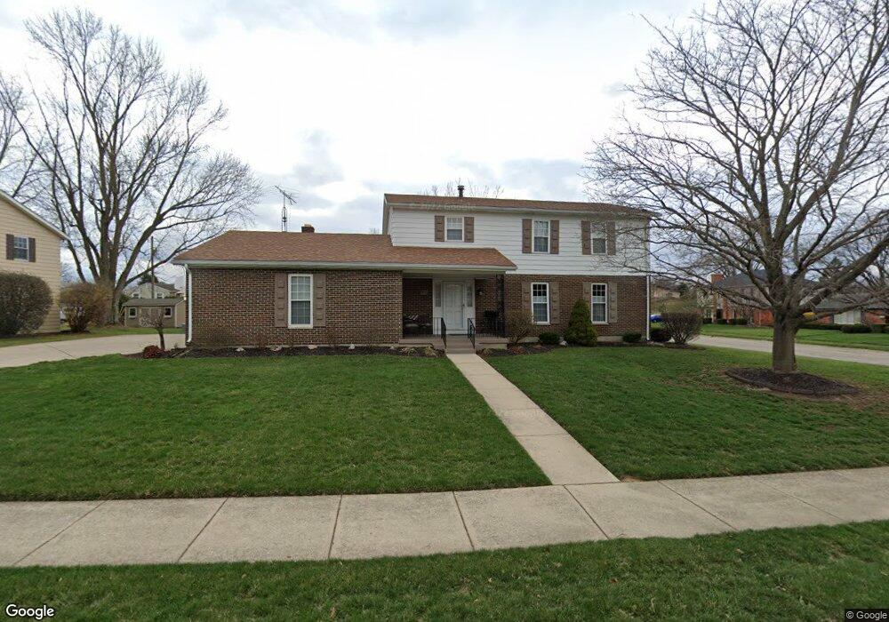
2831 Balsam Dr Springfield, OH 45503
Estimated Value: $298,689 - $335,000
4
Beds
3
Baths
2,338
Sq Ft
$133/Sq Ft
Est. Value
About This Home
This home is located at 2831 Balsam Dr, Springfield, OH 45503 and is currently estimated at $311,922, approximately $133 per square foot. 2831 Balsam Dr is a home located in Clark County with nearby schools including Kenton Elementary School, Roosevelt Middle School, and Springfield High School.
Ownership History
Date
Name
Owned For
Owner Type
Purchase Details
Closed on
May 1, 2015
Sold by
Nicolas Claude G and Nicolas Janet R
Bought by
Dennis Martin D and Dennis Carrie D
Current Estimated Value
Home Financials for this Owner
Home Financials are based on the most recent Mortgage that was taken out on this home.
Original Mortgage
$147,250
Outstanding Balance
$54,760
Interest Rate
3.68%
Mortgage Type
New Conventional
Estimated Equity
$257,162
Purchase Details
Closed on
Sep 29, 1997
Sold by
First Church Of Nazarene
Bought by
Nicholas Claude G and Nicholas Janet
Home Financials for this Owner
Home Financials are based on the most recent Mortgage that was taken out on this home.
Original Mortgage
$110,000
Interest Rate
7.63%
Mortgage Type
New Conventional
Purchase Details
Closed on
Jun 14, 1988
Create a Home Valuation Report for This Property
The Home Valuation Report is an in-depth analysis detailing your home's value as well as a comparison with similar homes in the area
Home Values in the Area
Average Home Value in this Area
Purchase History
| Date | Buyer | Sale Price | Title Company |
|---|---|---|---|
| Dennis Martin D | $155,000 | Attorney | |
| Nicholas Claude G | $110,000 | -- | |
| -- | $110,000 | -- |
Source: Public Records
Mortgage History
| Date | Status | Borrower | Loan Amount |
|---|---|---|---|
| Open | Dennis Martin D | $147,250 | |
| Closed | Nicholas Claude G | $110,000 |
Source: Public Records
Tax History Compared to Growth
Tax History
| Year | Tax Paid | Tax Assessment Tax Assessment Total Assessment is a certain percentage of the fair market value that is determined by local assessors to be the total taxable value of land and additions on the property. | Land | Improvement |
|---|---|---|---|---|
| 2024 | $3,291 | $68,270 | $12,010 | $56,260 |
| 2023 | $3,291 | $68,270 | $12,010 | $56,260 |
| 2022 | $3,371 | $68,270 | $12,010 | $56,260 |
| 2021 | $2,625 | $49,100 | $9,170 | $39,930 |
| 2020 | $2,631 | $49,100 | $9,170 | $39,930 |
| 2019 | $2,638 | $49,100 | $9,170 | $39,930 |
| 2018 | $3,052 | $54,500 | $9,150 | $45,350 |
| 2017 | $3,049 | $52,354 | $9,153 | $43,201 |
| 2016 | $3,053 | $52,354 | $9,153 | $43,201 |
| 2015 | $2,600 | $46,606 | $8,715 | $37,891 |
| 2014 | $2,091 | $46,606 | $8,715 | $37,891 |
| 2013 | $2,069 | $46,606 | $8,715 | $37,891 |
Source: Public Records
Map
Nearby Homes
- 537 Rensselaer St
- 2677 Carousel Dr
- 2813 Wellsford Dr
- 2540 Rebecca Dr
- 2933 Stonehaven Dr
- 2516 Balsam Dr
- 2408 Balsam Dr
- 2524 Home Orchard Dr
- 732 Grandview Dr Unit 732
- 2933 Bahia Dr
- 2683 Home Orchard Dr
- 647 Villa Rd Unit A
- 542 Villa Rd
- 1225 Vester Ave
- 2541 Derr Rd
- 2642 Kilkenny Ct
- 115 E Home Rd
- 0 E Home Rd
- 2823 Balsam Dr
- 549 Rensselaer St
- 554 Rensselaer St
- 548 Rensselaer St
- 2840 Balsam Dr
- 550 Rebecca Dr
- 541 Rensselaer St
- 2832 Balsam Dr
- 2815 Balsam Dr
- 546 Rebecca Dr
- 2915 Balsam Dr
- 2816 Balsam Dr
- 2908 Balsam Dr
- 2917 Balsam Dr
- 2917 Balsam Dr
- 542 Rebecca Dr
- 2919 Balsam Dr
- 2921 Balsam Dr Unit 2921
- 608 Rebecca Dr
- 536 Rensselaer St