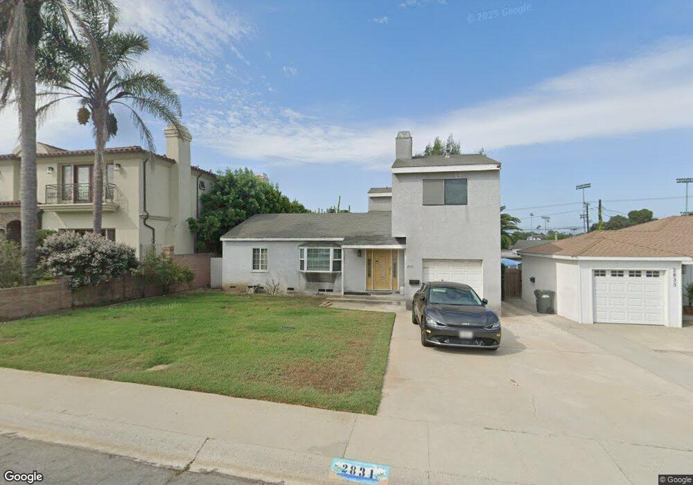
2831 May Ave Redondo Beach, CA 90278
North Redondo Beach NeighborhoodEstimated Value: $1,698,334 - $2,040,000
4
Beds
3
Baths
1,987
Sq Ft
$945/Sq Ft
Est. Value
About This Home
This home is located at 2831 May Ave, Redondo Beach, CA 90278 and is currently estimated at $1,878,584, approximately $945 per square foot. 2831 May Ave is a home located in Los Angeles County with nearby schools including Lincoln Elementary School, Adams Middle School, and Redondo Union High School.
Ownership History
Date
Name
Owned For
Owner Type
Purchase Details
Closed on
Aug 25, 2025
Sold by
Meas Bouda
Bought by
2024 Bouda Meas Revocable Living Trust and Meas
Current Estimated Value
Purchase Details
Closed on
Dec 30, 1997
Sold by
Meas Damnang
Bought by
Meas Bouda
Home Financials for this Owner
Home Financials are based on the most recent Mortgage that was taken out on this home.
Original Mortgage
$198,000
Interest Rate
7.13%
Purchase Details
Closed on
Jun 28, 1996
Sold by
Pleet Dorothy A
Bought by
Meas Bouda and Meas Damnang
Home Financials for this Owner
Home Financials are based on the most recent Mortgage that was taken out on this home.
Original Mortgage
$204,000
Interest Rate
8.2%
Mortgage Type
Balloon
Create a Home Valuation Report for This Property
The Home Valuation Report is an in-depth analysis detailing your home's value as well as a comparison with similar homes in the area
Home Values in the Area
Average Home Value in this Area
Purchase History
| Date | Buyer | Sale Price | Title Company |
|---|---|---|---|
| 2024 Bouda Meas Revocable Living Trust | -- | None Listed On Document | |
| Meas Bouda | -- | Stewart Title | |
| Meas Bouda | $240,000 | Investors Title Company |
Source: Public Records
Mortgage History
| Date | Status | Borrower | Loan Amount |
|---|---|---|---|
| Previous Owner | Meas Bouda | $198,000 | |
| Previous Owner | Meas Bouda | $204,000 |
Source: Public Records
Tax History Compared to Growth
Tax History
| Year | Tax Paid | Tax Assessment Tax Assessment Total Assessment is a certain percentage of the fair market value that is determined by local assessors to be the total taxable value of land and additions on the property. | Land | Improvement |
|---|---|---|---|---|
| 2025 | $6,112 | $470,858 | $355,938 | $114,920 |
| 2024 | $6,112 | $461,626 | $348,959 | $112,667 |
| 2023 | $6,009 | $452,575 | $342,117 | $110,458 |
| 2022 | $5,889 | $443,702 | $335,409 | $108,293 |
| 2021 | $5,724 | $435,003 | $328,833 | $106,170 |
| 2019 | $5,575 | $422,103 | $319,081 | $103,022 |
| 2018 | $5,401 | $413,827 | $312,825 | $101,002 |
| 2016 | $5,216 | $397,760 | $300,679 | $97,081 |
| 2015 | $5,127 | $391,786 | $296,163 | $95,623 |
| 2014 | $5,058 | $384,112 | $290,362 | $93,750 |
Source: Public Records
Map
Nearby Homes
- 2861 Pinckard Ave
- 2216 Bataan Rd Unit A
- 2410 Vail Ave
- 2206 Gates Ave Unit B
- 2206 Gates Ave
- 2206 Gates Ave Unit A
- 2209 Curtis Ave Unit 4
- 2517 Curtis Ave
- 2226 Voorhees Ave
- 3310 Blossom Ln
- 2113 Voorhees Ave Unit D
- 2211 Vail Ave
- 2021 Curtis Ave
- 2313 Nelson Ave Unit A
- 3202 Green Ln
- 2213 Nelson Ave
- 4740 W 161st St
- 2616 Voorhees Ave Unit 2
- 2701 Voorhees Ave Unit 3
- 1906 Plant Ave