Estimated Value: $233,000 - $299,869
3
Beds
1
Bath
576
Sq Ft
$480/Sq Ft
Est. Value
About This Home
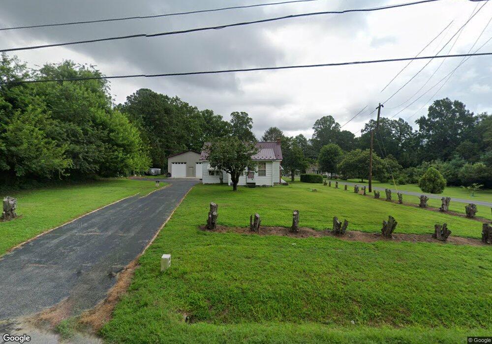
This home is located at 2836 Upper King Rd, Dover, DE 19904 and is currently estimated at $276,717, approximately $480 per square foot. 2836 Upper King Rd is a home located in Kent County with nearby schools including Nellie Hughes Stokes Elementary School, Fred Fifer Middle School, and Caesar Rodney High School.
Ownership History
Date
Name
Owned For
Owner Type
Purchase Details
Closed on
Jan 28, 2011
Sold by
Slaughter M Randall and Slaughter Holly L
Bought by
Slaughter Ii Matthew R
Current Estimated Value
Purchase Details
Closed on
Jun 10, 2005
Sold by
Clinton Carolyn D
Bought by
Slaughter M Randall and Slaughter Holly L
Home Financials for this Owner
Home Financials are based on the most recent Mortgage that was taken out on this home.
Original Mortgage
$124,000
Outstanding Balance
$64,819
Interest Rate
5.78%
Mortgage Type
New Conventional
Estimated Equity
$211,898
Create a Home Valuation Report for This Property
The Home Valuation Report is an in-depth analysis detailing your home's value as well as a comparison with similar homes in the area
Home Values in the Area
Average Home Value in this Area
Purchase History
| Date | Buyer | Sale Price | Title Company |
|---|---|---|---|
| Slaughter Ii Matthew R | -- | None Available | |
| Slaughter M Randall | $2,325 | None Available |
Source: Public Records
Mortgage History
| Date | Status | Borrower | Loan Amount |
|---|---|---|---|
| Open | Slaughter M Randall | $124,000 |
Source: Public Records
Tax History
| Year | Tax Paid | Tax Assessment Tax Assessment Total Assessment is a certain percentage of the fair market value that is determined by local assessors to be the total taxable value of land and additions on the property. | Land | Improvement |
|---|---|---|---|---|
| 2025 | $979 | $243,700 | $91,500 | $152,200 |
| 2024 | $975 | $243,700 | $91,500 | $152,200 |
| 2023 | $654 | $25,400 | $9,500 | $15,900 |
| 2022 | $618 | $25,400 | $9,500 | $15,900 |
| 2021 | $613 | $25,400 | $9,500 | $15,900 |
| 2020 | $603 | $25,400 | $9,500 | $15,900 |
| 2019 | $579 | $25,400 | $9,500 | $15,900 |
| 2018 | $559 | $25,400 | $9,500 | $15,900 |
| 2017 | $543 | $25,400 | $0 | $0 |
| 2016 | $532 | $25,400 | $0 | $0 |
| 2015 | $446 | $25,400 | $0 | $0 |
| 2014 | $445 | $25,400 | $0 | $0 |
Source: Public Records
Map
Nearby Homes
- 104 Lake Front Dr
- 43 E Darby Cir
- 268 N Red Haven Ln
- 147 N Red Haven Ln
- 96 Lochmeath Way
- 74 Nanticoke Dr
- 74 N Red Haven Ln
- 45 Harcrest Ct
- 3182 Upper King Rd
- 50 Nanticoke Dr
- 45 Capricorn Way
- 103 Candor Ln
- 39 Starfire Ct
- 235 Fawn Haven Walk
- 143 S Knight Ln Unit 107
- 107 S Hairgrove Ln Unit 86
- 11 N Kimmer Ln Unit 265
- 25 Martindale Way Unit 51
- 11 N Launden Ln Unit 246
- Lot 42 Lin Brookfield Dr
- 2816 Upper King Rd
- 344 Derby Wood Cir
- 366 Derby Wood Cir
- 328 Derby Wood Cir
- 388 Derby Wood Cir
- 1000 Sunset Cir
- 310 Derby Wood Cir
- 111 Sunset Cir
- 124 Tallman Dr
- 388 Derbywood Cir
- 321 Derbywood Cir
- 321 Derby Wood Cir
- 412 Derby Wood Cir
- 77 Brian Dr
- 91 Brian Dr
- 91 Brian Dr
- 77 Brian Dr
- 77 Brian Dr
- 91 Brian Dr
- 371 Derby Wood Cir
Your Personal Tour Guide
Ask me questions while you tour the home.