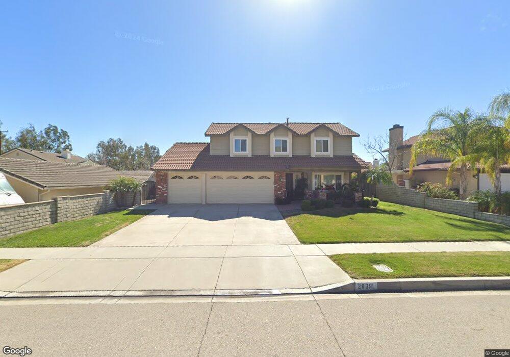
28391 Burns Ave Highland, CA 92346
East Highlands NeighborhoodEstimated Value: $575,281 - $665,000
4
Beds
3
Baths
2,028
Sq Ft
$308/Sq Ft
Est. Value
About This Home
This home is located at 28391 Burns Ave, Highland, CA 92346 and is currently estimated at $623,820, approximately $307 per square foot. 28391 Burns Ave is a home located in San Bernardino County with nearby schools including Highland Grove Elementary School, Beattie Middle School, and Citrus Valley High School.
Ownership History
Date
Name
Owned For
Owner Type
Purchase Details
Closed on
Jul 19, 2019
Sold by
Mann Richard K and Mann Rebecca
Bought by
Mann Richard K and Mann Rebecca
Current Estimated Value
Create a Home Valuation Report for This Property
The Home Valuation Report is an in-depth analysis detailing your home's value as well as a comparison with similar homes in the area
Home Values in the Area
Average Home Value in this Area
Purchase History
| Date | Buyer | Sale Price | Title Company |
|---|---|---|---|
| Mann Richard K | -- | None Available |
Source: Public Records
Tax History Compared to Growth
Tax History
| Year | Tax Paid | Tax Assessment Tax Assessment Total Assessment is a certain percentage of the fair market value that is determined by local assessors to be the total taxable value of land and additions on the property. | Land | Improvement |
|---|---|---|---|---|
| 2025 | $3,324 | $249,011 | $46,915 | $202,096 |
| 2024 | $3,324 | $244,128 | $45,995 | $198,133 |
| 2023 | $3,320 | $239,341 | $45,093 | $194,248 |
| 2022 | $3,271 | $234,648 | $44,209 | $190,439 |
| 2021 | $3,279 | $230,047 | $43,342 | $186,705 |
| 2020 | $3,219 | $227,689 | $42,898 | $184,791 |
| 2019 | $3,034 | $223,225 | $42,057 | $181,168 |
| 2018 | $2,897 | $218,848 | $41,232 | $177,616 |
| 2017 | $2,621 | $214,557 | $40,424 | $174,133 |
| 2016 | $2,590 | $210,350 | $39,631 | $170,719 |
| 2015 | $2,570 | $207,191 | $39,036 | $168,155 |
| 2014 | $2,523 | $203,132 | $38,271 | $164,861 |
Source: Public Records
Map
Nearby Homes
- 28390 Burns Ave
- 7214 Quail Run Dr
- 7223 Yarnell Rd
- 0 Baseline St Unit CV25136921
- 7354 Harding Ct
- 0 Gala St
- 7126 Ridge Dr
- 28780 Beattie St
- 28037 Clifton St
- 7459 Melanie Ct
- 7440 Apple Blossom Ct
- 28490 Sycamore Dr
- 28370 Coachman Ln
- 28947 Glenrock Place
- 28480 Merridy Ave
- 28817 Terrace Dr
- 27856 Fieldstone Dr
- 27953 Atlantic Ave
- 7466 Church St
- 7524 Sunny Ridge Loop
- 28389 Burns Ave
- 7122 Browning Rd
- 28388 Ashford Ct
- 28396 Ashford Ct
- 28377 Burns Ave
- 28376 Ashford Ct
- 28382 Burns Ave
- 28365 Burns Ave
- 7146 Browning Rd
- 28374 Burns Ave
- 28364 Ashford Ct
- 28366 Burns Ave
- 28387 Ashford Ct
- 7050 Browning Rd
- 28375 Ashford Ct
- 28358 Burns Ave
- 28363 Ashford Ct
- 7100 Quail Run Dr
- 7112 Quail Run Dr
- 7170 Browning Rd