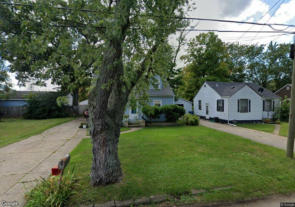
284 Elvern Dr Benton Harbor, MI 49022
Fair Plain NeighborhoodEstimated Value: $135,000 - $190,000
Studio
--
Bath
1,178
Sq Ft
$134/Sq Ft
Est. Value
About This Home
This home is located at 284 Elvern Dr, Benton Harbor, MI 49022 and is currently estimated at $158,437, approximately $134 per square foot. 284 Elvern Dr is a home located in Berrien County with nearby schools including Fair Plain Middle School, Benton Harbor High School, and Our Lady of the Lake Catholic School.
Ownership History
Date
Name
Owned For
Owner Type
Purchase Details
Closed on
Dec 20, 2005
Sold by
Clayborn Margaret and Clayborn Brian
Bought by
Clayborn Brian and Clayborn Margaret
Current Estimated Value
Home Financials for this Owner
Home Financials are based on the most recent Mortgage that was taken out on this home.
Original Mortgage
$74,600
Outstanding Balance
$41,863
Interest Rate
6.34%
Mortgage Type
Fannie Mae Freddie Mac
Estimated Equity
$116,574
Purchase Details
Closed on
Nov 11, 1997
Purchase Details
Closed on
May 21, 1986
Purchase Details
Closed on
Sep 29, 1980
Purchase Details
Closed on
Dec 23, 1977
Create a Home Valuation Report for This Property
The Home Valuation Report is an in-depth analysis detailing your home's value as well as a comparison with similar homes in the area
Home Values in the Area
Average Home Value in this Area
Purchase History
| Date | Buyer | Sale Price | Title Company |
|---|---|---|---|
| Clayborn Brian | -- | None Available | |
| -- | -- | -- | |
| -- | $26,900 | -- | |
| -- | -- | -- | |
| -- | $22,500 | -- |
Source: Public Records
Mortgage History
| Date | Status | Borrower | Loan Amount |
|---|---|---|---|
| Open | Clayborn Brian | $74,600 |
Source: Public Records
Tax History
| Year | Tax Paid | Tax Assessment Tax Assessment Total Assessment is a certain percentage of the fair market value that is determined by local assessors to be the total taxable value of land and additions on the property. | Land | Improvement |
|---|---|---|---|---|
| 2025 | $2,070 | $82,000 | $0 | $0 |
| 2024 | $682 | $78,600 | $0 | $0 |
| 2023 | $650 | $76,200 | $0 | $0 |
| 2022 | $619 | $70,400 | $0 | $0 |
| 2021 | $1,807 | $65,400 | $1,100 | $64,300 |
| 2020 | $1,720 | $65,100 | $0 | $0 |
| 2019 | $1,709 | $49,900 | $800 | $49,100 |
| 2018 | $1,640 | $49,900 | $0 | $0 |
| 2017 | $1,629 | $49,200 | $0 | $0 |
| 2016 | $1,572 | $48,300 | $0 | $0 |
| 2015 | $1,601 | $49,500 | $0 | $0 |
| 2014 | $525 | $44,600 | $0 | $0 |
Source: Public Records
Map
Nearby Homes
- 1593 Columbus Ave
- 1712 W Ogden Cir
- 180 Emery Ave
- 161 Eloise Dr
- 1238 Broadway
- V/L Mcalister
- 1342 Monroe St
- 1298 Colfax Ave
- 298 Bradford Rd
- 1216 Broadway
- 1250 Superior St
- 1968 Colfax Ave
- 1772 Lombard St
- 167 E Delaware Ave
- 379 Western Ave
- 1190 Monroe St
- 1096 Pearl St
- 1309 Agard Ave
- 287 Nickerson Ave
- 682 Waverly Dr
Your Personal Tour Guide
Ask me questions while you tour the home.