Estimated Value: $374,000 - $710,000
3
Beds
2
Baths
1,890
Sq Ft
$268/Sq Ft
Est. Value
About This Home
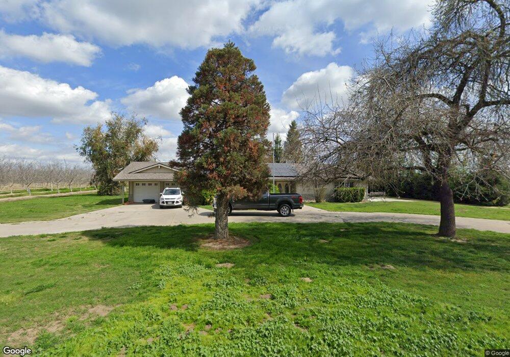
This home is located at 2843 9th Ave, Laton, CA 93242 and is currently estimated at $506,468, approximately $267 per square foot. 2843 9th Ave is a home located in Kings County with nearby schools including Kingsburg High School and Kings River-Hardwick Elementary School.
Ownership History
Date
Name
Owned For
Owner Type
Purchase Details
Closed on
Apr 13, 2004
Sold by
Wells Fargo Bank Minnesota Na
Bought by
Willis Joseph Scott and Willis Pamela E
Current Estimated Value
Home Financials for this Owner
Home Financials are based on the most recent Mortgage that was taken out on this home.
Original Mortgage
$182,400
Outstanding Balance
$84,215
Interest Rate
5.39%
Mortgage Type
Unknown
Estimated Equity
$422,253
Purchase Details
Closed on
Aug 8, 2003
Sold by
Rold David O and Rold Theresa
Bought by
Wells Fargo Bank Minnesota Na
Create a Home Valuation Report for This Property
The Home Valuation Report is an in-depth analysis detailing your home's value as well as a comparison with similar homes in the area
Purchase History
| Date | Buyer | Sale Price | Title Company |
|---|---|---|---|
| Willis Joseph Scott | $231,000 | Fidelity National Title Co | |
| Wells Fargo Bank Minnesota Na | $207,237 | -- |
Source: Public Records
Mortgage History
| Date | Status | Borrower | Loan Amount |
|---|---|---|---|
| Open | Willis Joseph Scott | $182,400 | |
| Closed | Willis Joseph Scott | $22,800 |
Source: Public Records
Tax History
| Year | Tax Paid | Tax Assessment Tax Assessment Total Assessment is a certain percentage of the fair market value that is determined by local assessors to be the total taxable value of land and additions on the property. | Land | Improvement |
|---|---|---|---|---|
| 2025 | $2,554 | $229,664 | $98,944 | $130,720 |
| 2023 | $2,554 | $219,855 | $94,210 | $125,645 |
| 2022 | $2,517 | $214,353 | $91,171 | $123,182 |
| 2021 | $2,462 | $210,502 | $89,735 | $120,767 |
| 2020 | $2,456 | $207,950 | $88,421 | $119,529 |
| 2019 | $2,386 | $203,769 | $86,584 | $117,185 |
| 2018 | $2,312 | $199,433 | $84,546 | $114,887 |
| 2017 | $2,291 | $196,260 | $83,626 | $112,634 |
| 2016 | $2,159 | $193,464 | $83,039 | $110,425 |
| 2015 | $2,187 | $190,953 | $82,187 | $108,766 |
| 2014 | $2,151 | $186,429 | $79,794 | $106,635 |
Source: Public Records
Map
Nearby Homes
- 8552 Cairo Ave
- 8651 Corona Ave
- 0 Dover Ave
- 5757 10th Ave
- 0 Elder Ave Unit 643716
- 0 Elder Ave Unit 26308518
- 4603 12th Ave
- 20745 S Pio Pico Ave
- 6505 10th Ave
- 343 S 6th Ave
- 0 E Mount Whitney Ave
- 5721 E Riverdale Ave
- 5750 Benicia Ave
- 0 Flint Ave
- 3178 Hickory Ct
- 15270 S Mccall Ave
- 10454 E Clarkson Ave
- 3262 Morning Dove Ln
- 5675 Boston Ave
- 16036 S Del Rey Ave
- 2774 9th Ave
- 3001 9th Ave
- 9166 Denver Ave
- 9233 Denver Ave
- 9241 Denver Ave
- 2742 8 1/2 Ave
- 8699 Cairo Ave
- 0 9th (East) St
- 8842 North Ave
- 0 9th (West) Ave
- 8704 Cairo Ave
- 2895 9 1/2 Ave
- 8646 Cairo Ave
- 9541 Denver Ave
- 2251 9th Ave
- 9560 Denver Ave
- 2250 9th Ave
- 3435 9th Ave
- 0 0 Denver Ave
- 0 Cairo Unit 497627
Your Personal Tour Guide
Ask me questions while you tour the home.