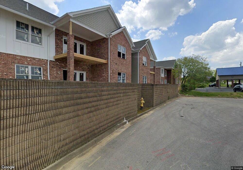
2848 2852 Charlestown Rd New Albany, IN 47150
Estimated Value: $352,000
3
Beds
3
Baths
2,695
Sq Ft
$131/Sq Ft
Est. Value
About This Home
This home is located at 2848 2852 Charlestown Rd, New Albany, IN 47150 and is currently estimated at $352,000, approximately $130 per square foot. 2848 2852 Charlestown Rd is a home located in Floyd County with nearby schools including Slate Run Elementary School, Hazelwood Middle School, and New Albany Senior High School.
Ownership History
Date
Name
Owned For
Owner Type
Purchase Details
Closed on
May 17, 2019
Sold by
Hollis Properties Llc
Bought by
Landings At Silver Run Llc
Current Estimated Value
Purchase Details
Closed on
May 19, 2015
Sold by
Hollis Kevin and Hollis Brenda
Bought by
Hollis Properties Llc
Purchase Details
Closed on
May 19, 2007
Sold by
Hollis Frances E and Hollis Harvey Glenn
Bought by
Hollls Kevin and Hollis Brenda
Purchase Details
Closed on
Apr 12, 2007
Sold by
Hollis Kevln and Hollis Brenda
Bought by
Hollis Propert1es Llc
Create a Home Valuation Report for This Property
The Home Valuation Report is an in-depth analysis detailing your home's value as well as a comparison with similar homes in the area
Home Values in the Area
Average Home Value in this Area
Purchase History
| Date | Buyer | Sale Price | Title Company |
|---|---|---|---|
| Landings At Silver Run Llc | -- | None Available | |
| Hollis Properties Llc | -- | -- | |
| Hollis Kevin | -- | -- | |
| Hollls Kevin | -- | Lorch & Naville Llc | |
| Hollis Propert1es Llc | -- | None Available |
Source: Public Records
Tax History Compared to Growth
Tax History
| Year | Tax Paid | Tax Assessment Tax Assessment Total Assessment is a certain percentage of the fair market value that is determined by local assessors to be the total taxable value of land and additions on the property. | Land | Improvement |
|---|---|---|---|---|
| 2024 | $15,164 | $7,004,700 | $566,400 | $6,438,300 |
| 2023 | $15,164 | $498,300 | $498,300 | $0 |
| 2022 | $14,444 | $498,300 | $498,300 | $0 |
| 2021 | $14,517 | $498,300 | $498,300 | $0 |
| 2020 | $14,166 | $498,300 | $498,300 | $0 |
| 2019 | $13,717 | $498,300 | $498,300 | $0 |
| 2018 | $14,456 | $665,500 | $498,300 | $167,200 |
| 2017 | $17,592 | $664,800 | $498,300 | $166,500 |
| 2016 | $16,182 | $662,700 | $498,300 | $164,400 |
| 2014 | $2,639 | $128,200 | $61,500 | $66,700 |
| 2013 | -- | $131,800 | $61,500 | $70,300 |
Source: Public Records
Map
Nearby Homes
- 213 Colonial Club Dr
- 303 Colonial Club Dr
- 3207 Blackiston Blvd
- 3828 Payne Koehler Rd
- 3903 Rainbow Dr
- 2705 Charlestown Rd
- 1709 Millerwood Dr
- 917 Brentwood Ct
- 3012 Grace Marie Way
- 3016 Grace Marie Way
- 3027 Grace Marie Way
- 3021 Grace Marie Way
- Elm Plan at Koehler Woods
- Downing Plan at Koehler Woods
- PINE Plan at Koehler Woods
- ADAIR Plan at Koehler Woods
- Manning Plan at Koehler Woods
- 1130 Eastridge Dr
- 30 Doebrook Ct
- 1672 Garretson Ln
- 2852 Charlestown Rd
- 2842 Charlestown Rd
- 1230 Serenity Springs Dr
- 2844 Charlestown Rd
- 2851 Charlestown Rd
- 2851 Charlestown Rd
- 1243 Serenity Springs Dr
- 211 Charlestown Rd
- 1241 Serenity Springs Dr
- 2836 Charlestown Rd
- 1246 Serenity Springs Dr
- 1239 Serenity Springs Dr
- 1244 Serenity Springs Dr
- 1237 Serenity Springs Dr
- 1242 Serenity Springs Dr
- 2830-2834 Charlestown Rd
- 1235 Serenity Springs Dr Unit 38
- 1235 Serenity Springs Dr
- 1240 Serenity Springs Dr
- 2829 Charlestown Rd