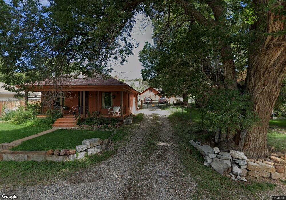
2849 Cr 27a Unit 2 Cotopaxi, CO 81223
Estimated Value: $383,000 - $540,000
3
Beds
2
Baths
2,380
Sq Ft
$199/Sq Ft
Est. Value
About This Home
This home is located at 2849 Cr 27a Unit 2, Cotopaxi, CO 81223 and is currently estimated at $474,269, approximately $199 per square foot. 2849 Cr 27a Unit 2 is a home located in Fremont County with nearby schools including Cotopaxi Elementary School and Cotopaxi Junior/Senior High School.
Ownership History
Date
Name
Owned For
Owner Type
Purchase Details
Closed on
Jul 27, 2020
Sold by
Mcc Sutton John
Bought by
Koferi Michael and Koferi Heather
Current Estimated Value
Home Financials for this Owner
Home Financials are based on the most recent Mortgage that was taken out on this home.
Original Mortgage
$337,250
Outstanding Balance
$299,717
Interest Rate
3.1%
Mortgage Type
New Conventional
Estimated Equity
$174,552
Purchase Details
Closed on
Nov 19, 2005
Sold by
Munn Dan Douglas and Munn Dan D
Bought by
Munn Richard W
Create a Home Valuation Report for This Property
The Home Valuation Report is an in-depth analysis detailing your home's value as well as a comparison with similar homes in the area
Purchase History
| Date | Buyer | Sale Price | Title Company |
|---|---|---|---|
| Koferi Michael | $355,000 | Fidelity National Title | |
| Munn Richard W | -- | None Available |
Source: Public Records
Mortgage History
| Date | Status | Borrower | Loan Amount |
|---|---|---|---|
| Open | Koferi Michael | $337,250 |
Source: Public Records
Tax History
| Year | Tax Paid | Tax Assessment Tax Assessment Total Assessment is a certain percentage of the fair market value that is determined by local assessors to be the total taxable value of land and additions on the property. | Land | Improvement |
|---|---|---|---|---|
| 2024 | $1,381 | $23,634 | $0 | $0 |
| 2023 | $955 | $19,708 | $0 | $0 |
| 2022 | $784 | $16,881 | $0 | $0 |
| 2021 | $789 | $17,367 | $0 | $0 |
| 2020 | $722 | $16,186 | $0 | $0 |
| 2019 | $545 | $12,232 | $0 | $0 |
| 2018 | $494 | $11,079 | $0 | $0 |
| 2017 | $495 | $11,079 | $0 | $0 |
| 2016 | $443 | $9,930 | $0 | $0 |
| 2015 | $442 | $9,930 | $0 | $0 |
| 2012 | $440 | $10,714 | $501 | $10,213 |
Source: Public Records
Map
Nearby Homes
- TBD County Road 18x
- 0 Tbd Vacant Land Unit 2517535
- 377 Color Sweet Dr
- 488 31st Trail
- 474 Deer Run Dr
- 430 Shannon Trail
- 171 Sunset Trail
- 464 Burro Back Ct
- 0 27th Trail
- 701 Shannon Trail
- TBD 27th Trail
- 92 Carpenter Trail
- 92 & 184 Carpenter Trail
- 0 30th and H Path
- 395 Gibbons Trailway
- 839 Shannon Trail
- 1629 County Road 27a
- 912 31st Trail
- 312 16th Trail
- 1048 Blazing Saddle Trail
- 2849 County Road 27a Unit FRE
- 2849 County Road 27a
- 2749 Cr 27a
- 2749 Cr 27a Unit 74
- 2956 County Road 27a Unit FRE
- 2956 Cr 27a
- 2956 Cr 27a
- 2749 County Road 27a
- 2975 County Road 27a
- 2975 County Road 27a
- 2975 Cr 27a
- 2975 Cr 27a Unit 21
- 563 27th Trail
- 563 27th Trail
- 562 26th Trail Unit FRE
- 562 26th Trail
- TR-29 County Road 18x
- 2998 Cr 27a
- 2998 Cr 27a Unit 27
- 2998 County Road 27a
Your Personal Tour Guide
Ask me questions while you tour the home.