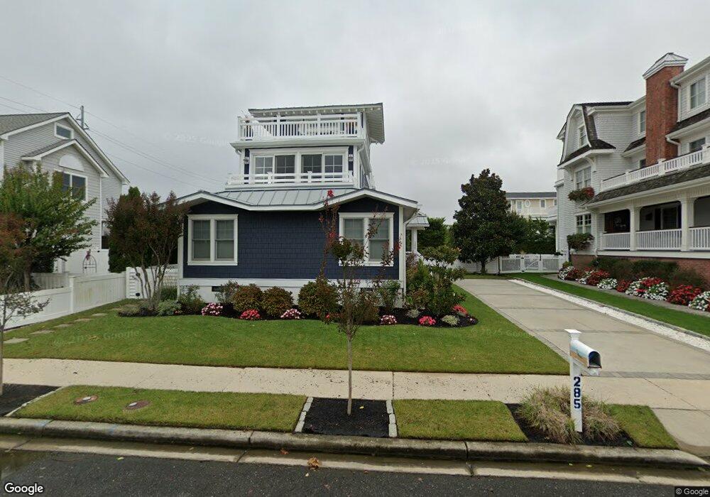
285 56th St Avalon, NJ 08202
Estimated Value: $2,478,000 - $3,659,000
--
Bed
--
Bath
1,724
Sq Ft
$1,654/Sq Ft
Est. Value
About This Home
This home is located at 285 56th St, Avalon, NJ 08202 and is currently estimated at $2,851,103, approximately $1,653 per square foot. 285 56th St is a home located in Cape May County with nearby schools including Avalon Elementary School.
Ownership History
Date
Name
Owned For
Owner Type
Purchase Details
Closed on
May 3, 2023
Sold by
Odonoghue Marilyn C
Bought by
Restated Declaration And Agreement Of Trust
Current Estimated Value
Purchase Details
Closed on
May 18, 2012
Sold by
Odonoghue J Clark and Odonoghue Marilyn C
Bought by
Odonoghue Marilyn C
Purchase Details
Closed on
Jun 14, 2000
Sold by
Fetherolf Kathryne
Bought by
O'Donoghue O'Donoghue J and O'Donoghue Marily C
Home Financials for this Owner
Home Financials are based on the most recent Mortgage that was taken out on this home.
Original Mortgage
$459,350
Interest Rate
8.24%
Purchase Details
Closed on
Jun 19, 1995
Sold by
Mirarchi Ralph E
Bought by
Fetherolf Kathryne
Purchase Details
Closed on
Dec 13, 1991
Sold by
New Jersey Dep
Bought by
Mirarchi Ralph E and Mirarchi Dorothy
Create a Home Valuation Report for This Property
The Home Valuation Report is an in-depth analysis detailing your home's value as well as a comparison with similar homes in the area
Home Values in the Area
Average Home Value in this Area
Purchase History
| Date | Buyer | Sale Price | Title Company |
|---|---|---|---|
| Restated Declaration And Agreement Of Trust | -- | None Listed On Document | |
| Odonoghue Marilyn C | -- | None Available | |
| O'Donoghue O'Donoghue J | $612,500 | -- | |
| Fetherolf Kathryne | $285,000 | -- | |
| Mirarchi Ralph E | $14,200 | -- |
Source: Public Records
Mortgage History
| Date | Status | Borrower | Loan Amount |
|---|---|---|---|
| Previous Owner | O'Donoghue O'Donoghue J | $459,350 |
Source: Public Records
Tax History Compared to Growth
Tax History
| Year | Tax Paid | Tax Assessment Tax Assessment Total Assessment is a certain percentage of the fair market value that is determined by local assessors to be the total taxable value of land and additions on the property. | Land | Improvement |
|---|---|---|---|---|
| 2025 | $6,861 | $1,117,500 | $1,000,000 | $117,500 |
| 2024 | $6,861 | $1,117,500 | $1,000,000 | $117,500 |
| 2023 | $6,806 | $1,117,500 | $1,000,000 | $117,500 |
| 2022 | $6,347 | $1,117,500 | $1,000,000 | $117,500 |
| 2021 | $6,113 | $1,117,500 | $1,000,000 | $117,500 |
| 2020 | $5,878 | $1,117,500 | $1,000,000 | $117,500 |
| 2019 | $5,699 | $1,117,500 | $1,000,000 | $117,500 |
| 2018 | $5,453 | $1,117,500 | $1,000,000 | $117,500 |
| 2017 | $5,136 | $923,800 | $800,000 | $123,800 |
| 2016 | $5,081 | $923,800 | $800,000 | $123,800 |
| 2015 | $4,998 | $923,800 | $800,000 | $123,800 |
| 2014 | $4,942 | $923,800 | $800,000 | $123,800 |
Source: Public Records
Map
Nearby Homes
- 245 57th St
- 5765 Ocean Dr
- 5499 Dune Dr
- 6229 Dune Dr
- 150 64th St
- 4640 Ocean Dr
- 4610 4th Ave
- 6762 Ocean Dr Unit 6762
- 6772 Ocean Dr Unit 6772
- 264 41st St
- 22 Pelican Dr S
- 74 38th St
- 7463 Ocean Dr
- 253 35th St Unit WEST
- 3429 Dune Dr
- 304 78th St Unit East
- 162 33rd St
- 315 79th St Unit 315
- 7888 Dune Dr Unit 218
- 173 33rd St Unit 3