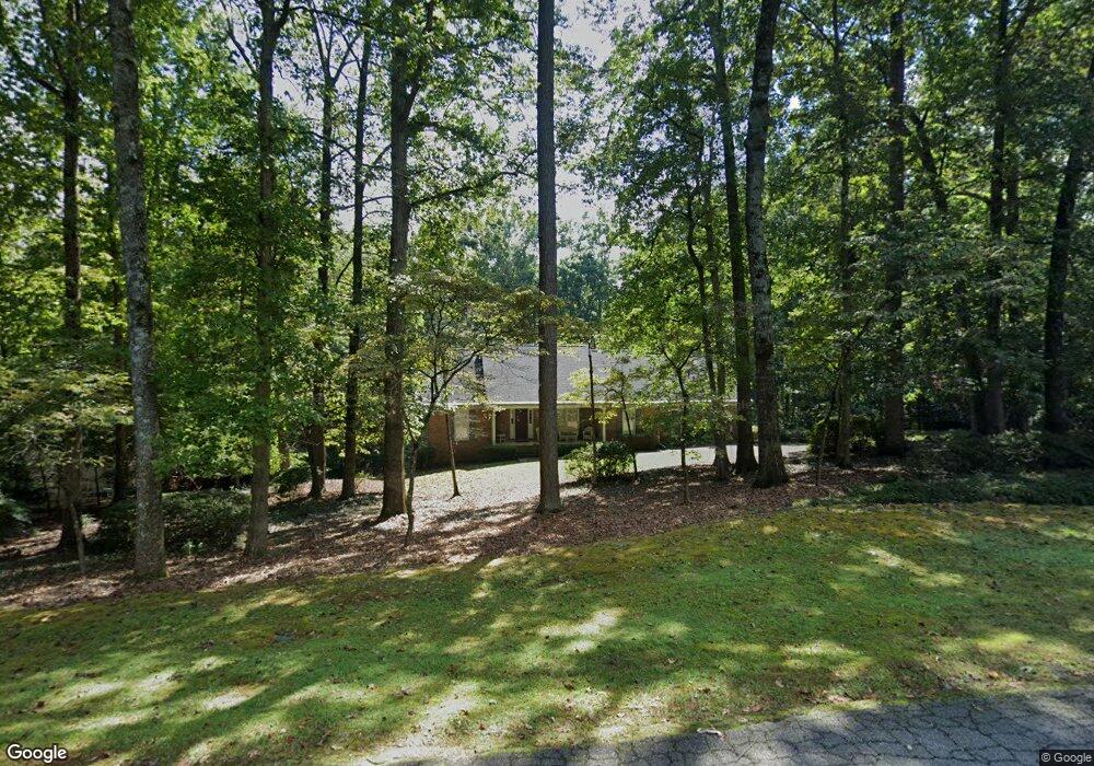
285 Ashland Trail Tyrone, GA 30290
Estimated Value: $480,000 - $651,000
--
Bed
3
Baths
2,319
Sq Ft
$240/Sq Ft
Est. Value
About This Home
This home is located at 285 Ashland Trail, Tyrone, GA 30290 and is currently estimated at $555,861, approximately $239 per square foot. 285 Ashland Trail is a home located in Fayette County with nearby schools including Crabapple Lane Elementary School, Flat Rock Middle School, and Sandy Creek High School.
Ownership History
Date
Name
Owned For
Owner Type
Purchase Details
Closed on
May 17, 2021
Sold by
Higbie Jon Allen
Bought by
Higbie Elizabeth Ann Johnson
Current Estimated Value
Purchase Details
Closed on
Aug 26, 1996
Sold by
Mcconnell Wm J Mary C
Bought by
Higbie Jon A Elizabeth
Create a Home Valuation Report for This Property
The Home Valuation Report is an in-depth analysis detailing your home's value as well as a comparison with similar homes in the area
Home Values in the Area
Average Home Value in this Area
Purchase History
| Date | Buyer | Sale Price | Title Company |
|---|---|---|---|
| Higbie Elizabeth Ann Johnson | -- | -- | |
| Higbie Jon A Elizabeth | $187,000 | -- |
Source: Public Records
Mortgage History
| Date | Status | Borrower | Loan Amount |
|---|---|---|---|
| Closed | Higbie Jon A Elizabeth | $0 |
Source: Public Records
Tax History Compared to Growth
Tax History
| Year | Tax Paid | Tax Assessment Tax Assessment Total Assessment is a certain percentage of the fair market value that is determined by local assessors to be the total taxable value of land and additions on the property. | Land | Improvement |
|---|---|---|---|---|
| 2024 | $3,036 | $211,576 | $28,000 | $183,576 |
| 2023 | $2,649 | $124,000 | $19,000 | $105,000 |
| 2022 | $3,065 | $124,000 | $19,000 | $105,000 |
| 2021 | $2,693 | $149,000 | $19,000 | $130,000 |
| 2020 | $3,476 | $113,800 | $19,000 | $94,800 |
| 2019 | $3,510 | $113,800 | $19,000 | $94,800 |
| 2018 | $3,557 | $134,240 | $19,000 | $115,240 |
| 2017 | $2,606 | $84,000 | $19,000 | $65,000 |
| 2016 | $2,659 | $84,000 | $19,000 | $65,000 |
| 2015 | $2,529 | $92,640 | $19,000 | $73,640 |
| 2014 | $2,798 | $100,480 | $19,000 | $81,480 |
| 2013 | -- | $98,000 | $0 | $0 |
Source: Public Records
Map
Nearby Homes
- 135 Crimson Ridge
- 2185 Castle Lake Dr
- 150 Kylemore Pass
- 100 Clydesdale Ct
- 100 Ashland Trail
- 104 Ashland Trail
- 110 Kylemore Pass
- 200 Chaparral Trace
- 240 Lynnwood Ave
- 28 Border Point
- 475 Castlewood Rd
- 575 Laurelwood Dr
- 121 Northwoods Rd
- 130 E Crestwood Rd
- 11 Line Creek Cir
- 100 Leisure Trail
- 110 Calypso Ct
- 105 Farmington Dr
- 125 Meadowview Cir
- 152 Ardenlee Dr
- 295 Ashland Trail
- 275 Ashland Trail Unit III/29
- 275 Ashland Trail
- 270 Ashland Trail
- 280 Ashland Trail
- 305 Ashland Trail
- 260 Ashland Trail
- 265 Ashland Trail
- 100 Crimson Ridge
- 250 Ashland Trail
- 105 Crimson Ridge
- 255 Ashland Trail
- 2270 Castle Lake Dr
- 412 Wicklow St Unit 69
- 410 Wicklow St Unit 68
- 110 Crimson Ridge
- 411 Wicklow St Unit 70
- 240 Ashland Trail
- 315 Ashland Trail
- 109 Crimson Ridge