Estimated Value: $331,760 - $361,000
1
Bed
2
Baths
1,966
Sq Ft
$177/Sq Ft
Est. Value
About This Home
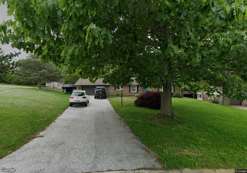
This home is located at 285 Lentzlyn Dr, York, PA 17403 and is currently estimated at $348,940, approximately $177 per square foot. 285 Lentzlyn Dr is a home located in York County with nearby schools including Leaders Heights Elementary School, Dallastown Area Middle School, and Dallastown Area High School.
Ownership History
Date
Name
Owned For
Owner Type
Purchase Details
Closed on
Jul 12, 2006
Sold by
East Mill Properties Llc
Bought by
Buschman Michael F and Buschman Amy S
Current Estimated Value
Home Financials for this Owner
Home Financials are based on the most recent Mortgage that was taken out on this home.
Original Mortgage
$216,000
Outstanding Balance
$128,658
Interest Rate
6.71%
Mortgage Type
Purchase Money Mortgage
Estimated Equity
$220,282
Purchase Details
Closed on
Mar 6, 2006
Sold by
Schauer Albert J and Pflieger Donald E
Bought by
East Mill Properties Llc
Create a Home Valuation Report for This Property
The Home Valuation Report is an in-depth analysis detailing your home's value as well as a comparison with similar homes in the area
Home Values in the Area
Average Home Value in this Area
Purchase History
| Date | Buyer | Sale Price | Title Company |
|---|---|---|---|
| Buschman Michael F | $270,000 | None Available | |
| East Mill Properties Llc | $191,000 | None Available |
Source: Public Records
Mortgage History
| Date | Status | Borrower | Loan Amount |
|---|---|---|---|
| Open | Buschman Michael F | $216,000 |
Source: Public Records
Tax History Compared to Growth
Tax History
| Year | Tax Paid | Tax Assessment Tax Assessment Total Assessment is a certain percentage of the fair market value that is determined by local assessors to be the total taxable value of land and additions on the property. | Land | Improvement |
|---|---|---|---|---|
| 2025 | $5,097 | $148,480 | $31,540 | $116,940 |
| 2024 | $5,023 | $148,480 | $31,540 | $116,940 |
| 2023 | $5,023 | $148,480 | $31,540 | $116,940 |
| 2022 | $4,858 | $148,480 | $31,540 | $116,940 |
| 2021 | $4,628 | $148,480 | $31,540 | $116,940 |
| 2020 | $4,628 | $148,480 | $31,540 | $116,940 |
| 2019 | $4,613 | $148,480 | $31,540 | $116,940 |
| 2018 | $4,582 | $148,480 | $31,540 | $116,940 |
| 2017 | $4,399 | $148,480 | $31,540 | $116,940 |
| 2016 | $0 | $148,480 | $31,540 | $116,940 |
| 2015 | -- | $148,480 | $31,540 | $116,940 |
| 2014 | -- | $148,480 | $31,540 | $116,940 |
Source: Public Records
Map
Nearby Homes
- 175 Scott Rd
- 2415 Emiray Ct
- 201 Ridgefield Dr
- 455 Days Mill Rd
- 2505 Joppa Rd
- 218 N Main St
- 18 Stonewood Dr
- 34 Woodland Dr
- 1715 Wyndham Dr
- 189 Tuscarora Dr
- 2064 Rosewood Ln Unit G2064
- 1920 Rosewood Ln
- 16 N Main St
- Lot #1 Rosewood Unit HAWTHORNE
- 1190 Overbrook Cir
- 8 N Main St
- 1899 Powder Mill Rd Unit B
- 102 Maribel Ln
- 0 Reynolds Mill Rd
- 215 Wyntre Brooke Dr Unit 1
- 292 Lentzlyn Dr
- 283 Lentzlyn Dr
- 296 Lentzlyn Dr
- 282 Amad Dr
- 300 Lentzlyn Dr
- 279 Lentzlyn Dr
- 278 Amad Dr
- 287 Amad Dr
- 275 Lentzlyn Dr
- 274 Amad Dr
- 283 Amad Dr
- 271 Lentzlyn Dr
- 279 Amad Dr
- 270 Amad Dr
- 275 Reynolds Mill Rd
- 273 Reynolds Mill Rd
- 281 Reynolds Mill Rd
- 283 Reynolds Mill Rd
- 275 Amad Dr
- 271 Reynolds Mill Rd