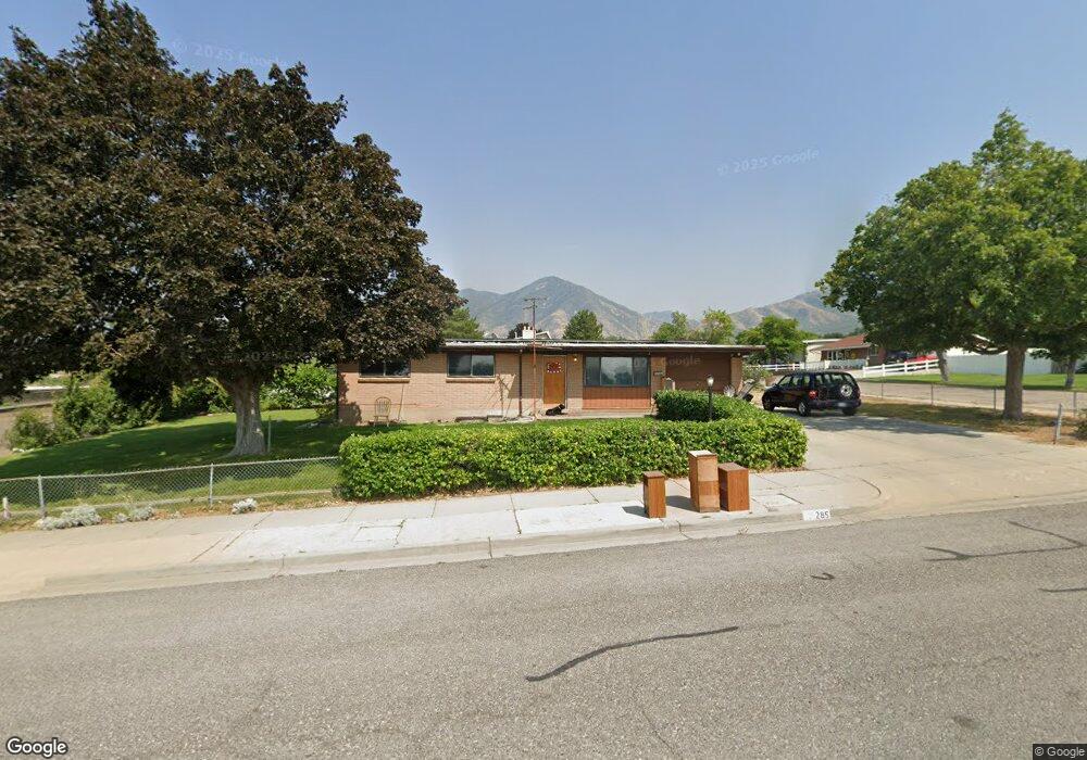
285 S 200 E Tooele, UT 84074
Estimated Value: $348,000 - $386,105
3
Beds
2
Baths
2,240
Sq Ft
$164/Sq Ft
Est. Value
About This Home
This home is located at 285 S 200 E, Tooele, UT 84074 and is currently estimated at $366,276, approximately $163 per square foot. 285 S 200 E is a home located in Tooele County with nearby schools including Sterling Elementary School, Tooele Junior High School, and Tooele High School.
Ownership History
Date
Name
Owned For
Owner Type
Purchase Details
Closed on
Dec 10, 2021
Sold by
Mountain Vista Development Inc
Bought by
Smith Kimberly Kaye and Smith Seth Adam
Current Estimated Value
Home Financials for this Owner
Home Financials are based on the most recent Mortgage that was taken out on this home.
Original Mortgage
$404,852
Outstanding Balance
$369,444
Interest Rate
3.14%
Mortgage Type
New Conventional
Estimated Equity
-$3,168
Purchase Details
Closed on
Aug 30, 2016
Sold by
Holmes Thanna
Bought by
Smith Kimberly Edwin and Smith Vicki J
Home Financials for this Owner
Home Financials are based on the most recent Mortgage that was taken out on this home.
Original Mortgage
$155,500
Interest Rate
3.42%
Mortgage Type
VA
Create a Home Valuation Report for This Property
The Home Valuation Report is an in-depth analysis detailing your home's value as well as a comparison with similar homes in the area
Purchase History
| Date | Buyer | Sale Price | Title Company |
|---|---|---|---|
| Smith Kimberly Kaye | -- | Sutherland Title | |
| Smith Kimberly Edwin | -- | Old Republic Title Tooele |
Source: Public Records
Mortgage History
| Date | Status | Borrower | Loan Amount |
|---|---|---|---|
| Open | Smith Kimberly Kaye | $404,852 | |
| Previous Owner | Smith Kimberly Edwin | $155,500 |
Source: Public Records
Tax History
| Year | Tax Paid | Tax Assessment Tax Assessment Total Assessment is a certain percentage of the fair market value that is determined by local assessors to be the total taxable value of land and additions on the property. | Land | Improvement |
|---|---|---|---|---|
| 2025 | -- | $367,095 | $130,000 | $237,095 |
| 2024 | -- | $203,638 | $71,500 | $132,138 |
| 2023 | $0 | $203,264 | $68,200 | $135,064 |
| 2022 | $0 | $225,002 | $68,200 | $156,802 |
| 2021 | $1,942 | $133,291 | $27,500 | $105,791 |
| 2020 | $1,942 | $242,348 | $50,000 | $192,348 |
| 2019 | $0 | $221,739 | $50,000 | $171,739 |
| 2018 | $0 | $189,338 | $40,000 | $149,338 |
| 2017 | $0 | $171,657 | $20,000 | $151,657 |
| 2016 | $1,007 | $83,532 | $11,000 | $72,532 |
| 2015 | $1,007 | $73,217 | $0 | $0 |
| 2014 | -- | $73,217 | $0 | $0 |
Source: Public Records
Map
Nearby Homes
- 195 Crest Cir
- 174 Crest Cir
- 186 Crest Cir
- 315 S 200 E
- 205 Crest Cir
- 196 Crest Cir
- 325 S 200 E
- 206 Crest Cir
- 213 Crest Cir
- 187 Stansbury Cir
- 197 Stansbury Cir
- 207 Stansbury Cir
- 214 Crest Cir
- 219 Crest Cir
- 184 Stansbury Cir
- 194 Stansbury Cir
- 220 Crest Cir
- 174 Stansbury Cir
- 215 Stansbury Cir
- 215 S 200 E
Your Personal Tour Guide
Ask me questions while you tour the home.