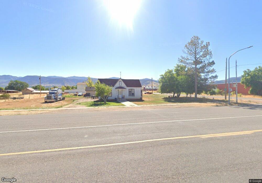
285 S Main Kanosh, UT 84637
Estimated Value: $294,000 - $321,209
2
Beds
1
Bath
1,225
Sq Ft
$254/Sq Ft
Est. Value
About This Home
This home is located at 285 S Main, Kanosh, UT 84637 and is currently estimated at $311,403, approximately $254 per square foot. 285 S Main is a home located in Millard County.
Ownership History
Date
Name
Owned For
Owner Type
Purchase Details
Closed on
Jun 28, 2011
Sold by
Fannie Mae
Bought by
Whitaker Roger D and Whitaker Johanna K
Current Estimated Value
Home Financials for this Owner
Home Financials are based on the most recent Mortgage that was taken out on this home.
Original Mortgage
$15,000
Outstanding Balance
$10,240
Interest Rate
4.5%
Estimated Equity
$301,163
Purchase Details
Closed on
Apr 12, 2010
Sold by
Etitle Insurance Agency
Bought by
Federal National Mortgage Association
Create a Home Valuation Report for This Property
The Home Valuation Report is an in-depth analysis detailing your home's value as well as a comparison with similar homes in the area
Purchase History
| Date | Buyer | Sale Price | Title Company |
|---|---|---|---|
| Whitaker Roger D | $30,500 | -- | |
| Federal National Mortgage Association | $45,993 | -- |
Source: Public Records
Mortgage History
| Date | Status | Borrower | Loan Amount |
|---|---|---|---|
| Open | Whitaker Roger D | $15,000 |
Source: Public Records
Tax History
| Year | Tax Paid | Tax Assessment Tax Assessment Total Assessment is a certain percentage of the fair market value that is determined by local assessors to be the total taxable value of land and additions on the property. | Land | Improvement |
|---|---|---|---|---|
| 2025 | -- | $105,344 | $32,981 | $72,363 |
| 2024 | $102,062 | $102,062 | $19,709 | $82,353 |
| 2023 | $102,062 | $102,062 | $19,709 | $82,353 |
| 2022 | $676 | $63,549 | $15,766 | $47,783 |
| 2021 | $580 | $52,575 | $13,710 | $38,865 |
| 2020 | $506 | $46,280 | $12,464 | $33,816 |
| 2019 | $457 | $42,038 | $11,435 | $30,603 |
| 2018 | $435 | $40,998 | $10,395 | $30,603 |
| 2017 | $455 | $40,998 | $10,395 | $30,603 |
| 2016 | $387 | $36,370 | $7,796 | $28,574 |
| 2015 | $387 | $36,370 | $7,796 | $28,574 |
| 2014 | -- | $36,370 | $7,796 | $28,574 |
| 2013 | -- | $22,696 | $7,796 | $14,900 |
Source: Public Records
Map
Nearby Homes
- 58 E 300 South St
- 8610 S Highway 91
- 135 E 200 N
- Parcel # 8816
- 145 N 200 E
- 50 N 100 Rd E
- 1565 W Sunflower Ln Unit 3
- 1615 W Sunflower Ln
- 1615 W Sunflower Ln Unit 4
- 1565 W Sunflower Ln
- 0 Tbd Black Rock Rd Unit LotWP001
- 2000 N West Frontage I-15
- 1100 S 725 Rd W
- 310 S 500 West Rd
- 465 S 100 W
- 190 W 400 St S
- 760 E 700 St S
- 155 E 500 St S
- 157 E 500 South St
- 290 W 200 S