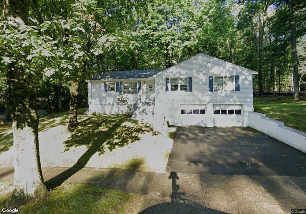
285 Stevenson Rd New Haven, CT 06515
Westville NeighborhoodEstimated Value: $422,334 - $512,000
2
Beds
2
Baths
1,786
Sq Ft
$263/Sq Ft
Est. Value
About This Home
This home is located at 285 Stevenson Rd, New Haven, CT 06515 and is currently estimated at $469,584, approximately $262 per square foot. 285 Stevenson Rd is a home located in New Haven County with nearby schools including Davis Academy for Arts & Design Innovation, Elm City Montessori School, and Hopkins School.
Ownership History
Date
Name
Owned For
Owner Type
Purchase Details
Closed on
Jun 25, 2025
Sold by
Sylvia L Zamkov Lt and Zamkov
Bought by
Zamkov Steven
Current Estimated Value
Purchase Details
Closed on
Dec 29, 2014
Sold by
Zamkov Sylvia L
Bought by
West Rock Gardens Llc
Create a Home Valuation Report for This Property
The Home Valuation Report is an in-depth analysis detailing your home's value as well as a comparison with similar homes in the area
Home Values in the Area
Average Home Value in this Area
Purchase History
| Date | Buyer | Sale Price | Title Company |
|---|---|---|---|
| Zamkov Steven | -- | -- | |
| West Rock Gardens Llc | -- | -- | |
| West Rock Gardens Llc | -- | -- |
Source: Public Records
Tax History
| Year | Tax Paid | Tax Assessment Tax Assessment Total Assessment is a certain percentage of the fair market value that is determined by local assessors to be the total taxable value of land and additions on the property. | Land | Improvement |
|---|---|---|---|---|
| 2025 | $8,048 | $204,260 | $63,420 | $140,840 |
| 2024 | $7,864 | $204,260 | $63,420 | $140,840 |
| 2023 | $7,598 | $204,260 | $63,420 | $140,840 |
| 2022 | $8,119 | $204,260 | $63,420 | $140,840 |
| 2021 | $6,880 | $156,800 | $41,230 | $115,570 |
| 2020 | $6,880 | $156,800 | $41,230 | $115,570 |
| 2019 | $6,739 | $156,800 | $41,230 | $115,570 |
| 2018 | $6,739 | $156,800 | $41,230 | $115,570 |
| 2017 | $6,065 | $156,800 | $41,230 | $115,570 |
| 2016 | $7,190 | $173,040 | $42,770 | $130,270 |
| 2015 | $7,190 | $173,040 | $42,770 | $130,270 |
| 2014 | $7,190 | $173,040 | $42,770 | $130,270 |
Source: Public Records
Map
Nearby Homes
- 690 Forest Rd Unit 702
- 690 Forest Rd Unit 761
- 690 Forest Rd Unit 501
- 690 Forest Rd Unit 651
- 56 Roger Rd
- 224 Ray Rd
- 21 Richmond Ave
- 119 Westwood Rd
- 51 Fountain Terrace
- 50 Morris Ave
- 125 Lowin Ave
- 55 Marvel Rd
- 252 Alden Ave
- 420 Central Ave
- 50 Maltby Ave
- 34 Maltby Ave
- 110 Fenwick St
- 846 Beechwood Rd
- 143 Fountain St Unit A11
- 107 Glen View Terrace
- 295 Stevenson Rd
- 271 Stevenson Rd
- 294 Stevenson Rd
- 284 Stevenson Rd
- 305 Stevenson Rd
- 270 Stevenson Rd
- 257 Stevenson Rd
- 46 Spencer Place
- 315 Stevenson Rd
- 36 Spencer Place
- 262 Stevenson Rd
- 26 Spencer Place
- 325 Stevenson Rd
- 245 Stevenson Rd
- 250 Stevenson Rd
- 16 Spencer Place
- 45 Spencer Place
- 345 Stevenson Rd
- 240 Stevenson Rd
- 235 Stevenson Rd
Your Personal Tour Guide
Ask me questions while you tour the home.