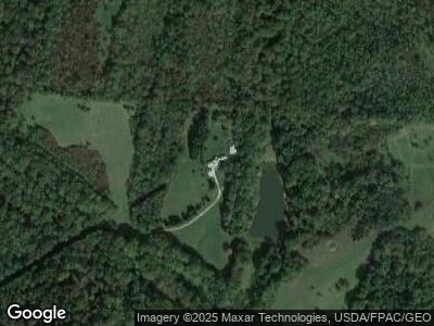
28538 Locust Grove Rd Mc Arthur, OH 45651
Estimated Value: $189,000 - $445,324
4
Beds
4
Baths
1,888
Sq Ft
$155/Sq Ft
Est. Value
About This Home
This home is located at 28538 Locust Grove Rd, Mc Arthur, OH 45651 and is currently estimated at $291,775, approximately $154 per square foot. 28538 Locust Grove Rd is a home located in Vinton County with nearby schools including Vinton County High School.
Ownership History
Date
Name
Owned For
Owner Type
Purchase Details
Closed on
Mar 7, 2023
Sold by
Connelly Diane and Connelly Patrick
Bought by
Broadstone Homestead Llc
Current Estimated Value
Purchase Details
Closed on
Oct 1, 2021
Home Financials for this Owner
Home Financials are based on the most recent Mortgage that was taken out on this home.
Interest Rate
3.01%
Purchase Details
Closed on
Sep 8, 2020
Sold by
Broadstone Dolores L
Bought by
Broadstone Brian C
Purchase Details
Closed on
Aug 19, 2013
Sold by
Broadstone Dolores L and Broadstone Andrew J
Bought by
Broadstone Dolores L
Create a Home Valuation Report for This Property
The Home Valuation Report is an in-depth analysis detailing your home's value as well as a comparison with similar homes in the area
Home Values in the Area
Average Home Value in this Area
Purchase History
| Date | Buyer | Sale Price | Title Company |
|---|---|---|---|
| Broadstone Homestead Llc | -- | None Listed On Document |
Source: Public Records
Tax History Compared to Growth
Tax History
| Year | Tax Paid | Tax Assessment Tax Assessment Total Assessment is a certain percentage of the fair market value that is determined by local assessors to be the total taxable value of land and additions on the property. | Land | Improvement |
|---|---|---|---|---|
| 2024 | $3,501 | $104,500 | $29,720 | $74,780 |
| 2023 | $1,340 | $73,570 | $15,140 | $58,430 |
| 2022 | $2,689 | $73,570 | $15,140 | $58,430 |
| 2021 | $2,322 | $73,570 | $15,140 | $58,430 |
| 2020 | $1,245 | $74,780 | $15,110 | $59,670 |
| 2019 | $2,504 | $75,290 | $15,110 | $60,180 |
| 2018 | $2,478 | $75,290 | $15,110 | $60,180 |
| 2017 | $2,295 | $89,500 | $34,790 | $54,710 |
| 2016 | $2,287 | $89,500 | $34,790 | $54,710 |
| 2015 | $2,131 | $90,090 | $34,860 | $55,230 |
| 2014 | $2,131 | $90,090 | $34,860 | $55,230 |
Source: Public Records
Map
Nearby Homes
- 62579 Dunkle Creek Rd
- 27721 Township Rd 16 J Unit 16 J
- 29809 Harry Short Rd
- 27891 Creola Rd Unit 27915
- 59665 U S 50
- 0 Bethel Rd
- 25242 Amerine Rd
- 63156 U S 50
- 58501 U S 50
- 28306 Allison Rd
- 25701 Ohio 93
- 57828 U S 50
- 63775 Ohio 56
- 32103 State Route 93
- 32017 Ohio 93
- 64574 Ohio 56
- 33695 Ohio 683
- 66551 Airport Rd
- 206 N Sugar St
- 200 E North St
- 28538 Locust Grove Rd
- 28496 Locust Grove Rd
- 28514 Locust Grove Rd
- 28457 Locust Grove Rd
- 28411 Locust Grove Rd
- 28460 Centenary Rd
- 28480 Centenary Rd
- 28538 Centenary Rd
- 28761 Locust Grove Rd
- 109 Gale Ct
- 28222 Locust Grove Rd
- 28086 Locust Grove Rd
- 28691 Centenary Rd
- 28075 Locust Grove Rd
- 28261 Locust Grove Rd
- 28715 Centenary Rd
- 27944 Locust Grove Rd
- 28815 Centenary Rd
- 28918 Centenary Rd
- 27837 Locust Grove Rd
