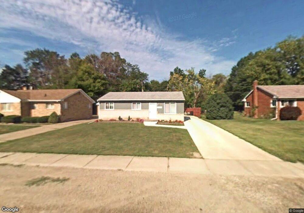
28559 Wexford Dr Warren, MI 48092
Northwest Warren NeighborhoodEstimated Value: $186,000 - $231,000
3
Beds
1
Bath
896
Sq Ft
$233/Sq Ft
Est. Value
About This Home
This home is located at 28559 Wexford Dr, Warren, MI 48092 and is currently estimated at $208,728, approximately $232 per square foot. 28559 Wexford Dr is a home located in Macomb County with nearby schools including Lean Elementary School, Beer Middle School, and Warren Mott High School.
Ownership History
Date
Name
Owned For
Owner Type
Purchase Details
Closed on
Oct 17, 2024
Sold by
Fanelli Catherine A
Bought by
Catherine A Fanelli Living Trust and Fanelli
Current Estimated Value
Purchase Details
Closed on
Oct 14, 2024
Sold by
Fanelli Dino M
Bought by
Fanelli Catherine A
Purchase Details
Closed on
Aug 10, 2022
Sold by
Mark Fanelli Dino and Mark Ann Catherine
Bought by
Fanelli Dino M and Fanelli Dino M
Create a Home Valuation Report for This Property
The Home Valuation Report is an in-depth analysis detailing your home's value as well as a comparison with similar homes in the area
Home Values in the Area
Average Home Value in this Area
Purchase History
| Date | Buyer | Sale Price | Title Company |
|---|---|---|---|
| Catherine A Fanelli Living Trust | -- | None Listed On Document | |
| Catherine A Fanelli Living Trust | -- | None Listed On Document | |
| Fanelli Catherine A | -- | None Listed On Document | |
| Fanelli Catherine A | -- | None Listed On Document | |
| Fanelli Dino M | -- | Pittman Nickolas | |
| Fanelli Dino M | -- | Pittman Nickolas |
Source: Public Records
Tax History Compared to Growth
Tax History
| Year | Tax Paid | Tax Assessment Tax Assessment Total Assessment is a certain percentage of the fair market value that is determined by local assessors to be the total taxable value of land and additions on the property. | Land | Improvement |
|---|---|---|---|---|
| 2025 | $2,246 | $89,310 | $0 | $0 |
| 2024 | $2,182 | $84,720 | $0 | $0 |
| 2023 | $2,069 | $73,700 | $0 | $0 |
| 2022 | $1,999 | $65,110 | $0 | $0 |
| 2021 | $2,034 | $62,540 | $0 | $0 |
| 2020 | $1,961 | $63,020 | $0 | $0 |
| 2019 | $1,891 | $62,360 | $0 | $0 |
| 2018 | $0 | $46,910 | $0 | $0 |
| 2017 | $1,896 | $46,460 | $10,850 | $35,610 |
| 2016 | $1,894 | $46,460 | $0 | $0 |
| 2015 | -- | $42,570 | $0 | $0 |
| 2013 | $3,555 | $32,580 | $0 | $0 |
Source: Public Records
Map
Nearby Homes
- 28570 Norwood Ave
- 28130 Liberty Dr
- 28530 Ryan Rd
- 28314 James Dr
- 3454 Winterfield Dr
- 29269 Ryan Rd
- 29202 W Nottingham Cir
- 29265 van Laan Dr
- 4480 Bayberry Ct
- 28160 Universal Dr Unit J125
- 29119 Orvylle Dr
- 28230 Universal Dr Unit F69
- 28264 Universal Dr Unit 82
- 28000 Universal Dr Unit 1
- 28012 Universal Dr
- 27365 Ryan Rd
- 27575 Strathmoor Dr
- 29512 Orvylle Dr
- 3922 Dwight Dr
- 27226 Warner Ave
- 28555 Wexford Dr Unit Bldg-Unit
- 28555 Wexford Dr
- 28561 Wexford Dr
- 28581 Wexford Dr
- 28551 Wexford Dr
- 3515 Parent Ave Unit Bldg-Unit
- 3515 Parent Ave
- 28511 Wexford Dr
- 28597 Wexford Dr
- 28509 Wexford Dr
- 3511 Parent Ave
- 28600 Norwood Ave
- 28507 Wexford Dr
- 28605 Wexford Dr
- 28556 Wexford Dr
- 28540 Norwood Ave
- 28560 Wexford Dr
- 28570 Wexford Dr
- 3499 Parent Ave
- 28630 Norwood Ave