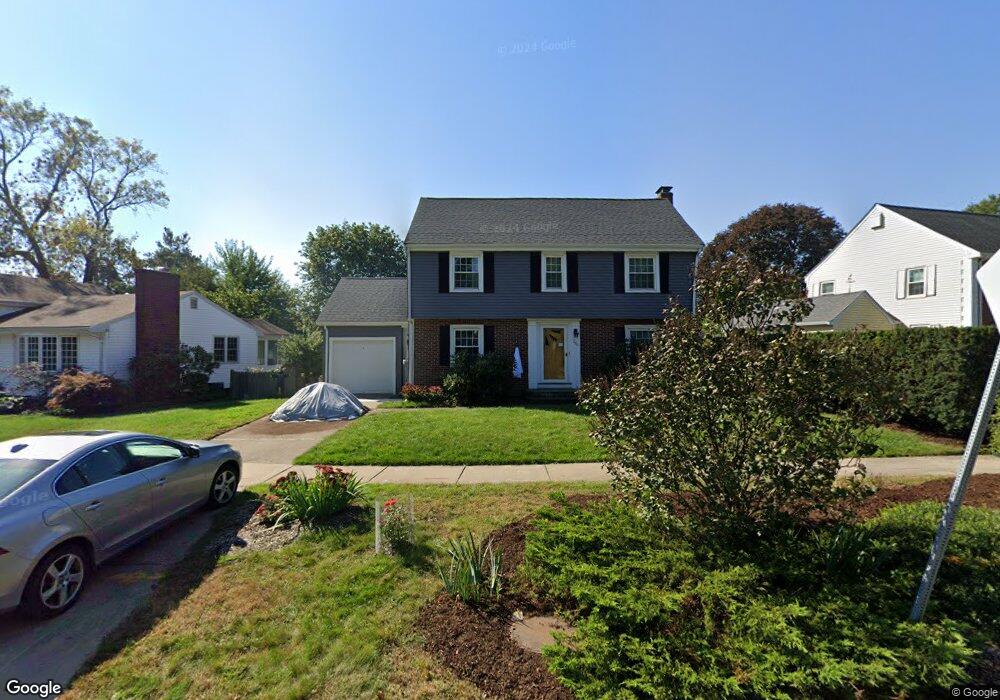
286 Grove St Belmont, MA 02478
Cushing Square NeighborhoodEstimated Value: $1,298,000 - $1,392,583
3
Beds
2
Baths
1,714
Sq Ft
$787/Sq Ft
Est. Value
About This Home
This home is located at 286 Grove St, Belmont, MA 02478 and is currently estimated at $1,349,396, approximately $787 per square foot. 286 Grove St is a home located in Middlesex County with nearby schools including Mary Lee Burbank Elementary School, Winthrop L Chenery Middle School, and Belmont High School.
Ownership History
Date
Name
Owned For
Owner Type
Purchase Details
Closed on
May 28, 1999
Sold by
Com-Bel Rt and Goldstein George
Bought by
Pierre Claudette B and Goodman Brian K
Current Estimated Value
Home Financials for this Owner
Home Financials are based on the most recent Mortgage that was taken out on this home.
Original Mortgage
$326,750
Outstanding Balance
$84,543
Interest Rate
6.82%
Mortgage Type
Purchase Money Mortgage
Estimated Equity
$1,264,853
Create a Home Valuation Report for This Property
The Home Valuation Report is an in-depth analysis detailing your home's value as well as a comparison with similar homes in the area
Home Values in the Area
Average Home Value in this Area
Purchase History
| Date | Buyer | Sale Price | Title Company |
|---|---|---|---|
| Pierre Claudette B | $344,000 | -- |
Source: Public Records
Mortgage History
| Date | Status | Borrower | Loan Amount |
|---|---|---|---|
| Open | Pierre Claudette B | $326,750 |
Source: Public Records
Tax History Compared to Growth
Tax History
| Year | Tax Paid | Tax Assessment Tax Assessment Total Assessment is a certain percentage of the fair market value that is determined by local assessors to be the total taxable value of land and additions on the property. | Land | Improvement |
|---|---|---|---|---|
| 2025 | $12,597 | $1,106,000 | $661,000 | $445,000 |
| 2024 | $12,376 | $1,172,000 | $824,000 | $348,000 |
| 2023 | $11,656 | $1,037,000 | $719,000 | $318,000 |
| 2022 | $11,248 | $973,000 | $676,000 | $297,000 |
| 2021 | $10,975 | $951,000 | $705,000 | $246,000 |
| 2020 | $5,162 | $936,000 | $690,000 | $246,000 |
| 2019 | $9,091 | $779,000 | $543,000 | $236,000 |
| 2018 | $6,490 | $803,000 | $494,000 | $309,000 |
| 2017 | $9,619 | $758,000 | $453,000 | $305,000 |
| 2016 | $9,495 | $756,000 | $453,000 | $303,000 |
| 2015 | $8,669 | $672,000 | $377,000 | $295,000 |
Source: Public Records
Map
Nearby Homes
- 105 Watson Rd
- 36 Madison St
- 118 Blanchard Rd
- 48 Concord Ave
- 73 Foster Rd Unit 2
- 4 Merrill Ave
- 15 Sunset Rd
- 48 Hamilton Rd
- 46 Hamilton Rd
- 30 Unity Ave Unit 30
- 95 Griswold St Unit 95
- 93 Griswold St Unit 93
- 73 Trowbridge St Unit 73A
- 73 Trowbridge St Unit 73B
- 55 S Normandy Ave
- 276 Belmont St Unit 1
- 161 Cushing St
- 23 Loomis St Unit 23
- 38 Myrtle St
- 10 Marlboro St Unit 1