Estimated Value: $298,000 - $387,958
4
Beds
3
Baths
1,824
Sq Ft
$186/Sq Ft
Est. Value
About This Home
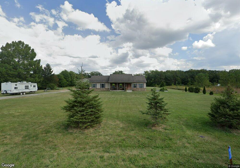
This home is located at 286 N Copus Rd, Lima, OH 45807 and is currently estimated at $338,490, approximately $185 per square foot. 286 N Copus Rd is a home with nearby schools including Maplewood Elementary School, Elmwood Elementary School, and Shawnee Middle School.
Ownership History
Date
Name
Owned For
Owner Type
Purchase Details
Closed on
Oct 3, 2011
Sold by
Mcguire Christopher J and Mcguire Shannon D
Bought by
Carroll Scott A and Carroll Melissa L
Current Estimated Value
Home Financials for this Owner
Home Financials are based on the most recent Mortgage that was taken out on this home.
Original Mortgage
$30,000
Interest Rate
4.14%
Mortgage Type
Purchase Money Mortgage
Purchase Details
Closed on
Jun 13, 2011
Sold by
Sudhoff Adam and Sudhoff Karen
Bought by
Mcguire Christopher J and Mcguire Shannon D
Purchase Details
Closed on
Apr 1, 2011
Sold by
Mcguire C Jason and Mcguire Shannon
Bought by
Sudhoff Adam and Sudhoff Karen
Purchase Details
Closed on
Jun 14, 2006
Sold by
Gossard Thomas L and Gossard Joan
Bought by
Mcguire C Jason and Mcguire Shannon
Purchase Details
Closed on
Nov 18, 1987
Bought by
Gossard Thomas
Create a Home Valuation Report for This Property
The Home Valuation Report is an in-depth analysis detailing your home's value as well as a comparison with similar homes in the area
Purchase History
| Date | Buyer | Sale Price | Title Company |
|---|---|---|---|
| Carroll Scott A | $37,500 | Attorney | |
| Mcguire Christopher J | $37,000 | Attorney | |
| Sudhoff Adam | $37,000 | Attorney | |
| Mcguire C Jason | $45,000 | None Available | |
| Gossard Thomas | $1,700 | -- |
Source: Public Records
Mortgage History
| Date | Status | Borrower | Loan Amount |
|---|---|---|---|
| Closed | Carroll Scott A | $30,000 |
Source: Public Records
Tax History
| Year | Tax Paid | Tax Assessment Tax Assessment Total Assessment is a certain percentage of the fair market value that is determined by local assessors to be the total taxable value of land and additions on the property. | Land | Improvement |
|---|---|---|---|---|
| 2024 | $5,049 | $111,690 | $18,310 | $93,380 |
| 2023 | $4,109 | $80,930 | $13,270 | $67,660 |
| 2022 | $4,090 | $79,880 | $13,270 | $66,610 |
| 2021 | $4,110 | $79,880 | $13,270 | $66,610 |
| 2020 | $3,509 | $70,430 | $13,200 | $57,230 |
| 2019 | $3,509 | $70,430 | $13,200 | $57,230 |
| 2018 | $2,643 | $70,430 | $13,200 | $57,230 |
| 2017 | $3,232 | $62,970 | $13,200 | $49,770 |
| 2016 | $3,205 | $62,970 | $13,200 | $49,770 |
| 2015 | $2,962 | $62,270 | $13,200 | $49,070 |
| 2014 | $2,962 | $57,300 | $13,720 | $43,580 |
| 2013 | $644 | $13,720 | $13,720 | $0 |
Source: Public Records
Map
Nearby Homes
- 000 N Stevick Rd
- 0000 N Stevick Rd
- 3953 Willow Oak Trail
- 616 Wildbrook Ln
- 123 Eagles Point W
- 2940 Koop Rd
- 1393 N Stevick Rd
- 206 Eagles Point St E
- 145 N Concept Dr
- 3055 Freyer Rd
- 00 Allentown Rd
- 4875 Wenatchi Trail
- N/A Eastown Rd N
- 845 Atalan Trail
- 4906 Shoshone Trail
- 1515 Cessna Ave
- 1392 Chancellor Dr
- 3360 Springview Dr
- 0 Springview Dr
- 1558 Chancellor Dr
Your Personal Tour Guide
Ask me questions while you tour the home.