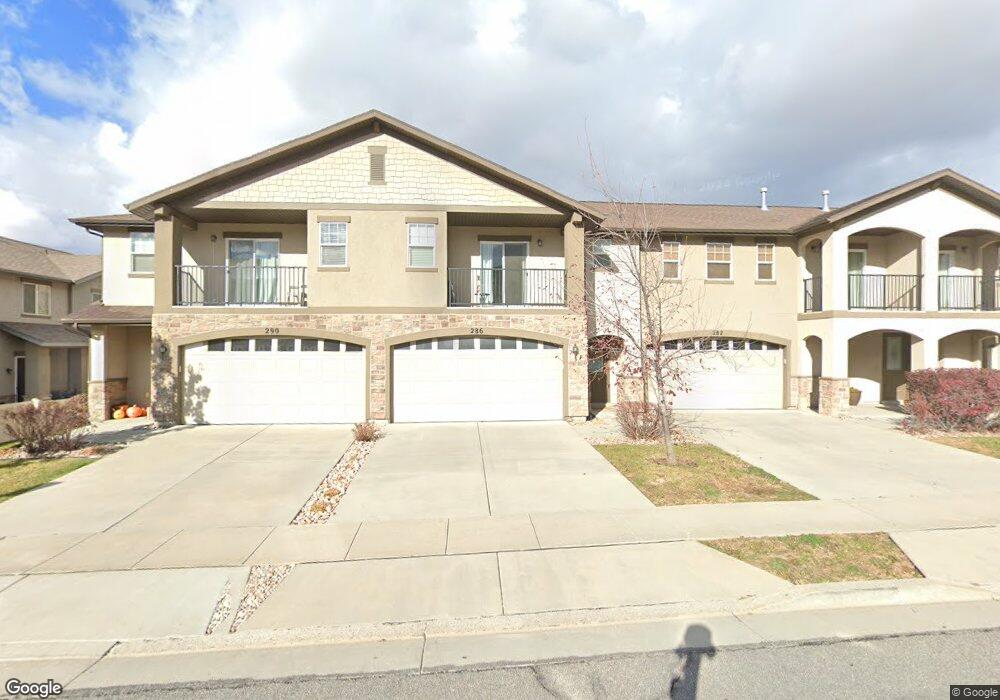
286 W 650 N Centerville, UT 84014
Estimated Value: $456,000 - $470,000
3
Beds
3
Baths
1,785
Sq Ft
$260/Sq Ft
Est. Value
About This Home
This home is located at 286 W 650 N, Centerville, UT 84014 and is currently estimated at $463,961, approximately $259 per square foot. 286 W 650 N is a home located in Davis County with nearby schools including Centerville Elementary, Centerville Jr High, and Viewmont High School.
Ownership History
Date
Name
Owned For
Owner Type
Purchase Details
Closed on
Feb 9, 2022
Sold by
Anthony Cole Trevor
Bought by
Nelson Melanie
Current Estimated Value
Home Financials for this Owner
Home Financials are based on the most recent Mortgage that was taken out on this home.
Original Mortgage
$356,000
Outstanding Balance
$328,039
Interest Rate
3.55%
Mortgage Type
New Conventional
Estimated Equity
$135,922
Purchase Details
Closed on
Sep 22, 2021
Sold by
Cole Trevor Anthony
Bought by
Cole Trevor Anthony and Cole Stephanie Marie
Home Financials for this Owner
Home Financials are based on the most recent Mortgage that was taken out on this home.
Original Mortgage
$235,000
Interest Rate
2.8%
Mortgage Type
New Conventional
Purchase Details
Closed on
Jun 24, 2016
Sold by
Monson Phillip and Monson Stacle
Bought by
Cole Trevor Anthony
Purchase Details
Closed on
Jul 27, 2009
Sold by
Cityview Pineae Village 227 Lp
Bought by
Monson Phillip and Monson Stacie
Home Financials for this Owner
Home Financials are based on the most recent Mortgage that was taken out on this home.
Original Mortgage
$196,270
Interest Rate
5.59%
Mortgage Type
FHA
Create a Home Valuation Report for This Property
The Home Valuation Report is an in-depth analysis detailing your home's value as well as a comparison with similar homes in the area
Purchase History
| Date | Buyer | Sale Price | Title Company |
|---|---|---|---|
| Nelson Melanie | -- | Us Title | |
| Cole Trevor Anthony | -- | Service Link | |
| Cole Trevor Anthony | -- | North American Title | |
| Monson Phillip | -- | Mountain View Title |
Source: Public Records
Mortgage History
| Date | Status | Borrower | Loan Amount |
|---|---|---|---|
| Open | Nelson Melanie | $356,000 | |
| Previous Owner | Cole Trevor Anthony | $235,000 | |
| Previous Owner | Monson Phillip | $196,270 |
Source: Public Records
Tax History
| Year | Tax Paid | Tax Assessment Tax Assessment Total Assessment is a certain percentage of the fair market value that is determined by local assessors to be the total taxable value of land and additions on the property. | Land | Improvement |
|---|---|---|---|---|
| 2025 | $2,455 | $234,850 | $72,050 | $162,800 |
| 2024 | $2,352 | $228,800 | $55,000 | $173,800 |
| 2023 | $2,406 | $423,000 | $98,000 | $325,000 |
| 2022 | $2,432 | $235,400 | $52,800 | $182,600 |
| 2021 | $0 | $328,000 | $69,000 | $259,000 |
| 2020 | $1,924 | $290,000 | $64,500 | $225,500 |
| 2019 | $1,909 | $281,000 | $62,000 | $219,000 |
| 2018 | $1,705 | $248,000 | $58,000 | $190,000 |
| 2016 | $1,381 | $111,650 | $15,015 | $96,635 |
| 2015 | $1,336 | $101,915 | $15,015 | $86,900 |
| 2014 | $1,316 | $102,694 | $15,015 | $87,679 |
| 2013 | -- | $106,750 | $15,015 | $91,735 |
Source: Public Records
Map
Nearby Homes
- 303 W 650 N Unit I
- 281 W 650 N Unit B
- 292 W 680 N
- 282 W 605 N Unit A
- 282 W 605 N Unit I
- 781 Pheasantbrook Dr
- 165 W Pheasantbrook Dr
- 493 W 620 N Unit 122
- 775 Pheasantbrook Cir
- 507 W 620 N
- 66 Brookside Ln
- 271 Brookfield Ln
- 371 W 1125 N
- 132 W 200 N
- 56 W 200 N
- 563 N 220 E
- 147 N 360 W Unit 21
- 243 Balsam Dr
- 1021 N 740 W
- 2 S 285 W
Your Personal Tour Guide
Ask me questions while you tour the home.