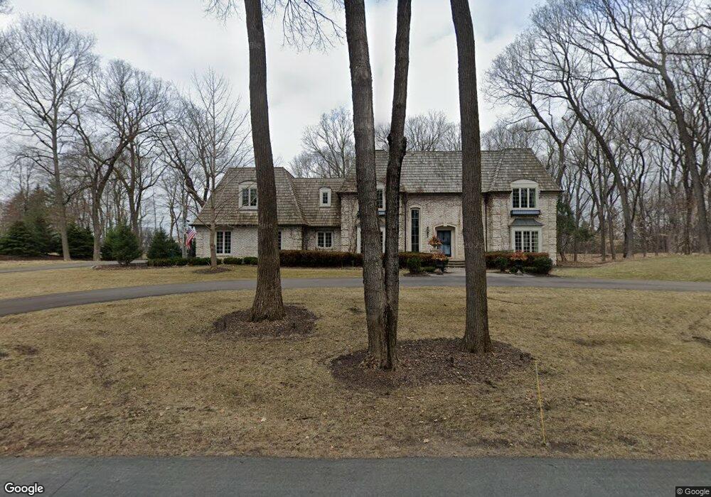
2860 Gale Rd Wayzata, MN 55391
Estimated Value: $1,980,000 - $2,599,629
6
Beds
6
Baths
5,200
Sq Ft
$423/Sq Ft
Est. Value
About This Home
This home is located at 2860 Gale Rd, Wayzata, MN 55391 and is currently estimated at $2,199,157, approximately $422 per square foot. 2860 Gale Rd is a home located in Hennepin County with nearby schools including Groveland Elementary School, Minnetonka East Middle School, and Minnetonka Senior High School.
Ownership History
Date
Name
Owned For
Owner Type
Purchase Details
Closed on
Apr 4, 2017
Sold by
Marks Curtis G and Marks Stacy R
Bought by
Kinzer Joshua and Kinzer Kelly
Current Estimated Value
Home Financials for this Owner
Home Financials are based on the most recent Mortgage that was taken out on this home.
Original Mortgage
$940,000
Interest Rate
4.16%
Mortgage Type
Commercial
Purchase Details
Closed on
May 1, 2008
Sold by
Evenstad Mark B
Bought by
Marks Curtis G and Marks Stacy R
Purchase Details
Closed on
Nov 1, 2000
Sold by
Kuneck Paul
Bought by
Evenstad Mark B and Evenstad Shannon M
Create a Home Valuation Report for This Property
The Home Valuation Report is an in-depth analysis detailing your home's value as well as a comparison with similar homes in the area
Purchase History
| Date | Buyer | Sale Price | Title Company |
|---|---|---|---|
| Kinzer Joshua | $1,175,000 | Burnet Title | |
| Marks Curtis G | $1,575,000 | -- | |
| Evenstad Mark B | $1,160,000 | -- |
Source: Public Records
Mortgage History
| Date | Status | Borrower | Loan Amount |
|---|---|---|---|
| Closed | Kinzer Joshua | $940,000 |
Source: Public Records
Tax History
| Year | Tax Paid | Tax Assessment Tax Assessment Total Assessment is a certain percentage of the fair market value that is determined by local assessors to be the total taxable value of land and additions on the property. | Land | Improvement |
|---|---|---|---|---|
| 2024 | $19,656 | $1,684,700 | $552,000 | $1,132,700 |
| 2023 | $18,675 | $1,684,300 | $533,600 | $1,150,700 |
| 2022 | $15,273 | $1,561,000 | $506,000 | $1,055,000 |
| 2021 | $15,189 | $1,252,000 | $420,000 | $832,000 |
| 2020 | $15,563 | $1,239,000 | $414,000 | $825,000 |
| 2019 | $16,394 | $1,211,000 | $414,000 | $797,000 |
| 2018 | $18,036 | $1,262,000 | $460,000 | $802,000 |
| 2017 | $19,588 | $1,477,000 | $504,000 | $973,000 |
| 2016 | $24,007 | $1,760,000 | $617,000 | $1,143,000 |
| 2015 | $21,830 | $1,593,000 | $572,000 | $1,021,000 |
| 2014 | -- | $1,450,000 | $567,000 | $883,000 |
Source: Public Records
Map
Nearby Homes
- 2770 Gale Rd
- 2505 Cedar Point Dr
- 2670 Woolsey Ln
- 17870 Breezy Point Rd
- 17945 Breezy Point Rd
- 18445 Northome Blvd
- 3574 Northome Rd
- 2918 County Road 101 S
- 3605 Parkway St
- 3114 County Road 101 S
- 3610 Northome Ave
- 32xx County Road 101 S
- 3205 County Road 101
- 18545 Rutledge Rd
- 18540 Azure Rd
- 18065 Berry Ln
- 17435 Sanctuary Dr
- 17209 Grays Bay Blvd
- 325 Highcroft Ln
- 445 Bovey Rd
Your Personal Tour Guide
Ask me questions while you tour the home.