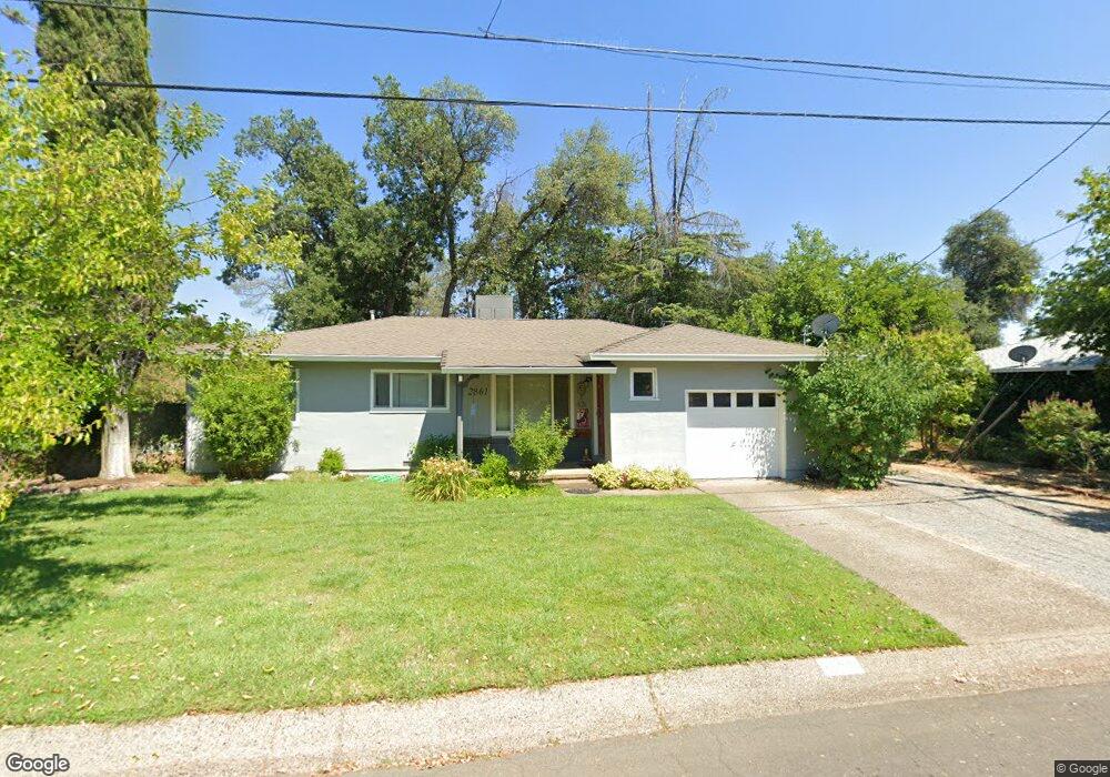
2861 Churn Ct Unit 1 Redding, CA 96002
Reservoir NeighborhoodEstimated Value: $284,000 - $307,000
3
Beds
2
Baths
1,157
Sq Ft
$256/Sq Ft
Est. Value
About This Home
This home is located at 2861 Churn Ct Unit 1, Redding, CA 96002 and is currently estimated at $296,369, approximately $256 per square foot. 2861 Churn Ct Unit 1 is a home located in Shasta County with nearby schools including Shasta Meadows Elementary School, Parsons Junior High School, and Enterprise High School.
Ownership History
Date
Name
Owned For
Owner Type
Purchase Details
Closed on
Dec 29, 2017
Sold by
Weld Patricia A
Bought by
Duccini Deborah L
Current Estimated Value
Home Financials for this Owner
Home Financials are based on the most recent Mortgage that was taken out on this home.
Original Mortgage
$193,922
Outstanding Balance
$165,530
Interest Rate
4.4%
Mortgage Type
FHA
Estimated Equity
$130,839
Purchase Details
Closed on
Jan 29, 2013
Sold by
Weld Patricia A
Bought by
Weld Patricia A and Virgil & Patricia Weld 1995 Trust
Home Financials for this Owner
Home Financials are based on the most recent Mortgage that was taken out on this home.
Original Mortgage
$61,312
Interest Rate
3.33%
Mortgage Type
New Conventional
Create a Home Valuation Report for This Property
The Home Valuation Report is an in-depth analysis detailing your home's value as well as a comparison with similar homes in the area
Home Values in the Area
Average Home Value in this Area
Purchase History
| Date | Buyer | Sale Price | Title Company |
|---|---|---|---|
| Duccini Deborah L | $197,500 | Placer Title Co | |
| Weld Patricia A | -- | Placer Title Company | |
| Weld Patricia A | -- | Placer Title Company |
Source: Public Records
Mortgage History
| Date | Status | Borrower | Loan Amount |
|---|---|---|---|
| Open | Duccini Deborah L | $193,922 | |
| Previous Owner | Weld Patricia A | $61,312 |
Source: Public Records
Tax History
| Year | Tax Paid | Tax Assessment Tax Assessment Total Assessment is a certain percentage of the fair market value that is determined by local assessors to be the total taxable value of land and additions on the property. | Land | Improvement |
|---|---|---|---|---|
| 2025 | $2,375 | $224,715 | $56,889 | $167,826 |
| 2024 | $2,340 | $220,310 | $55,774 | $164,536 |
| 2023 | $2,340 | $215,991 | $54,681 | $161,310 |
| 2022 | $2,273 | $211,757 | $53,609 | $158,148 |
| 2021 | $2,194 | $207,606 | $52,558 | $155,048 |
| 2020 | $2,183 | $205,479 | $52,020 | $153,459 |
| 2019 | $2,164 | $201,450 | $51,000 | $150,450 |
| 2018 | $1,175 | $103,317 | $27,548 | $75,769 |
| 2017 | $1,195 | $101,292 | $27,008 | $74,284 |
| 2016 | $1,119 | $99,307 | $26,479 | $72,828 |
| 2015 | $1,110 | $97,817 | $26,082 | $71,735 |
| 2014 | $1,102 | $95,902 | $25,572 | $70,330 |
Source: Public Records
Map
Nearby Homes
- 2728 Jasmine Way
- 2976 West Way
- 3072 Alta Mesa Dr
- 2455 Belladonna St
- 1701 E Cypress Ave
- 2906 Regal Ave
- 2571 Erin Ln
- 3341 Timbercreek Dr
- 1890 Manchester Dr
- 0 Shasta View Unit 25-1945
- 3051 Leonard St
- 3283 Middleton Ln
- 2681 Hartnell Ave
- 2687 Wilson Ave
- 2583 Reservoir Ln
- 3425 Silverwood St
- 2855 Irwin Rd
- 3293 Middleton Ln
- 3594 Laramie St
- 3466 Silverwood St
Your Personal Tour Guide
Ask me questions while you tour the home.