Estimated Value: $254,000 - $288,000
3
Beds
2
Baths
1,440
Sq Ft
$189/Sq Ft
Est. Value
About This Home
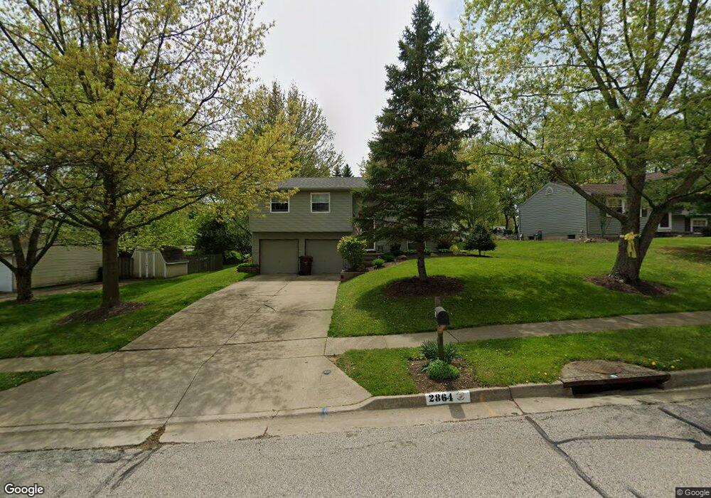
This home is located at 2864 Wexford Blvd, Stow, OH 44224 and is currently estimated at $272,064, approximately $188 per square foot. 2864 Wexford Blvd is a home located in Summit County with nearby schools including Stow-Munroe Falls High School, St Patrick Elementary School, and Walsh Jesuit High School.
Ownership History
Date
Name
Owned For
Owner Type
Purchase Details
Closed on
Jun 12, 2006
Sold by
Millar Steven R and Millar Catherine Ann
Bought by
Johnson Sharon R
Current Estimated Value
Home Financials for this Owner
Home Financials are based on the most recent Mortgage that was taken out on this home.
Original Mortgage
$114,400
Outstanding Balance
$73,183
Interest Rate
8.2%
Mortgage Type
Fannie Mae Freddie Mac
Estimated Equity
$198,881
Create a Home Valuation Report for This Property
The Home Valuation Report is an in-depth analysis detailing your home's value as well as a comparison with similar homes in the area
Home Values in the Area
Average Home Value in this Area
Purchase History
| Date | Buyer | Sale Price | Title Company |
|---|---|---|---|
| Johnson Sharon R | $143,000 | Trident Title Agency Inc |
Source: Public Records
Mortgage History
| Date | Status | Borrower | Loan Amount |
|---|---|---|---|
| Open | Johnson Sharon R | $114,400 |
Source: Public Records
Tax History Compared to Growth
Tax History
| Year | Tax Paid | Tax Assessment Tax Assessment Total Assessment is a certain percentage of the fair market value that is determined by local assessors to be the total taxable value of land and additions on the property. | Land | Improvement |
|---|---|---|---|---|
| 2025 | $3,307 | $67,452 | $15,876 | $51,576 |
| 2024 | $3,307 | $67,452 | $15,876 | $51,576 |
| 2023 | $3,307 | $67,452 | $15,876 | $51,576 |
| 2022 | $3,339 | $52,011 | $12,212 | $39,799 |
| 2021 | $2,991 | $52,011 | $12,212 | $39,799 |
| 2020 | $2,940 | $52,010 | $12,210 | $39,800 |
| 2019 | $2,835 | $46,850 | $12,090 | $34,760 |
| 2018 | $2,789 | $46,850 | $12,090 | $34,760 |
| 2017 | $2,584 | $46,850 | $12,090 | $34,760 |
| 2016 | $2,659 | $42,130 | $12,090 | $30,040 |
| 2015 | $2,584 | $42,130 | $12,090 | $30,040 |
| 2014 | $2,587 | $42,130 | $12,090 | $30,040 |
| 2013 | $2,694 | $44,210 | $12,090 | $32,120 |
Source: Public Records
Map
Nearby Homes
- 2908 Wexford Blvd
- 2714 Wexford Blvd
- 2831 Saybrooke Blvd
- 4444 Hickory Trail
- 4445 Kenneth Trail
- 4556 Fishcreek Rd
- 4638 Dresher Trail
- 4910 Independence Cir Unit D
- 4155 Burton Dr
- 4131 Burton Dr
- 4916 Friar Rd Unit B
- 4078 Pardee Rd
- 3788 Woodbury Oval Unit 60
- 3860 Lake Run Blvd
- 0 Vira Rd
- 2410 Wrens Dr S
- 2260 E Gilwood Dr
- 76 Wanda Ct
- 4322 Lorwood Dr
- 3801 Baird Rd
- 2854 Wexford Blvd
- 2876 Wexford Blvd
- 2851 Williamsburg Cir
- 2846 Wexford Blvd
- 4274 Williamsburg Dr
- 2843 Williamsburg Cir
- 2861 Wexford Blvd
- 2836 Wexford Blvd
- 2879 Wexford Blvd
- 2853 Wexford Blvd
- 2835 Williamsburg Cir
- 2890 Wexford Blvd
- 4401 Oldham Way
- 4277 Williamsburg Dr
- 2828 Wexford Blvd
- 2827 Williamsburg Cir
- 2891 Wexford Blvd
- 2854 Williamsburg Cir
- 2900 Wexford Blvd
- 2879 Williamsburg Cir