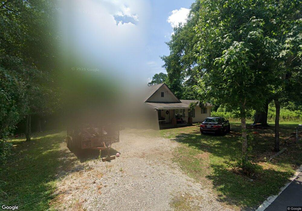
2866 Fork Rd Unit 70 Gainesville, GA 30506
Estimated Value: $175,000 - $273,483
3
Beds
2
Baths
1,272
Sq Ft
$183/Sq Ft
Est. Value
About This Home
This home is located at 2866 Fork Rd Unit 70, Gainesville, GA 30506 and is currently estimated at $232,621, approximately $182 per square foot. 2866 Fork Rd Unit 70 is a home located in Hall County with nearby schools including Sardis Elementary School, Chestatee Middle School, and Chestatee High School.
Ownership History
Date
Name
Owned For
Owner Type
Purchase Details
Closed on
Mar 12, 2004
Sold by
Greenpoint Mtg Funding Inc
Bought by
Petraroi Shelia
Current Estimated Value
Purchase Details
Closed on
Dec 2, 2003
Sold by
Pacatte Brian P
Bought by
Green Point Mortgage Funding Inc
Purchase Details
Closed on
Oct 21, 2003
Sold by
Wbx Llc
Bought by
Pacatte Brian P
Purchase Details
Closed on
Oct 1, 2002
Sold by
Pacatte Brian P
Bought by
Wbx Llc
Create a Home Valuation Report for This Property
The Home Valuation Report is an in-depth analysis detailing your home's value as well as a comparison with similar homes in the area
Home Values in the Area
Average Home Value in this Area
Purchase History
| Date | Buyer | Sale Price | Title Company |
|---|---|---|---|
| Petraroi Shelia | $52,500 | -- | |
| Green Point Mortgage Funding Inc | -- | -- | |
| Pacatte Brian P | -- | -- | |
| Wbx Llc | -- | -- |
Source: Public Records
Tax History
| Year | Tax Paid | Tax Assessment Tax Assessment Total Assessment is a certain percentage of the fair market value that is determined by local assessors to be the total taxable value of land and additions on the property. | Land | Improvement |
|---|---|---|---|---|
| 2025 | $1,914 | $77,240 | $20,360 | $56,880 |
| 2024 | $1,957 | $76,280 | $20,360 | $55,920 |
| 2023 | $1,669 | $64,600 | $6,640 | $57,960 |
| 2022 | $1,172 | $42,640 | $6,640 | $36,000 |
| 2021 | $1,104 | $39,240 | $6,560 | $32,680 |
| 2020 | $1,097 | $37,880 | $6,560 | $31,320 |
| 2019 | $967 | $32,760 | $6,560 | $26,200 |
| 2018 | $521 | $15,834 | $6,560 | $9,274 |
| 2017 | $516 | $15,834 | $6,560 | $9,274 |
| 2016 | $505 | $15,834 | $6,560 | $9,274 |
| 2015 | $509 | $15,834 | $6,560 | $9,274 |
| 2014 | $509 | $15,834 | $6,560 | $9,274 |
Source: Public Records
Map
Nearby Homes
- 2935 Fork Rd
- 2496 Venture Dr
- 3490 Springdale Forrest Blvd
- 2520 Dawsonville Hwy
- 2667 Tammi Ln
- 2439 Venture Dr
- 3112 Hidden Pass
- 3081 Simpson Park Rd
- 3129 Hidden Pass
- 2650 Westview Cir
- 3319 Russell Dr
- 3116 Lake Ranch Cir
- 2620 Walnut Rd
- 3176 Deepwater Dr
- 2733 Old Dawsonville Rd
- 3120 Lake Ranch Cir
- 3650 Galley Ct
- 2406 Winterview Ridge
- 2741 Old Dawsonville Rd
- 3214 Simpson Park Rd
- 2873 Fork Rd
- 2875 Fork Rd
- 2812 Lynncliff Dr
- 2790 Lynncliff Dr Unit 70
- 2790 Lynncliff Dr
- 2906 Fork Rd
- 2817 Lynncliff Dr
- 2785 Lynncliff Dr
- 2915 Fork Rd
- 2825 Lynncliff Dr
- 2821 Jay Mountain Rd
- 2634 Lynncliff Dr
- 2835 Lynncliff Dr
- 2926 Simpson Park Rd
- 2938 Fork Rd
- 2839 Lynncliff Dr
- 2839 Lynncliff Dr Unit 2839
- 2943 Fork Rd
- 2807 Dawsonville Hwy
- 2949 Fork Rd
Your Personal Tour Guide
Ask me questions while you tour the home.