28661 Williams Farm Rd Lower Salem, OH 45745
Estimated payment $868/month
Total Views
388
29.7
Acres
$4,980
Price per Acre
1,293,732
Sq Ft Lot
About This Lot
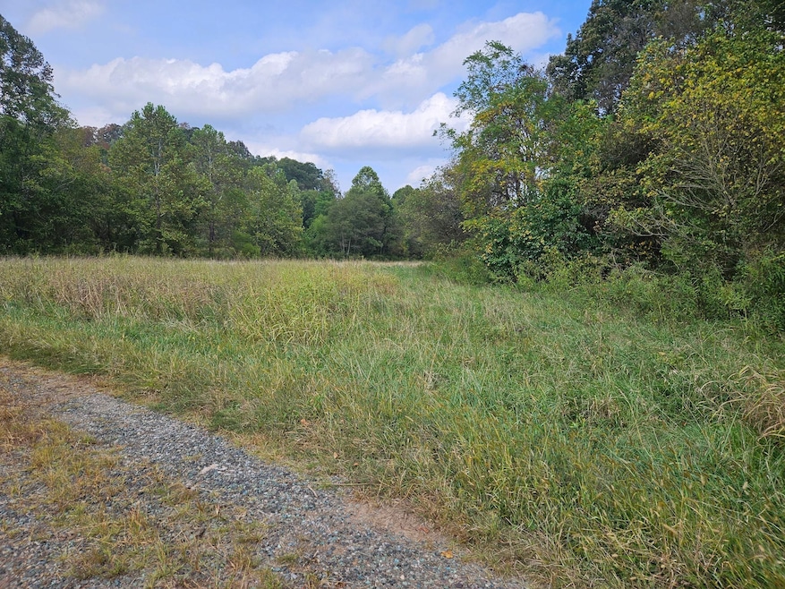
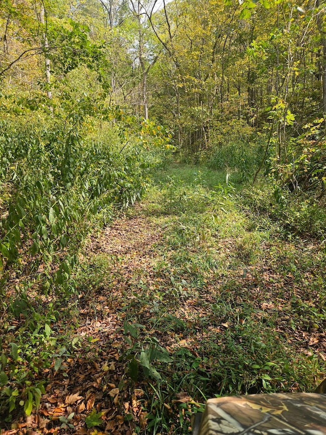
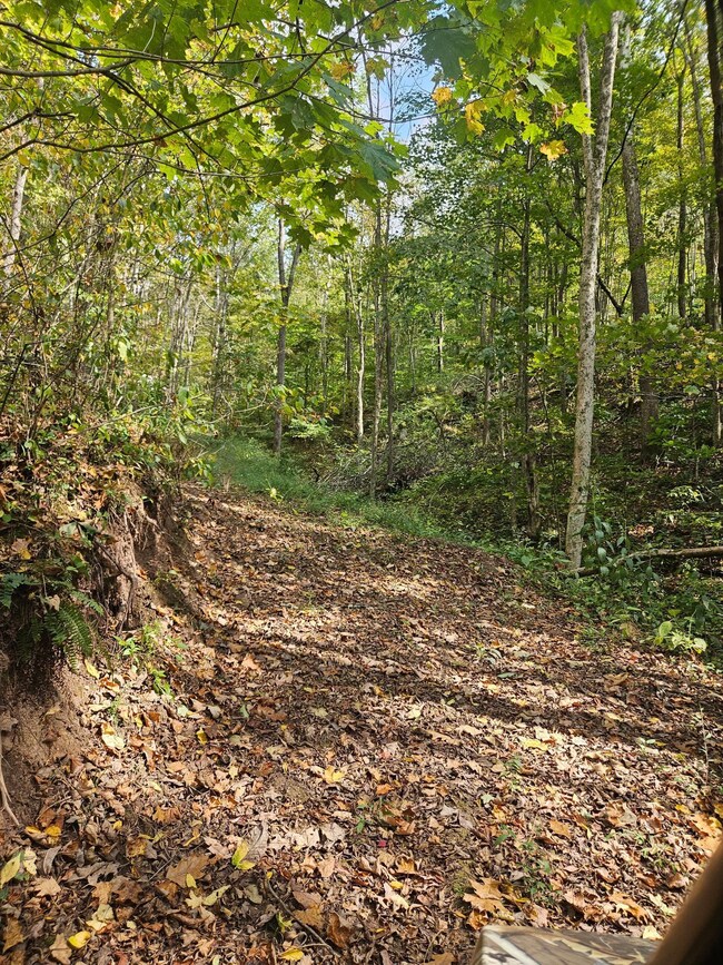
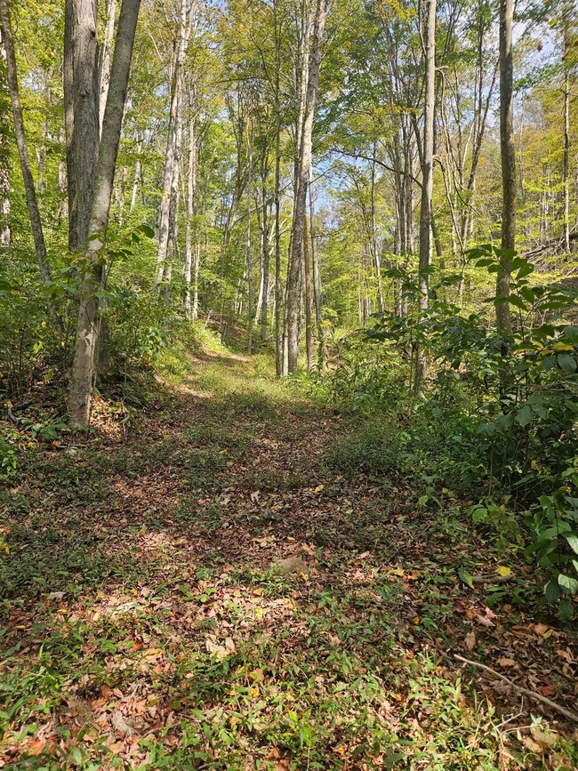
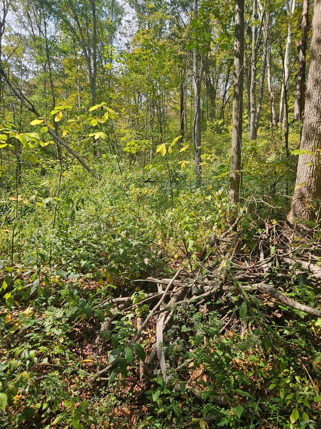
Both parcels are great for hunting! Was select cut, leaving an excellent trail system for access. Property is bordered by local coal company, front of property is bordered by a large creek for added seclusion with access for a dead end township road.
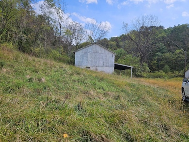
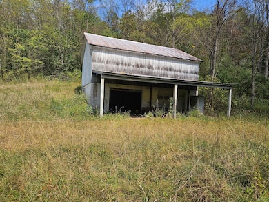
29 acres- has a nice, clean pond and an old barn to store side by side and hunting gear in. Open fields are secluded and would be good to plant food plots.
Listing Agent
Becky Bruner
Becky Bruner Listed on: 11/17/2025
Listing Provided By

Property Details
Property Type
- Land
Est. Annual Taxes
- $1,048
Map
Create a Home Valuation Report for This Property
The Home Valuation Report is an in-depth analysis detailing your home's value as well as a comparison with similar homes in the area
Home Values in the Area
Average Home Value in this Area
Tax History
| Year | Tax Paid | Tax Assessment Tax Assessment Total Assessment is a certain percentage of the fair market value that is determined by local assessors to be the total taxable value of land and additions on the property. | Land | Improvement |
|---|---|---|---|---|
| 2024 | $1,048 | $36,500 | $28,820 | $7,680 |
| 2023 | $1,878 | $36,500 | $28,820 | $7,680 |
| 2022 | $1,028 | $34,900 | $28,210 | $6,690 |
| 2021 | $1,029 | $34,900 | $28,210 | $6,690 |
| 2020 | $1,028 | $34,900 | $28,210 | $6,690 |
| 2019 | $959 | $32,190 | $26,770 | $5,420 |
| 2018 | $972 | $32,190 | $26,770 | $5,420 |
| 2017 | $1,704 | $32,190 | $26,770 | $5,420 |
| 2016 | $1,679 | $31,410 | $26,440 | $4,970 |
| 2015 | $1,713 | $31,410 | $26,440 | $4,970 |
| 2014 | $1,742 | $31,410 | $26,440 | $4,970 |
| 2013 | $1,382 | $24,920 | $20,050 | $4,870 |
Source: Public Records
Property History
| Date | Event | Price | List to Sale | Price per Sq Ft | Prior Sale |
|---|---|---|---|---|---|
| 11/17/2025 11/17/25 | For Sale | $214,900 | +45.3% | -- | |
| 11/17/2025 11/17/25 | For Sale | $147,900 | -55.2% | -- | |
| 09/10/2024 09/10/24 | Sold | $330,150 | 0.0% | -- | View Prior Sale |
| 07/16/2024 07/16/24 | Pending | -- | -- | -- | |
| 06/11/2024 06/11/24 | For Sale | $330,150 | -- | -- |
Purchase History
| Date | Type | Sale Price | Title Company |
|---|---|---|---|
| Warranty Deed | $330,150 | -- |
Source: Public Records
Nearby Homes
- 0 Baker Hill Rd
- 40989 Greer Rd
- 00001 Morton Hill Rd
- State Route 260
- 0 Sheepskin Ridge Rd
- 44885 Road Fork Rd Unit 44885
- 0 Kinnen Rd
- 35604 Paw Rd
- 0 Ohio 260
- 44099 Harriettsville Rd
- 0 Heddleson Ridge Unit 223033844
- 34799 Paw Rd
- 0 Rado Ridge Rd Unit 5157805
- 25966 Pump Station Rd
- 0 Township Highway 272
- 38100 Ogles Ridge Rd
- 44800 Jim Stimpert Rd
- 34108 Edwina Rd
- 200 Frakes Rd
- 39110 State Route 26
- 23120 Bates Rd Unit ID1290644P
- 23120 Bates Rd Unit ID1290641P
- 23120 Bates Rd Unit ID1290643P
- 315 Colegate Dr
- 533 4th St Unit Upper
- 404 Scammel St Unit 2
- 1415 Lancaster St
- 84 Nutter Ct Unit 1
- 204 E 9th St Unit B
- 435 S Lincoln Ave Unit F6
- 349 W South St
- 111 Mackey Dr
- 811 3rd St Unit House
- 202 Meek Ave
- 3420 Point Lookout Rd
- 512 47th St
- 1012 18th St
- 310 S Jefferson St
- 308 S Jefferson St
- 500 S 8th St