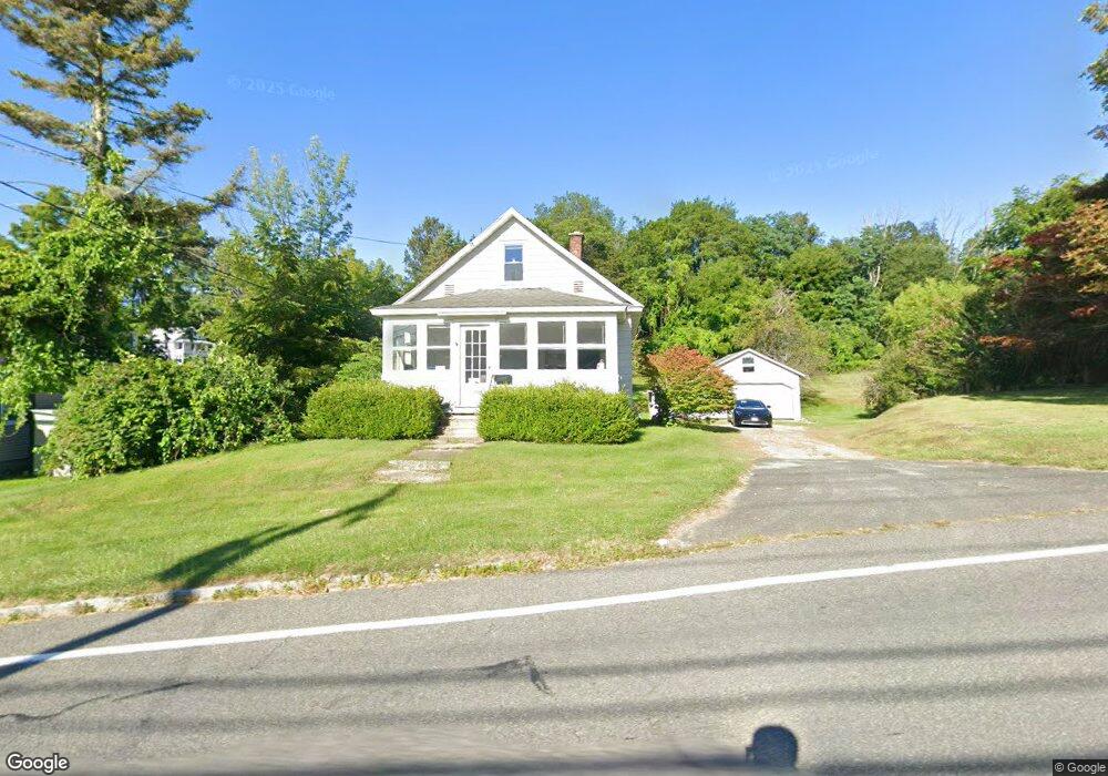
287 Benedict Rd Pittsfield, MA 01201
Estimated Value: $243,000 - $341,000
3
Beds
1
Bath
1,216
Sq Ft
$227/Sq Ft
Est. Value
About This Home
This home is located at 287 Benedict Rd, Pittsfield, MA 01201 and is currently estimated at $275,877, approximately $226 per square foot. 287 Benedict Rd is a home located in Berkshire County with nearby schools including Allendale Elementary School, Theodore Herberg Middle School, and Sinai Academy of the Berkshires.
Ownership History
Date
Name
Owned For
Owner Type
Purchase Details
Closed on
Sep 12, 2020
Sold by
Sala Roger C
Bought by
Sala Claudia J
Current Estimated Value
Purchase Details
Closed on
Jun 19, 2020
Sold by
Lipari Lawrence J Jr Est
Bought by
Sala Roger C
Purchase Details
Closed on
Mar 1, 1968
Bought by
Lipari Lawrence J and Lipari Jeanne M
Create a Home Valuation Report for This Property
The Home Valuation Report is an in-depth analysis detailing your home's value as well as a comparison with similar homes in the area
Home Values in the Area
Average Home Value in this Area
Purchase History
| Date | Buyer | Sale Price | Title Company |
|---|---|---|---|
| Sala Claudia J | -- | None Available | |
| Sala Roger C | -- | None Available | |
| Sala Roger C | -- | None Available | |
| Lipari Lawrence J | -- | -- |
Source: Public Records
Mortgage History
| Date | Status | Borrower | Loan Amount |
|---|---|---|---|
| Previous Owner | Lipari Lawrence J | $50,000 | |
| Previous Owner | Lipari Lawrence J | $15,000 | |
| Previous Owner | Lipari Lawrence J | $37,000 | |
| Previous Owner | Lipari Lawrence J | $41,700 |
Source: Public Records
Tax History Compared to Growth
Tax History
| Year | Tax Paid | Tax Assessment Tax Assessment Total Assessment is a certain percentage of the fair market value that is determined by local assessors to be the total taxable value of land and additions on the property. | Land | Improvement |
|---|---|---|---|---|
| 2025 | $3,809 | $212,300 | $70,900 | $141,400 |
| 2024 | $3,555 | $192,700 | $70,900 | $121,800 |
| 2023 | $3,380 | $184,500 | $70,900 | $113,600 |
| 2022 | $3,044 | $164,000 | $65,900 | $98,100 |
| 2021 | $2,745 | $142,600 | $65,900 | $76,700 |
| 2020 | $2,507 | $127,200 | $52,900 | $74,300 |
| 2019 | $2,354 | $121,200 | $48,900 | $72,300 |
| 2018 | $2,377 | $118,800 | $48,900 | $69,900 |
| 2017 | $2,328 | $118,600 | $50,900 | $67,700 |
| 2016 | $1,974 | $105,200 | $38,900 | $66,300 |
| 2015 | $1,900 | $105,200 | $38,900 | $66,300 |
Source: Public Records
Map
Nearby Homes
- 156 Draper Ave
- 52 Bossidy Dr
- 81 Dartmouth St Unit 102
- 67 Scammell Ave
- 135 Allengate Ave
- I11001904 Scammell Ave
- 153 Elberon Ave
- 122 Allengate Ave
- 919 Tyler St
- 326 Dalton Ave
- 0 Brown St
- LOT 20 Plunkett St
- 24 Glenwood Ave
- 0 Faucett Ln
- 29 Glenwood Ave
- 48 Brown St
- 41 Brown St
- 56 Spring St
- 87 Maryland Ave
- 0 Courtland Place
- 305 Benedict Rd
- 321 Benedict Rd
- 279 Benedict Rd
- 272 Benedict Rd
- 288 Benedict Rd
- 147 Broadview Terrace
- 298 Benedict Rd Unit 1
- 298 Benedict Rd
- 155 Broadview Terrace
- 137 Broadview Terrace
- 304 Benedict Rd
- 306 Benedict Rd
- 310 Benedict Rd
- 325 Benedict Rd
- 308 Benedict Rd
- 312 Benedict Rd
- 290 Benedict Rd
- 123 Broadview Terrace
- 148 Broadview Terrace
- 140 Broadview Terrace