Estimated Value: $309,000 - $420,000
3
Beds
2
Baths
2,120
Sq Ft
$166/Sq Ft
Est. Value
About This Home
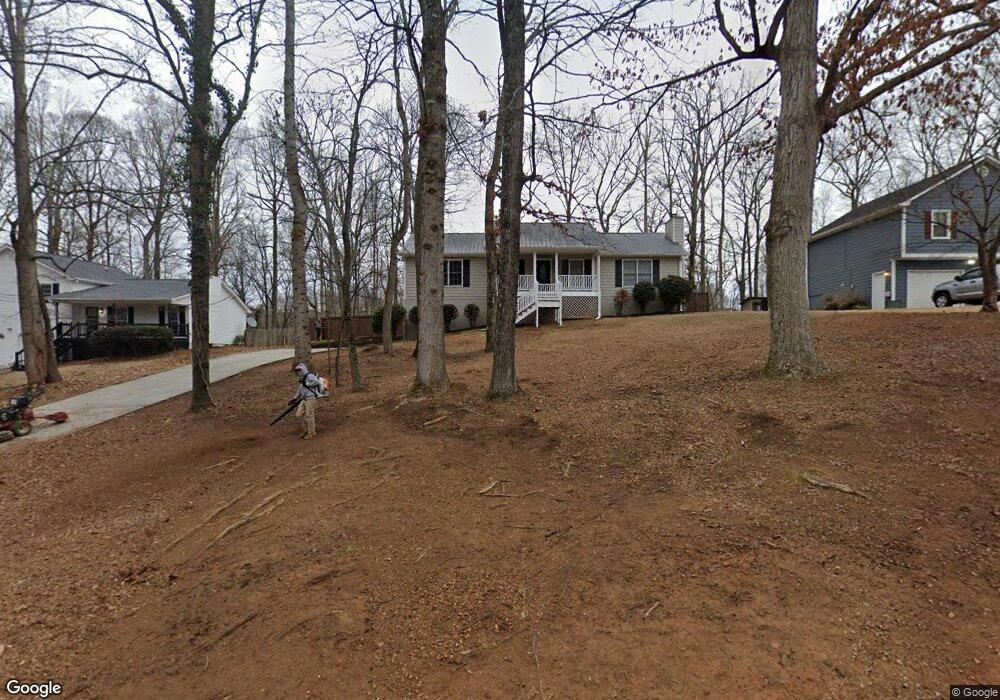
This home is located at 287 Jamie Dr, Hiram, GA 30141 and is currently estimated at $351,109, approximately $165 per square foot. 287 Jamie Dr is a home located in Paulding County with nearby schools including Connie Dugan Elementary School, Irma C. Austin Middle School, and South Paulding High School.
Ownership History
Date
Name
Owned For
Owner Type
Purchase Details
Closed on
Mar 27, 2025
Sold by
Open House Atlanta Realty & Investments
Bought by
Koei Delight Co Ltd
Current Estimated Value
Purchase Details
Closed on
Jul 26, 2024
Sold by
Offerpad Spvborrower1 Llc
Bought by
Open House Atlanta Realty & Investments
Purchase Details
Closed on
Jul 16, 2024
Sold by
Tolbert Bryan L
Bought by
Offerpad Spvborrower1 Llc
Purchase Details
Closed on
Apr 18, 2011
Sold by
Us Bank Na 2006-Ff12
Bought by
Tolbert Dorothy L and Tolbert Johnny L
Home Financials for this Owner
Home Financials are based on the most recent Mortgage that was taken out on this home.
Original Mortgage
$47,920
Interest Rate
4.74%
Mortgage Type
New Conventional
Purchase Details
Closed on
Feb 1, 2011
Sold by
Crutchfield Mark A and Crutchfield Veda M
Bought by
Us Bank Na Series 2006-Ff12
Create a Home Valuation Report for This Property
The Home Valuation Report is an in-depth analysis detailing your home's value as well as a comparison with similar homes in the area
Home Values in the Area
Average Home Value in this Area
Purchase History
| Date | Buyer | Sale Price | Title Company |
|---|---|---|---|
| Koei Delight Co Ltd | $377,000 | -- | |
| Open House Atlanta Realty & Investments | $244,000 | -- | |
| Offerpad Spvborrower1 Llc | $235,000 | -- | |
| Tolbert Dorothy L | $59,900 | -- | |
| Us Bank Na Series 2006-Ff12 | $54,185 | -- |
Source: Public Records
Mortgage History
| Date | Status | Borrower | Loan Amount |
|---|---|---|---|
| Previous Owner | Tolbert Dorothy L | $47,920 |
Source: Public Records
Tax History Compared to Growth
Tax History
| Year | Tax Paid | Tax Assessment Tax Assessment Total Assessment is a certain percentage of the fair market value that is determined by local assessors to be the total taxable value of land and additions on the property. | Land | Improvement |
|---|---|---|---|---|
| 2024 | $2,774 | $114,744 | $12,000 | $102,744 |
| 2023 | $2,836 | $111,300 | $12,000 | $99,300 |
| 2022 | $2,539 | $99,272 | $12,000 | $87,272 |
| 2021 | $2,071 | $71,276 | $10,000 | $61,276 |
| 2020 | $2,061 | $69,404 | $10,000 | $59,404 |
| 2019 | $1,810 | $60,076 | $10,000 | $50,076 |
| 2018 | $1,801 | $59,780 | $10,000 | $49,780 |
| 2017 | $1,740 | $56,972 | $10,000 | $46,972 |
Source: Public Records
Map
Nearby Homes
- 269 Shelby Ln
- 23 Bomar Ln
- 461 Austin Bridge Rd
- 81 Bridgemill Dr
- 214 Bruce Rd
- 3061 Dallas Nebo Rd
- 554 Oak Landing Cir
- 512 Oakbridge Dr
- 43 Oak Landing Cir
- 47 Collins Dr
- 196 Lambeth Dr
- 1150 Denton Rd Unit 371
- 1150 Denton Rd
- 1267 Austin Bridge Rd
- 66 Charlotte Place
- 50 Carrington Hills
- 1050 Denton Rd
- 280 Glenn Eagles Way
- 1305 Denton Rd
- 94 Oberlochen Way
- 311 Jamie Dr
- 51 Elizabeth Place
- 263 Jamie Dr
- 58 Shelby Ln
- 61 Elizabeth Place
- 298 Jamie Dr
- 278 Jamie Dr
- 316 Jamie Dr
- 258 Jamie Dr
- 258 Jamie Dr Unit LOT 42
- 359 Jamie Dr
- 84 Shelby Ln
- 348 Jamie Dr
- 75 Elizabeth Place
- 75 Elizabeth Place
- 75 Elizabeth Place Unit 63
- 240 Jamie Dr
- 66 Elizabeth Place
- 362 Jamie Dr
- 377 Jamie Dr