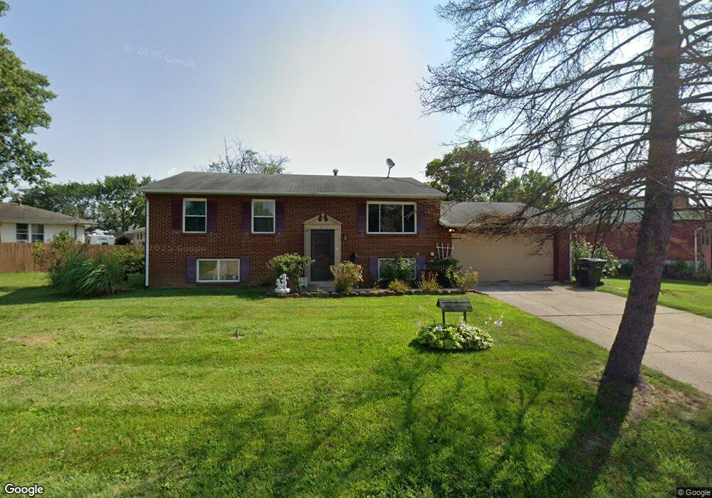
2870 Chesfield Dr Columbus, OH 43204
Brookshire NeighborhoodEstimated Value: $224,000 - $273,000
3
Beds
2
Baths
2,128
Sq Ft
$119/Sq Ft
Est. Value
About This Home
This home is located at 2870 Chesfield Dr, Columbus, OH 43204 and is currently estimated at $253,712, approximately $119 per square foot. 2870 Chesfield Dr is a home located in Franklin County with nearby schools including Binns Elementary School, Wedgewood Middle School, and Briggs High School.
Ownership History
Date
Name
Owned For
Owner Type
Purchase Details
Closed on
Dec 22, 2023
Sold by
Barrett Tina M and Jeffries Sheila J
Bought by
Barrett Tina M and Barrett Michael R
Current Estimated Value
Home Financials for this Owner
Home Financials are based on the most recent Mortgage that was taken out on this home.
Original Mortgage
$135,836
Outstanding Balance
$133,457
Interest Rate
7.22%
Mortgage Type
FHA
Estimated Equity
$120,255
Purchase Details
Closed on
May 15, 1964
Bought by
Rose Junior B and Rose Mollie A
Create a Home Valuation Report for This Property
The Home Valuation Report is an in-depth analysis detailing your home's value as well as a comparison with similar homes in the area
Home Values in the Area
Average Home Value in this Area
Purchase History
| Date | Buyer | Sale Price | Title Company |
|---|---|---|---|
| Barrett Tina M | $105,800 | Great American Title | |
| Rose Junior B | -- | -- |
Source: Public Records
Mortgage History
| Date | Status | Borrower | Loan Amount |
|---|---|---|---|
| Open | Barrett Tina M | $135,836 |
Source: Public Records
Tax History Compared to Growth
Tax History
| Year | Tax Paid | Tax Assessment Tax Assessment Total Assessment is a certain percentage of the fair market value that is determined by local assessors to be the total taxable value of land and additions on the property. | Land | Improvement |
|---|---|---|---|---|
| 2024 | $3,324 | $74,070 | $15,580 | $58,490 |
| 2023 | $3,282 | $74,070 | $15,580 | $58,490 |
| 2022 | $3,343 | $42,950 | $9,940 | $33,010 |
| 2021 | $2,232 | $42,950 | $9,940 | $33,010 |
| 2020 | $2,234 | $42,950 | $9,940 | $33,010 |
| 2019 | $2,228 | $36,720 | $8,650 | $28,070 |
| 2018 | $1,992 | $36,720 | $8,650 | $28,070 |
| 2017 | $2,226 | $36,720 | $8,650 | $28,070 |
| 2016 | $1,941 | $29,300 | $6,270 | $23,030 |
| 2015 | $1,762 | $29,300 | $6,270 | $23,030 |
| 2014 | $1,766 | $29,300 | $6,270 | $23,030 |
| 2013 | $765 | $34,475 | $7,385 | $27,090 |
Source: Public Records
Map
Nearby Homes
- 2856 Chesfield Dr
- 1248 Gresham Rd
- 2987 Daisy Ln
- 2929 Briggs Rd
- 1520 Fall Brook Rd
- 2743 Saint Joseph Ave
- 1037 Chestershire Rd
- 2547 Rosedale Ave
- 2610 Spaatz Ave
- 1465 Tall Meadows Dr
- 1181 Onslow Dr
- 3029 Rosedale Ave
- 903 S Harris Ave
- 2743 Bernadette Rd
- 2783-2785 Vanderberg Ave
- 898 Chestershire Rd
- 890 S Roys Ave
- 2687 Vanderberg Ave
- 898 Binns Blvd
- 894 Binns Blvd
- 2864 Chesfield Dr
- 2861 Longfield Rd
- 2876 Chesfield Dr
- 2853 Longfield Rd
- 2869 Chesfield Dr
- 2867 Chesfield Dr
- 2841 Longfield Rd
- 2871 Chesfield Dr
- 2865 Chesfield Dr
- 2873 Chesfield Dr
- 2861 Chesfield Dr
- 2848 Chesfield Dr
- 2875 Chesfield Dr
- 2833 Longfield Rd
- 2885 Longfield Rd
- 2853 Chesfield Dr
- 1328 Bellflower Ave
- 2860 Longfield Rd
- 2836 Chesfield Dr
- 1336 Bellflower Ave