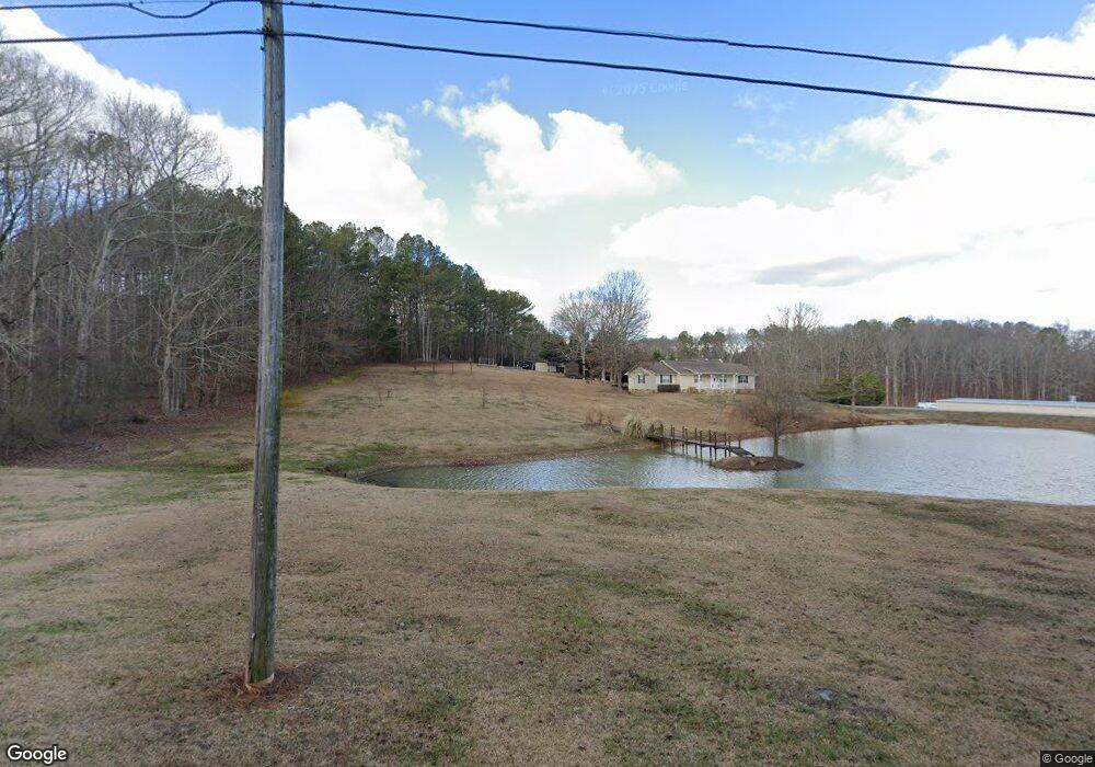
2871 McDaniel Station Rd SW Adairsville, GA 30103
Estimated Value: $226,000 - $274,000
3
Beds
2
Baths
1,929
Sq Ft
$132/Sq Ft
Est. Value
About This Home
This home is located at 2871 McDaniel Station Rd SW, Adairsville, GA 30103 and is currently estimated at $253,811, approximately $131 per square foot. 2871 McDaniel Station Rd SW is a home located in Gordon County with nearby schools including Swain Elementary School, Ashworth Middle School, and Gordon Central High School.
Ownership History
Date
Name
Owned For
Owner Type
Purchase Details
Closed on
Nov 18, 2022
Sold by
Talley Martha H
Bought by
Thomas Martin K and Thomas Carmen L
Current Estimated Value
Purchase Details
Closed on
Oct 3, 2003
Sold by
Talley Phillis
Bought by
Talley Edwin J and Talley Martha H
Purchase Details
Closed on
Jan 4, 2002
Sold by
Vanhorn Wesley B
Bought by
Talley Phillis
Purchase Details
Closed on
Dec 13, 1995
Bought by
Vanhorn Wesley B
Create a Home Valuation Report for This Property
The Home Valuation Report is an in-depth analysis detailing your home's value as well as a comparison with similar homes in the area
Home Values in the Area
Average Home Value in this Area
Purchase History
| Date | Buyer | Sale Price | Title Company |
|---|---|---|---|
| Thomas Martin K | $135,000 | -- | |
| Talley Edwin J | $106,000 | -- | |
| Talley Phillis | $107,000 | -- | |
| Vanhorn Wesley B | -- | -- |
Source: Public Records
Tax History Compared to Growth
Tax History
| Year | Tax Paid | Tax Assessment Tax Assessment Total Assessment is a certain percentage of the fair market value that is determined by local assessors to be the total taxable value of land and additions on the property. | Land | Improvement |
|---|---|---|---|---|
| 2024 | $1,923 | $75,680 | $5,040 | $70,640 |
| 2023 | $1,789 | $70,400 | $5,040 | $65,360 |
| 2022 | $604 | $65,520 | $5,040 | $60,480 |
| 2021 | $718 | $52,720 | $5,040 | $47,680 |
| 2020 | $746 | $53,320 | $5,040 | $48,280 |
| 2019 | $754 | $53,460 | $5,040 | $48,420 |
| 2018 | $626 | $49,020 | $5,040 | $43,980 |
| 2017 | $555 | $46,140 | $5,040 | $41,100 |
| 2016 | $557 | $46,140 | $5,040 | $41,100 |
| 2015 | $532 | $45,180 | $5,040 | $40,140 |
| 2014 | $1,193 | $42,976 | $5,070 | $37,906 |
Source: Public Records
Map
Nearby Homes
- 2857 McDaniel Station Rd SW
- 238 Lighthouse Cove SW
- 365 Riverboat Dr
- 178 Harbor Trail
- 269 Riverboat Dr
- Woodridge Plan at The Landing at Miller’s Ferry
- Kensington Plan at The Landing at Miller’s Ferry
- Northwyck Plan at The Landing at Miller’s Ferry
- Richmond Plan at The Landing at Miller’s Ferry
- Brookhaven Plan at The Landing at Miller’s Ferry
- Newport I Plan at The Landing at Miller’s Ferry
- Wesley Plan at The Landing at Miller’s Ferry
- Newport II Plan at The Landing at Miller’s Ferry
- Richardson Plan at The Landing at Miller’s Ferry
- Dewhurst Plan at The Landing at Miller’s Ferry
- 0 Woody Rd NW Unit 10634615
- 3293 Rome Rd SW
- 110 Darby Rd SW
- 211 Darby Rd SW
- 3610 Rome Rd SW
- 2875 McDaniel Station Rd SW
- 2929 McDaniel Station Rd SW
- 2861 McDaniel Station Rd SW
- 2861A McDaniel Station Rd SW
- 2876 McDaniel Station Rd SW
- 2864 McDaniel Station Rd SW
- 3029 McDaniel Station Rd SW
- 1694 Miller Ferry Rd SW
- 1818 Miller Ferry Rd SW
- 1290 Miller Ferry Rd SW
- 222 Robbins Creek Trail SW
- 208 Robbins Creek Trail SW
- 1570 Miller Ferry Rd SW
- 310 Robbins Creek Trail SW
- 314 Robbins Creek Trail SW
- 225 Robbins Creek Trail SW
- 295 Robbins Creek Trail SW
- 250 Robbins Creek Trail SW
- 152 Robbins Creek Trail SW