


PENDING
$10K PRICE DROP
28730 State Highway T Excello, MO 65247
Estimated payment $2,171/month
Total Views
2,015
3
Beds
3
Baths
1,952
Sq Ft
$191
Price per Sq Ft
Highlights
- Above Ground Pool
- Covered Deck
- 1 Fireplace
- Waterfront
- Wood Flooring
- Side Porch
About This Home
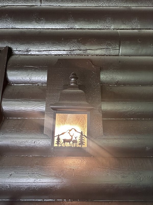
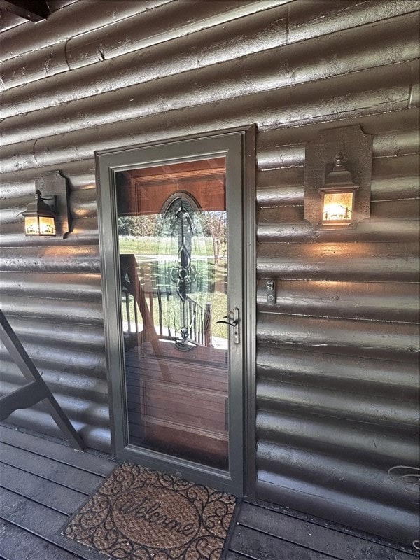
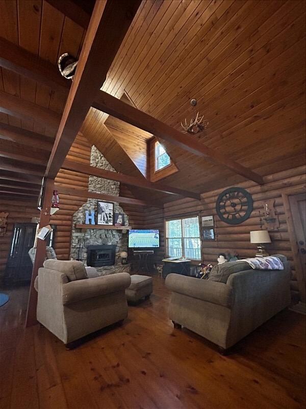
Beautiful 3-bed, 3-bath log home on 2.9 wooded acres with waterfront views. Featuring tall ceilings and an open floor plan, this home blends rustic charm with modern comfort. Enjoy summers by the above-ground pool, with a massive 5-car garage plus a lean-to for extra toys and storage. Surrounded by mature trees and natural beauty, this property offers privacy, comfort, and a true connection to the outdoors—all while being just a short drive from town amenities. Call Tiger Country Realty at 660-385-7297.
Home Details
Home Type
- Single Family
Est. Annual Taxes
- $2,296
Year Built
- Built in 1997
Lot Details
- 2.97 Acre Lot
- Waterfront
- Property is in excellent condition
HOA Fees
- $23 Monthly HOA Fees
Home Design
- Fire Rated Drywall
- Metal Roof
Interior Spaces
- 1,952 Sq Ft Home
- 2-Story Property
- Ceiling Fan
- 1 Fireplace
- Vinyl Clad Windows
- Window Treatments
- Family Room Downstairs
- Living Room
- Dining Room
Kitchen
- Electric Oven or Range
- Microwave
- Dishwasher
Flooring
- Wood
- Carpet
Bedrooms and Bathrooms
- 3 Bedrooms
- 3 Full Bathrooms
Laundry
- Laundry on main level
- Dryer
- Washer
Basement
- Walk-Out Basement
- Basement Fills Entire Space Under The House
Home Security
- Storm Doors
- Carbon Monoxide Detectors
- Fire and Smoke Detector
Parking
- 5 Car Garage
- Garage Door Opener
Outdoor Features
- Above Ground Pool
- Covered Deck
- Side Porch
Utilities
- Forced Air Heating and Cooling System
- Propane
- Rural Water
- Electric Water Heater
- Septic Tank
Map
Create a Home Valuation Report for This Property
The Home Valuation Report is an in-depth analysis detailing your home's value as well as a comparison with similar homes in the area
Home Values in the Area
Average Home Value in this Area
Tax History
| Year | Tax Paid | Tax Assessment Tax Assessment Total Assessment is a certain percentage of the fair market value that is determined by local assessors to be the total taxable value of land and additions on the property. | Land | Improvement |
|---|---|---|---|---|
| 2025 | $2,296 | $48,300 | $7,800 | $40,500 |
| 2024 | $2,296 | $43,140 | $0 | $0 |
| 2023 | $2,288 | $43,140 | $0 | $0 |
| 2022 | $2,199 | $43,140 | $0 | $0 |
| 2021 | $2,188 | $41,560 | $0 | $0 |
| 2020 | $2,200 | $41,560 | $0 | $0 |
| 2019 | $2,194 | $41,560 | $41,560 | $0 |
| 2018 | $2,103 | $41,560 | $41,560 | $0 |
| 2017 | $1,948 | $218,750 | $36,600 | $182,150 |
| 2016 | $1,899 | $41,560 | $0 | $0 |
| 2015 | -- | $40,310 | $0 | $0 |
| 2014 | -- | $36,990 | $0 | $0 |
| 2012 | -- | $36,990 | $0 | $0 |
Source: Public Records
Property History
| Date | Event | Price | List to Sale | Price per Sq Ft |
|---|---|---|---|---|
| 10/31/2025 10/31/25 | Pending | -- | -- | -- |
| 09/10/2025 09/10/25 | Price Changed | $372,000 | -2.6% | $191 / Sq Ft |
| 07/02/2025 07/02/25 | For Sale | $382,000 | -- | $196 / Sq Ft |
Source: Northeast Central Association of REALTORS®
Purchase History
| Date | Type | Sale Price | Title Company |
|---|---|---|---|
| Grant Deed | -- | Towne & Cntry Abs | |
| Grant Deed | $100,000 | -- |
Source: Public Records
Mortgage History
| Date | Status | Loan Amount | Loan Type |
|---|---|---|---|
| Previous Owner | $80,000 | New Conventional |
Source: Public Records
About the Listing Agent
I am a hardworking, go getter Broker that works intentionally for my clients. I will keep pushing and finding solutions to anything that may comes up. I take pride that I am in this with you even past the closing table. I keep in contact and assist my sellers and buyers new to the area to make sure they get settled and connected to the community. This is my full time concentration and my passion is working with past and new folks! I love my job and my energy shows that! Call me today, I
Sonja's Other Listings
Source: Northeast Central Association of REALTORS®
MLS Number: 41881
APN: 000022-0930-00000-000306
Disclaimer: Certain information contained herein is derived from information provided by parties other than Homes.com. All information provided is deemed reliable, but is not guaranteed to be accurate and should be independently verified.
![]() IDX information is provided exclusively for personal, non-commercial use, and may not be used for any purpose other than to identify prospective properties consumers may be interested in purchasing. Information is deemed reliable but not guaranteed.
IDX information is provided exclusively for personal, non-commercial use, and may not be used for any purpose other than to identify prospective properties consumers may be interested in purchasing. Information is deemed reliable but not guaranteed.
Nearby Homes
- 28156 State Highway T
- 30663 E Press St
- 35581 Hwy Y
- 181 E Randolph St
- 34648 U S 63
- 0 State Highway T
- 201 S Lake Cir
- 23393 Gazelle St
- 23245 Gazelle St
- 29601 Cottonwood Ln
- 803 Coates St
- 902 S Rollins St
- 35581 State Hwy Y
- 408 Crescent Dr
- 102 W 2nd St
- 205 S Rutherford St
- 25457 Helmet Rd
- 25596 Southwest Blvd
- 1002 W Bourke St
- 204 Duff St