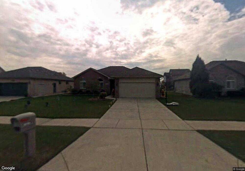
28750 Yorkshire Dr Chesterfield, MI 48047
Estimated Value: $314,339 - $360,000
--
Bed
1
Bath
1,577
Sq Ft
$217/Sq Ft
Est. Value
About This Home
This home is located at 28750 Yorkshire Dr, Chesterfield, MI 48047 and is currently estimated at $342,085, approximately $216 per square foot. 28750 Yorkshire Dr is a home located in Macomb County with nearby schools including Joseph M. Carkenord Elementary School, L'Anse Creuse High School - North, and Austin Catholic Academy.
Ownership History
Date
Name
Owned For
Owner Type
Purchase Details
Closed on
Sep 29, 2003
Sold by
Pozar Frank A
Bought by
Pozar Frank A and Pozar Zsuzsanna
Current Estimated Value
Home Financials for this Owner
Home Financials are based on the most recent Mortgage that was taken out on this home.
Original Mortgage
$100,800
Interest Rate
6.43%
Mortgage Type
Purchase Money Mortgage
Purchase Details
Closed on
Jul 10, 1997
Sold by
Gino Building Co
Bought by
Pozar F
Create a Home Valuation Report for This Property
The Home Valuation Report is an in-depth analysis detailing your home's value as well as a comparison with similar homes in the area
Home Values in the Area
Average Home Value in this Area
Purchase History
| Date | Buyer | Sale Price | Title Company |
|---|---|---|---|
| Pozar Frank A | -- | -- | |
| Pozar F | $154,585 | -- |
Source: Public Records
Mortgage History
| Date | Status | Borrower | Loan Amount |
|---|---|---|---|
| Closed | Pozar Frank A | $100,800 |
Source: Public Records
Tax History Compared to Growth
Tax History
| Year | Tax Paid | Tax Assessment Tax Assessment Total Assessment is a certain percentage of the fair market value that is determined by local assessors to be the total taxable value of land and additions on the property. | Land | Improvement |
|---|---|---|---|---|
| 2025 | $3,395 | $152,100 | $0 | $0 |
| 2024 | $2,288 | $143,200 | $0 | $0 |
| 2023 | $2,170 | $133,300 | $0 | $0 |
| 2022 | $3,031 | $122,100 | $0 | $0 |
| 2021 | $2,948 | $118,600 | $0 | $0 |
| 2020 | $1,992 | $114,300 | $0 | $0 |
| 2019 | $2,522 | $108,400 | $0 | $0 |
| 2018 | $2,669 | $101,300 | $16,500 | $84,800 |
| 2017 | $2,577 | $93,750 | $16,500 | $77,250 |
| 2016 | $2,522 | $93,750 | $0 | $0 |
| 2015 | $858 | $88,900 | $0 | $0 |
| 2014 | $858 | $78,000 | $16,500 | $61,500 |
| 2012 | -- | $0 | $0 | $0 |
Source: Public Records
Map
Nearby Homes
- 28691 Yorkshire Dr
- 28787 Yorkshire Dr
- 28552 Buckinghamshire Dr
- 50325 Maurice Rd
- 48713 Chelmsford Ct Unit 127
- 50131 N Benny Ct
- 48345 Whittington Dr
- 48832 Birmingham Dr
- 50218 N Benny Ct
- 28734 Yarmouth Ct Unit 18
- 48117 Cotton Creek Blvd
- 28715 Portsmouth Ct Unit 32
- 50013 S Jimmy Ct
- 50451 Bay Run N
- 28342 Nadia Ln
- 28327 Nadia Ln
- 27944 Cotton Rd
- 28326 Nadia Ln
- 0 23 Mile Rd Unit 50172164
- 28315 Gold Rd
- 28762 Yorkshire Dr
- 28738 Yorkshire Dr
- 28726 Yorkshire Dr
- 49688 Brockton Ct
- 49736 Brockton Ct
- 28774 Yorkshire Dr
- 49737 Edinborough Dr
- 28751 Yorkshire Dr
- 28739 Yorkshire Dr
- 28714 Yorkshire Dr
- 49689 Edinborough Dr
- 49735 Brockton Ct
- 49592 Brockton Ct
- 28775 Yorkshire Dr
- 28727 Yorkshire Dr
- 28702 Yorkshire Dr Unit 23
- 49593 Edinborough Dr
- 50015 Pembroke Dr
- 28715 Yorkshire Dr
- 49687 Brockton Ct