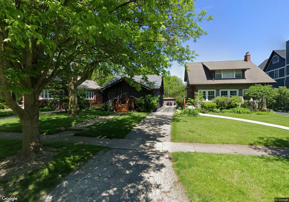
288 Addison Rd Riverside, IL 60546
Estimated Value: $431,000 - $636,000
4
Beds
2
Baths
2,270
Sq Ft
$254/Sq Ft
Est. Value
About This Home
This home is located at 288 Addison Rd, Riverside, IL 60546 and is currently estimated at $575,784, approximately $253 per square foot. 288 Addison Rd is a home located in Cook County with nearby schools including Central Elementary School, L J Hauser Jr High School, and Riverside Brookfield High School.
Ownership History
Date
Name
Owned For
Owner Type
Purchase Details
Closed on
May 5, 2015
Sold by
Soluri Anthony F and Soluri Suzanne Recht
Bought by
Soluri Anthony F and Soluri Suzanne Recht
Current Estimated Value
Home Financials for this Owner
Home Financials are based on the most recent Mortgage that was taken out on this home.
Original Mortgage
$180,000
Outstanding Balance
$121,247
Interest Rate
0.78%
Mortgage Type
New Conventional
Estimated Equity
$454,537
Purchase Details
Closed on
Sep 26, 1997
Sold by
Samos Veronica
Bought by
Soluri Anthony F and Recht Suzanne R
Home Financials for this Owner
Home Financials are based on the most recent Mortgage that was taken out on this home.
Original Mortgage
$193,500
Interest Rate
7.65%
Purchase Details
Closed on
Apr 10, 1997
Sold by
First American Bank
Bought by
Samos Veronica
Create a Home Valuation Report for This Property
The Home Valuation Report is an in-depth analysis detailing your home's value as well as a comparison with similar homes in the area
Home Values in the Area
Average Home Value in this Area
Purchase History
| Date | Buyer | Sale Price | Title Company |
|---|---|---|---|
| Soluri Anthony F | $10,000 | None Available | |
| Soluri Anthony F | $143,333 | -- | |
| Samos Veronica | -- | -- |
Source: Public Records
Mortgage History
| Date | Status | Borrower | Loan Amount |
|---|---|---|---|
| Open | Soluri Anthony F | $180,000 | |
| Closed | Soluri Anthony F | $193,500 |
Source: Public Records
Tax History
| Year | Tax Paid | Tax Assessment Tax Assessment Total Assessment is a certain percentage of the fair market value that is determined by local assessors to be the total taxable value of land and additions on the property. | Land | Improvement |
|---|---|---|---|---|
| 2025 | $13,127 | $47,000 | $9,120 | $37,880 |
| 2024 | $13,127 | $47,000 | $9,120 | $37,880 |
| 2023 | $10,829 | $47,000 | $9,120 | $37,880 |
| 2022 | $10,829 | $34,428 | $7,980 | $26,448 |
| 2021 | $10,464 | $34,427 | $7,980 | $26,447 |
| 2020 | $10,268 | $34,427 | $7,980 | $26,447 |
| 2019 | $10,806 | $36,874 | $7,296 | $29,578 |
| 2018 | $12,597 | $36,874 | $7,296 | $29,578 |
| 2017 | $11,121 | $39,718 | $7,296 | $32,422 |
| 2016 | $9,438 | $31,082 | $6,384 | $24,698 |
| 2015 | $10,950 | $34,445 | $6,384 | $28,061 |
| 2014 | $10,781 | $34,445 | $6,384 | $28,061 |
| 2013 | $9,932 | $34,464 | $6,384 | $28,080 |
Source: Public Records
Map
Nearby Homes
- 269 Shenstone Rd
- 369 Addison Rd
- 475 Shenstone Rd Unit 104
- 475 Shenstone Rd Unit 304
- 475 Shenstone Rd Unit 303
- 484 Shenstone Rd
- 231 Bartram Rd
- 280 Blackhawk Rd
- 10 E Burlington St Unit 2C
- 10 E Burlington St Unit 2B
- 7048 35th St
- 176 Riverside Rd
- 3111 Wenonah Ave
- 262 Lionel Rd
- 303 Lionel Rd
- 315 Bartram Rd
- 101 Southcote Rd
- 562 Byrd Rd
- 305 Desplaines Ave
- 78 Pine Ave
- 292 Addison Rd
- 296 Addison Rd
- 300 Addison Rd
- 276 Addison Rd
- 272 Addison Rd
- 311 Shenstone Rd
- 309 Shenstone Rd
- 317 Shenstone Rd
- 305 Shenstone Rd
- 304 Addison Rd
- 321 Shenstone Rd
- 285 Addison Rd
- 287 Addison Rd
- 301 Shenstone Rd
- 268 Addison Rd
- 283 Addison Rd
- 297 Addison Rd
- 306 Addison Rd
- 279 Addison Rd
- 325 Shenstone Rd
Your Personal Tour Guide
Ask me questions while you tour the home.