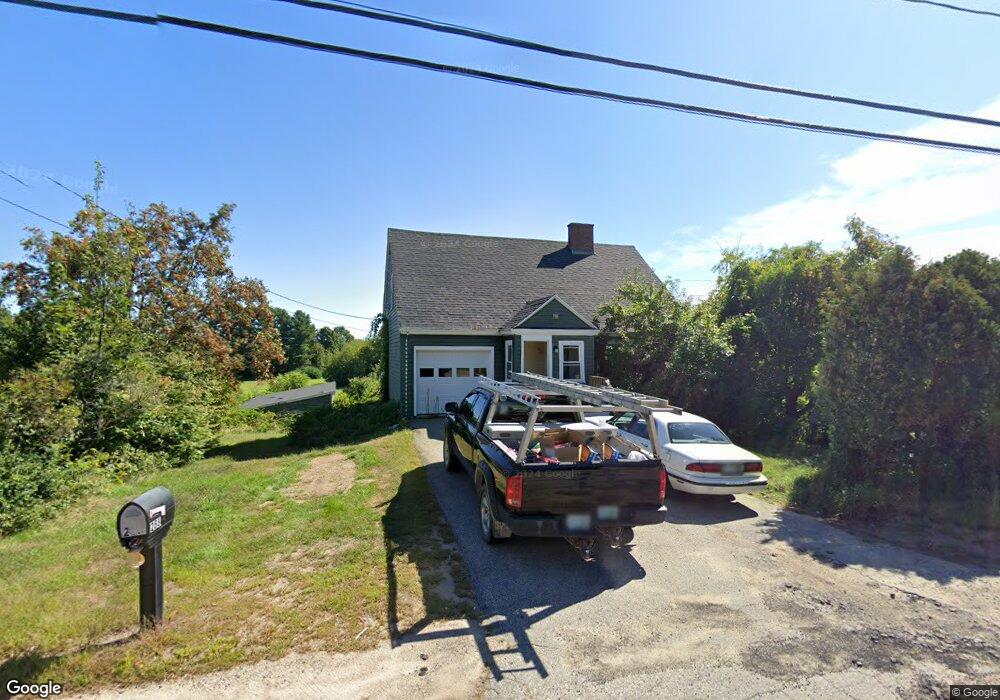
288 Dover Point Rd Dover, NH 03820
Dover Point NeighborhoodEstimated Value: $542,414 - $592,000
3
Beds
2
Baths
1,521
Sq Ft
$370/Sq Ft
Est. Value
About This Home
This home is located at 288 Dover Point Rd, Dover, NH 03820 and is currently estimated at $562,854, approximately $370 per square foot. 288 Dover Point Rd is a home located in Strafford County with nearby schools including Garrison School, Dover Middle School, and Dover Senior High School.
Ownership History
Date
Name
Owned For
Owner Type
Purchase Details
Closed on
Mar 27, 2024
Sold by
Angel Goddess T and Angel Deters
Bought by
Dover Point T and Konyha
Current Estimated Value
Purchase Details
Closed on
Jan 5, 2017
Sold by
Deters Kelsi
Bought by
Angel Goddess T and Angel Deters
Purchase Details
Closed on
Jan 3, 2017
Sold by
Angel Goddess T and Angel Deters
Bought by
Deters Kelsi
Purchase Details
Closed on
Jun 2, 2006
Sold by
Cherub Ralph T
Bought by
Angel Goddess T
Create a Home Valuation Report for This Property
The Home Valuation Report is an in-depth analysis detailing your home's value as well as a comparison with similar homes in the area
Home Values in the Area
Average Home Value in this Area
Purchase History
| Date | Buyer | Sale Price | Title Company |
|---|---|---|---|
| Dover Point T | -- | None Available | |
| Dover Point T | -- | None Available | |
| Dover Point T | -- | None Available | |
| Angel Goddess T | -- | -- | |
| Angel Goddess T | -- | -- | |
| Deters Kelsi | -- | -- | |
| Deters Kelsi | -- | -- | |
| Angel Goddess T | $100,000 | -- | |
| Angel Goddess T | $100,000 | -- |
Source: Public Records
Tax History
| Year | Tax Paid | Tax Assessment Tax Assessment Total Assessment is a certain percentage of the fair market value that is determined by local assessors to be the total taxable value of land and additions on the property. | Land | Improvement |
|---|---|---|---|---|
| 2024 | $8,340 | $459,000 | $181,200 | $277,800 |
| 2023 | $7,437 | $397,700 | $158,500 | $239,200 |
| 2022 | $7,503 | $378,200 | $158,500 | $219,700 |
| 2021 | $7,068 | $325,700 | $134,900 | $190,800 |
| 2020 | $7,221 | $290,600 | $134,900 | $155,700 |
| 2019 | $6,942 | $275,600 | $123,100 | $152,500 |
| 2018 | $6,380 | $256,000 | $111,300 | $144,700 |
| 2017 | $6,105 | $236,000 | $95,600 | $140,400 |
| 2016 | $5,723 | $217,700 | $90,000 | $127,700 |
| 2015 | $5,386 | $202,400 | $77,800 | $124,600 |
| 2014 | $5,264 | $202,400 | $77,800 | $124,600 |
| 2011 | $4,979 | $198,200 | $72,700 | $125,500 |
Source: Public Records
Map
Nearby Homes
- 21 Clearwater Dr
- Slip B18 Little Bay
- 18 Deborah Ln
- 41 Clearwater Dr
- 0 Cote Dr Unit 55B
- 348 Dover Point Rd
- 354 Dover Point Rd
- 220 Dover Point Rd
- 33 Little Bay Dr
- 13 Little Bay Dr
- 18 Little Bay Dr
- 708 River Rd Unit 2
- 708 River Rd Unit 3
- 25 Fosters Dr
- 71 Shipwright Way
- 10 Shipwright Way
- 69 Polly Ann Trailer Park
- TBD Pasture Hill Dr
- Lot 2 Pasture Hill Dr
- 10 Pasture Hill Dr
- 286 Dover Point Rd
- 285 Dover Point Rd
- 284 Dover Point Rd
- 294 Dover Point Rd
- 283 Dover Point Rd
- 283 Dover Point Rd
- 289 Dover Point Rd
- 282 Dover Point Rd
- 293 Dover Point Rd
- 281 Dover Point Rd
- 3 Pineview Dr
- 296 Dover Point Rd
- 2 Pineview Dr
- 1 Homestead Ln
- 278 Dover Point Rd
- 306A Dover Point Rd
- 5 Pineview Dr
- 298A Dover Point Rd
- 298 Dover Point Rd
- 298 Dover Point Rd
Your Personal Tour Guide
Ask me questions while you tour the home.