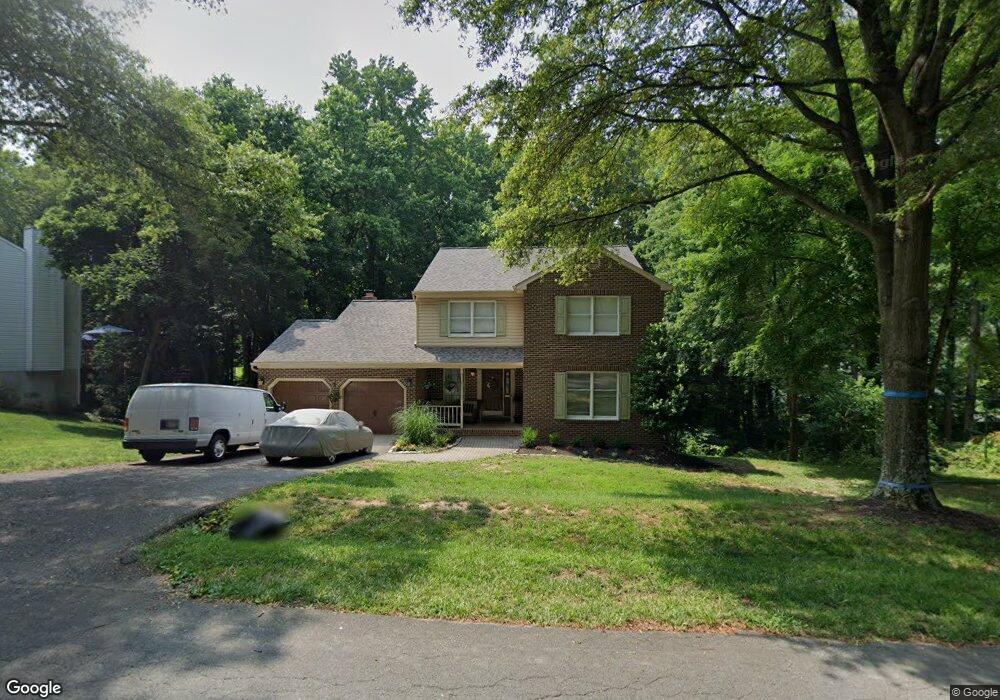
288 Locust Ridge Ln Arnold, MD 21012
Estimated Value: $602,297 - $757,000
4
Beds
4
Baths
2,292
Sq Ft
$286/Sq Ft
Est. Value
About This Home
This home is located at 288 Locust Ridge Ln, Arnold, MD 21012 and is currently estimated at $655,574, approximately $286 per square foot. 288 Locust Ridge Ln is a home located in Anne Arundel County with nearby schools including Arnold Elementary School, Severn River Middle School, and Broadneck High School.
Ownership History
Date
Name
Owned For
Owner Type
Purchase Details
Closed on
Jan 15, 2019
Sold by
Diveibliss Watson Catherine A and Watson Bye Catherine A
Bought by
Watson Bye Catherine A
Current Estimated Value
Purchase Details
Closed on
Jun 28, 2004
Sold by
Divelbliss Rex A
Purchase Details
Closed on
Mar 24, 2004
Sold by
Divelbliss Rex A
Create a Home Valuation Report for This Property
The Home Valuation Report is an in-depth analysis detailing your home's value as well as a comparison with similar homes in the area
Home Values in the Area
Average Home Value in this Area
Purchase History
| Date | Buyer | Sale Price | Title Company |
|---|---|---|---|
| Watson Bye Catherine A | -- | United Title & Escrow Inc | |
| -- | -- | -- | |
| -- | -- | -- |
Source: Public Records
Tax History
| Year | Tax Paid | Tax Assessment Tax Assessment Total Assessment is a certain percentage of the fair market value that is determined by local assessors to be the total taxable value of land and additions on the property. | Land | Improvement |
|---|---|---|---|---|
| 2025 | $5,925 | $516,000 | -- | -- |
| 2024 | $5,925 | $495,200 | $279,700 | $215,500 |
| 2023 | $5,792 | $487,033 | $0 | $0 |
| 2022 | $5,434 | $478,867 | $0 | $0 |
| 2020 | $5,311 | $470,700 | $264,700 | $206,000 |
| 2019 | $5,315 | $470,700 | $264,700 | $206,000 |
| 2018 | $4,942 | $487,400 | $196,000 | $291,400 |
| 2017 | $4,989 | $467,967 | $0 | $0 |
| 2016 | -- | $448,533 | $0 | $0 |
| 2015 | -- | $429,100 | $0 | $0 |
| 2014 | -- | $429,100 | $0 | $0 |
Source: Public Records
Map
Nearby Homes
- 1241 Tamarack Trail
- 1078 Brightleaf Ct
- 136 Collington Ct
- 303 Ternwing Dr
- 19 Roe Ln
- 394 Kings College Dr
- 276 Overleaf Dr
- 371 Freshfield Ln
- 1232 Taylor Ave
- 1294 Circle Dr
- 1304 Farley Ct S
- 413 Colonial Ridge Ln
- 1350 Ritchie Hwy
- 539 Greenblades Ct
- 208 Admirals Ct
- 1419 Mariner Dr
- 1420 Mariner Dr
- 1159 Greenhill Rd
- 1254 Masters Dr
- 1277 Ritchie Hwy Unit 195
- 286 Locust Ridge Ln
- 290 Locust Ridge Ln
- 257 Claremont Ct
- 289 Locust Ridge Ln
- 287 Locust Ridge Ln
- 291 Locust Ridge Ln
- 253 Pickett Ct
- 255 Claremont Ct
- 280 Locust Ridge Ln
- 294 Locust Ridge Ln
- 285 Locust Ridge Ln
- 283 Locust Ridge Ln
- 293 Locust Ridge Ln
- 259 Claremont Ct
- 281 Locust Ridge Ln
- 255 Pickett Ct
- 295 Locust Ridge Ln
- 457 College Pkwy
- 256 Claremont Ct
- 279 Locust Ridge Ln
Your Personal Tour Guide
Ask me questions while you tour the home.