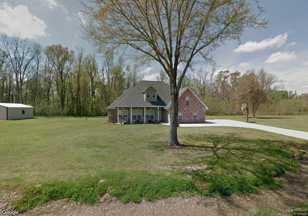
2881 Laurel Point Dr Blanks, LA 70756
Estimated Value: $273,000 - $395,000
4
Beds
2
Baths
2,082
Sq Ft
$152/Sq Ft
Est. Value
About This Home
This home is located at 2881 Laurel Point Dr, Blanks, LA 70756 and is currently estimated at $317,483, approximately $152 per square foot. 2881 Laurel Point Dr is a home located in Pointe Coupee Parish.
Ownership History
Date
Name
Owned For
Owner Type
Purchase Details
Closed on
Oct 5, 2020
Sold by
Graffeo Craig J and Graffeo Kristen L
Bought by
Gibson Meshia
Current Estimated Value
Home Financials for this Owner
Home Financials are based on the most recent Mortgage that was taken out on this home.
Original Mortgage
$46,000
Outstanding Balance
$40,915
Interest Rate
2.9%
Mortgage Type
New Conventional
Estimated Equity
$276,568
Purchase Details
Closed on
Sep 30, 2011
Sold by
Cashio Samuel Charles and Cashio Spring Guilott
Bought by
Graffeo Craig J and Graffeo Kristen L
Create a Home Valuation Report for This Property
The Home Valuation Report is an in-depth analysis detailing your home's value as well as a comparison with similar homes in the area
Home Values in the Area
Average Home Value in this Area
Purchase History
| Date | Buyer | Sale Price | Title Company |
|---|---|---|---|
| Gibson Meshia | $230,000 | None Available | |
| Graffeo Craig J | -- | -- |
Source: Public Records
Mortgage History
| Date | Status | Borrower | Loan Amount |
|---|---|---|---|
| Open | Gibson Meshia | $46,000 |
Source: Public Records
Tax History Compared to Growth
Tax History
| Year | Tax Paid | Tax Assessment Tax Assessment Total Assessment is a certain percentage of the fair market value that is determined by local assessors to be the total taxable value of land and additions on the property. | Land | Improvement |
|---|---|---|---|---|
| 2024 | $1,323 | $24,080 | $3,000 | $21,080 |
| 2023 | $1,276 | $23,780 | $2,800 | $20,980 |
| 2022 | $1,579 | $23,780 | $2,800 | $20,980 |
| 2021 | $1,579 | $23,780 | $2,800 | $20,980 |
| 2020 | $1,579 | $23,780 | $2,800 | $20,980 |
| 2019 | $1,365 | $23,980 | $3,000 | $20,980 |
| 2018 | $1,361 | $23,980 | $3,000 | $20,980 |
| 2017 | $1,361 | $23,980 | $3,000 | $20,980 |
| 2015 | $1,460 | $23,500 | $3,000 | $20,500 |
| 2013 | $1,573 | $23,500 | $3,000 | $20,500 |
Source: Public Records
Map
Nearby Homes
- 000 Louisiana 976 Unit 2129
- 8096 E La Hwy 81
- 8361 Newfield Dr
- 8489 Lebeau St
- 2259 Maringouin Rd W
- TBD Highway 190
- 8572 Bergeron St
- 2284 W Maringouin Rd
- 4314 Overton St
- 8693 Lebeau St
- 8718 Glaser St
- 1949 Valverda Rd
- 8874 Elton St
- 4454 Oak Dr
- 6008 Fordoche Rd
- 6200 Fordoche Rd
- 4307 Cleveland Rd
- Lot 3 Cleveland Rd
- 4598 Louisiana 81
- 1602 Valverda Rd
- 2881 Laurel Pointe Dr
- 2872 Laurel Point Dr
- LOT 1-B-15 Laurel Point Dr
- 2871 Laurel Pointe Dr
- 2889 Laurel Point Dr
- 2889 Laurel Pointe Dr
- 2880 Laurel Pointe Dr
- 2845 Laurel Point Dr
- 2848 Laurel Pointe Dr
- 2845 Laurel Pointe Dr
- 2848 Laurel Pointe Dr
- 2910 Laurel Pointe Dr
- 2816 Laurel Point Dr
- 2848 Laurel Point Dr
- 1-B-23 Laurel Point Dr
- 1-B-16 Laurel Point Dr
- 1-B-15 Laurel Point Dr
- 1-B-14 Laurel Point Dr
- 1-B-12 Laurel Point Dr
- 1-B-11 Laurel Point Dr