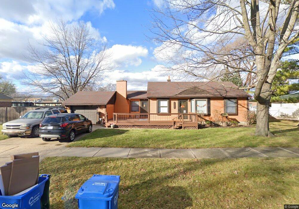
28821 Roan Dr Warren, MI 48093
Northeast Warren NeighborhoodEstimated Value: $217,000 - $227,854
3
Beds
2
Baths
1,066
Sq Ft
$209/Sq Ft
Est. Value
About This Home
This home is located at 28821 Roan Dr, Warren, MI 48093 and is currently estimated at $222,964, approximately $209 per square foot. 28821 Roan Dr is a home located in Macomb County with nearby schools including Warren Woods Tower High School, Frontier International Academy Elementary, and Warren SDA Junior Academy.
Ownership History
Date
Name
Owned For
Owner Type
Purchase Details
Closed on
Aug 24, 2005
Sold by
K Lin Enterprises Llc
Bought by
Richardson Lisa
Current Estimated Value
Home Financials for this Owner
Home Financials are based on the most recent Mortgage that was taken out on this home.
Original Mortgage
$95,920
Outstanding Balance
$56,943
Interest Rate
7.75%
Mortgage Type
Fannie Mae Freddie Mac
Estimated Equity
$166,021
Purchase Details
Closed on
Jun 29, 2005
Sold by
Arnaiz Walter
Bought by
K Lin Enterprises Llc
Home Financials for this Owner
Home Financials are based on the most recent Mortgage that was taken out on this home.
Original Mortgage
$95,920
Outstanding Balance
$56,943
Interest Rate
7.75%
Mortgage Type
Fannie Mae Freddie Mac
Estimated Equity
$166,021
Purchase Details
Closed on
Jul 23, 1999
Sold by
Ellis Jenny
Bought by
Arnaiz Walter
Create a Home Valuation Report for This Property
The Home Valuation Report is an in-depth analysis detailing your home's value as well as a comparison with similar homes in the area
Home Values in the Area
Average Home Value in this Area
Purchase History
| Date | Buyer | Sale Price | Title Company |
|---|---|---|---|
| Richardson Lisa | $119,900 | American Land Title Agency I | |
| K Lin Enterprises Llc | $90,000 | Htc | |
| Arnaiz Walter | $100,000 | -- |
Source: Public Records
Mortgage History
| Date | Status | Borrower | Loan Amount |
|---|---|---|---|
| Open | Richardson Lisa | $95,920 |
Source: Public Records
Tax History Compared to Growth
Tax History
| Year | Tax Paid | Tax Assessment Tax Assessment Total Assessment is a certain percentage of the fair market value that is determined by local assessors to be the total taxable value of land and additions on the property. | Land | Improvement |
|---|---|---|---|---|
| 2025 | $3,097 | $100,890 | $0 | $0 |
| 2024 | $3,032 | $92,910 | $0 | $0 |
| 2023 | $2,870 | $84,510 | $0 | $0 |
| 2022 | $2,722 | $74,410 | $0 | $0 |
| 2021 | $2,692 | $70,910 | $0 | $0 |
| 2020 | $2,607 | $68,400 | $0 | $0 |
| 2019 | $2,519 | $64,890 | $0 | $0 |
| 2018 | $56 | $53,550 | $0 | $0 |
| 2017 | $2,418 | $48,950 | $17,600 | $31,350 |
| 2016 | $1,774 | $48,950 | $0 | $0 |
| 2015 | -- | $41,950 | $0 | $0 |
| 2012 | -- | $34,550 | $0 | $0 |
Source: Public Records
Map
Nearby Homes
- 28621 Pinto Dr
- 11916 Geoffry Dr
- 29366 Wagner Dr
- 28203 Newport Dr
- 29379 Newport Dr
- 13053 Geoffry Dr
- 11582 Gerald Dr
- 29667 Newport Dr
- 29638 Hoover Rd Unit 638
- 29626 Hoover Rd Unit 626
- 29365 Dover Ave
- 29723 Roan Dr
- 11555 Newbern Dr
- 11511 Gerald Dr
- 12876 Martin Rd
- 13265 Geoffry Dr
- 29820 Palomino Dr
- 29819 Bonnie Dr
- 11960 E Fort Lauderdale St
- 11447 Edwin Dr
- 28841 Roan Dr
- 28781 Roan Dr
- 28820 Roan Dr
- 28780 Roan Dr
- 28840 Roan Dr
- 28961 Roan Dr
- 28741 Roan Dr
- 28821 Pinto Dr
- 28740 Roan Dr
- 28781 Pinto Dr
- 28841 Pinto Dr
- 28741 Pinto Dr
- 28701 Roan Dr
- 12292 Twelve Mile Rd
- 12434 E 12 Mile Rd
- 12434 E 12 Mile Rd Unit 101
- 12434 E 12 Mile Rd Unit 202
- 12434 E 12 Mile Rd
- 28700 Roan Dr
- 28820 Pinto Dr