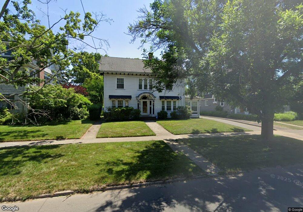
289 Central Ave New Haven, CT 06515
Westville NeighborhoodEstimated Value: $513,540 - $530,000
4
Beds
2
Baths
1,996
Sq Ft
$261/Sq Ft
Est. Value
About This Home
This home is located at 289 Central Ave, New Haven, CT 06515 and is currently estimated at $521,635, approximately $261 per square foot. 289 Central Ave is a home located in New Haven County with nearby schools including Elm City Montessori School and Hopkins School.
Ownership History
Date
Name
Owned For
Owner Type
Purchase Details
Closed on
Jul 19, 1996
Sold by
Wasserman Leslie and Ladin Ronald B
Bought by
Henderson Thomas L and Henderson Deborah A
Current Estimated Value
Home Financials for this Owner
Home Financials are based on the most recent Mortgage that was taken out on this home.
Original Mortgage
$114,950
Interest Rate
7.5%
Mortgage Type
Unknown
Create a Home Valuation Report for This Property
The Home Valuation Report is an in-depth analysis detailing your home's value as well as a comparison with similar homes in the area
Home Values in the Area
Average Home Value in this Area
Purchase History
| Date | Buyer | Sale Price | Title Company |
|---|---|---|---|
| Henderson Thomas L | $121,000 | -- |
Source: Public Records
Mortgage History
| Date | Status | Borrower | Loan Amount |
|---|---|---|---|
| Closed | Henderson Thomas L | $77,500 | |
| Open | Henderson Thomas L | $120,000 | |
| Closed | Henderson Thomas L | $100,000 | |
| Closed | Henderson Thomas L | $114,950 |
Source: Public Records
Tax History Compared to Growth
Tax History
| Year | Tax Paid | Tax Assessment Tax Assessment Total Assessment is a certain percentage of the fair market value that is determined by local assessors to be the total taxable value of land and additions on the property. | Land | Improvement |
|---|---|---|---|---|
| 2025 | $9,374 | $237,930 | $75,600 | $162,330 |
| 2024 | $9,160 | $237,930 | $75,600 | $162,330 |
| 2023 | $8,851 | $237,930 | $75,600 | $162,330 |
| 2022 | $9,458 | $237,930 | $75,600 | $162,330 |
| 2021 | $8,204 | $186,970 | $58,940 | $128,030 |
| 2020 | $8,204 | $186,970 | $58,940 | $128,030 |
| 2019 | $8,036 | $186,970 | $58,940 | $128,030 |
| 2018 | $8,036 | $186,970 | $58,940 | $128,030 |
| 2017 | $7,232 | $186,970 | $58,940 | $128,030 |
| 2016 | $8,022 | $193,060 | $69,790 | $123,270 |
| 2015 | $8,022 | $193,060 | $69,790 | $123,270 |
| 2014 | $8,022 | $193,060 | $69,790 | $123,270 |
Source: Public Records
Map
Nearby Homes
- 119 Westwood Rd
- 1975 Chapel St
- 55 Marvel Rd
- 206 W Rock Ave
- 96 Hubinger St
- 699 Forest Rd
- 126 Willard St
- 907 Elm St
- 595 Central Ave
- 868 Elm St
- 865 Elm St
- 55 Irving St
- 690 Forest Rd Unit 702
- 690 Forest Rd Unit 392
- 690 Forest Rd Unit 511
- 168 Ellsworth Ave
- 30 Ellsworth Ave
- 1599 Chapel St
- 471 Whalley Ave Unit G
- 1016 Whalley Ave Unit 6
- 285 Central Ave
- 295 Central Ave
- 279 Central Ave
- 68 W Rock Ave
- 62 W Rock Ave
- 2 Elmwood Rd
- 70 W Rock Ave
- 54 W Rock Ave
- 275 Central Ave
- 309 Central Ave
- 75 Westwood Rd
- 74 W Rock Ave
- 10 Elmwood Rd
- 105 Westwood Rd
- 44 W Rock Ave
- 315 Central Ave
- 304 Central Ave
- 304 Central Ave Unit 306
- 71 Westwood Rd
- 115 Westwood Rd