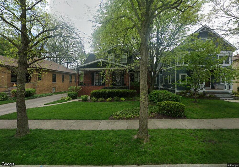
289 Olmsted Rd Riverside, IL 60546
Estimated Value: $485,000 - $649,000
3
Beds
2
Baths
1,918
Sq Ft
$301/Sq Ft
Est. Value
About This Home
This home is located at 289 Olmsted Rd, Riverside, IL 60546 and is currently estimated at $576,518, approximately $300 per square foot. 289 Olmsted Rd is a home located in Cook County with nearby schools including Central Elementary School, L J Hauser Jr High School, and Riverside Brookfield High School.
Ownership History
Date
Name
Owned For
Owner Type
Purchase Details
Closed on
Sep 17, 2009
Sold by
Carlson Donald A and Carlson Janet R
Bought by
Carlson Donald A and Carlson Janet R
Current Estimated Value
Purchase Details
Closed on
Oct 5, 1999
Sold by
Carlson Donald A and Carlson Janet R
Bought by
Carlson Donald A and Carlson Janetr
Create a Home Valuation Report for This Property
The Home Valuation Report is an in-depth analysis detailing your home's value as well as a comparison with similar homes in the area
Home Values in the Area
Average Home Value in this Area
Purchase History
| Date | Buyer | Sale Price | Title Company |
|---|---|---|---|
| Carlson Donald A | -- | None Available | |
| Carlson Donald A | -- | -- |
Source: Public Records
Tax History
| Year | Tax Paid | Tax Assessment Tax Assessment Total Assessment is a certain percentage of the fair market value that is determined by local assessors to be the total taxable value of land and additions on the property. | Land | Improvement |
|---|---|---|---|---|
| 2025 | $11,709 | $40,132 | $8,600 | $31,532 |
| 2024 | $11,709 | $40,132 | $8,600 | $31,532 |
| 2023 | $9,898 | $42,568 | $8,600 | $33,968 |
| 2022 | $9,898 | $32,000 | $7,525 | $24,475 |
| 2021 | $9,571 | $31,999 | $7,525 | $24,474 |
| 2020 | $9,404 | $31,999 | $7,525 | $24,474 |
| 2019 | $9,180 | $32,255 | $6,880 | $25,375 |
| 2018 | $8,907 | $32,255 | $6,880 | $25,375 |
| 2017 | $10,269 | $34,442 | $6,880 | $27,562 |
| 2016 | $8,995 | $28,039 | $6,020 | $22,019 |
| 2015 | $8,746 | $28,039 | $6,020 | $22,019 |
| 2014 | $8,614 | $28,039 | $6,020 | $22,019 |
| 2013 | $9,279 | $32,373 | $6,020 | $26,353 |
Source: Public Records
Map
Nearby Homes
- 284 Blackhawk Rd
- 280 Blackhawk Rd
- 262 Lionel Rd
- 176 Riverside Rd
- 7336 39th St
- 7330 39th St
- 7335 Oakwood Ave Unit P-10
- 7335 Oakwood Ave Unit P-12
- 7335 Oakwood Ave Unit P-8
- 7335 Oakwood Ave Unit P-11
- 7335 Oakwood Ave Unit P-14
- 193 Herrick Rd
- 7048 35th St
- 7316 40th St Unit 2E
- 7316 40th St Unit P-9
- 7316 40th St Unit P-10
- 7316 40th St Unit P-13
- 108 E Burlington St Unit B
- 3829 Wisconsin Ave
- 369 Addison Rd
- 285 Olmsted Rd
- 293 Olmsted Rd
- 281 Olmsted Rd
- 297 Olmsted Rd
- 301 Olmsted Rd
- 277 Olmsted Rd
- 312 Blackhawk Rd
- 308 Blackhawk Rd
- 273 Olmsted Rd
- 305 Olmsted Rd
- 316 Blackhawk Rd
- 304 Blackhawk Rd
- 320 Blackhawk Rd
- 269 Olmsted Rd
- 309 Olmsted Rd
- 300 Blackhawk Rd
- 288 Olmsted Rd
- 284 Olmsted Rd
- 324 Blackhawk Rd
- 292 Olmsted Rd
Your Personal Tour Guide
Ask me questions while you tour the home.