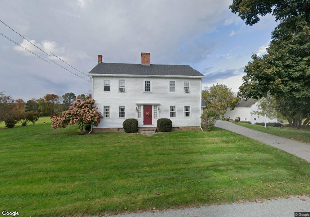
289 W Quasset Rd Woodstock, CT 06281
Estimated Value: $645,521 - $1,121,000
--
Bed
3
Baths
--
Sq Ft
10.5
Acres
About This Home
This home is located at 289 W Quasset Rd, Woodstock, CT 06281 and is currently estimated at $796,880. 289 W Quasset Rd is a home located in Windham County with nearby schools including Woodstock Elementary School and Woodstock Middle School.
Ownership History
Date
Name
Owned For
Owner Type
Purchase Details
Closed on
Sep 9, 1998
Sold by
Peterson Raymond J Est and Burke
Bought by
Motley Robert H
Current Estimated Value
Home Financials for this Owner
Home Financials are based on the most recent Mortgage that was taken out on this home.
Original Mortgage
$184,800
Interest Rate
6.92%
Mortgage Type
Purchase Money Mortgage
Purchase Details
Closed on
Feb 23, 1998
Sold by
Peterson Raymond Est and Burke
Bought by
Deluca John E and Deluca Karen J
Create a Home Valuation Report for This Property
The Home Valuation Report is an in-depth analysis detailing your home's value as well as a comparison with similar homes in the area
Home Values in the Area
Average Home Value in this Area
Purchase History
| Date | Buyer | Sale Price | Title Company |
|---|---|---|---|
| Motley Robert H | $231,000 | -- | |
| Deluca John E | $89,100 | -- |
Source: Public Records
Mortgage History
| Date | Status | Borrower | Loan Amount |
|---|---|---|---|
| Open | Deluca John E | $25,001 | |
| Closed | Deluca John E | $169,800 | |
| Closed | Deluca John E | $175,900 | |
| Closed | Deluca John E | $184,800 |
Source: Public Records
Tax History Compared to Growth
Tax History
| Year | Tax Paid | Tax Assessment Tax Assessment Total Assessment is a certain percentage of the fair market value that is determined by local assessors to be the total taxable value of land and additions on the property. | Land | Improvement |
|---|---|---|---|---|
| 2025 | $9,228 | $378,060 | $52,060 | $326,000 |
| 2024 | $8,711 | $378,060 | $52,060 | $326,000 |
| 2023 | $8,472 | $378,060 | $52,060 | $326,000 |
| 2022 | $7,883 | $378,060 | $52,060 | $326,000 |
| 2021 | $8,138 | $319,140 | $47,840 | $271,300 |
| 2020 | $7,385 | $301,440 | $47,840 | $253,600 |
| 2019 | $7,385 | $301,440 | $47,840 | $253,600 |
| 2018 | $7,385 | $301,440 | $47,840 | $253,600 |
| 2017 | $7,325 | $301,440 | $47,840 | $253,600 |
| 2016 | $6,470 | $269,140 | $55,440 | $213,700 |
| 2015 | $6,287 | $269,140 | $55,440 | $213,700 |
| 2014 | $6,217 | $269,140 | $55,440 | $213,700 |
Source: Public Records
Map
Nearby Homes
- 182 Baxter Rd
- 211 New Sweden Rd
- 134 New Sweden Rd
- 33 Bassett Hill Rd
- 76 Mill Brook Ln
- 70 Brayman Hollow Rd
- 104 Pulpit Rock Rd
- 0 Connecticut 171
- 140 Ragged Hill Rd
- 175 Pulpit Rock Rd
- 172 Peake Brook Rd
- 402 Perrin Rd
- 698 Brayman Hollow Rd
- 101 Child Hill Rd
- 30 Tyrone Rd
- 166 Taft Pond Rd
- 42 Woodstock Meadows Unit 42
- 17 Woodstock Meadows
- 5 Woodstock Hills Dr
- 12 Beech St
- 288 W Quasset Rd
- 330 W Quasset Rd
- 337 W Quasset Rd
- 210 W Quasset Rd
- 226 W Quasset Rd
- 359 W Quasset Rd
- 236 Tyott Rd
- 228 Tyott Rd
- 232B W Quasset Rd
- 220 W Quasset Rd
- 216 W Quasset Rd
- 232 W Quasset Rd
- 234 W Quasset Rd
- 192 W Quasset Rd
- 186 W Quasset Rd
- 198 W Quasset Rd
- 236 W Quasset Rd
- 215 Angel Rd
- 168 W Quasset Rd
- 174 W Quasset Rd