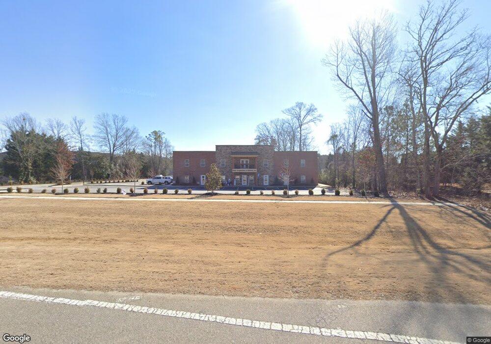
2891 Monroe Hwy Bogart, GA 30622
Estimated Value: $422,000 - $1,935,267
--
Bed
--
Bath
1,100
Sq Ft
$1,116/Sq Ft
Est. Value
About This Home
This home is located at 2891 Monroe Hwy, Bogart, GA 30622 and is currently estimated at $1,227,756, approximately $1,116 per square foot. 2891 Monroe Hwy is a home located in Oconee County with nearby schools including Rocky Branch Elementary School, Malcom Bridge Middle School, and North Oconee High School.
Ownership History
Date
Name
Owned For
Owner Type
Purchase Details
Closed on
Jul 31, 2013
Sold by
Scott Robert S
Bought by
Sapphire Properties Lp
Current Estimated Value
Purchase Details
Closed on
Mar 19, 2013
Sold by
Sapphire Properties Lp
Bought by
Scott Robert S
Purchase Details
Closed on
Dec 13, 2012
Sold by
Burrell Laura L
Bought by
Sapphire Properties Lp
Purchase Details
Closed on
Jun 29, 2004
Sold by
Bratcher Lisa F
Bought by
Burrell Laura L
Create a Home Valuation Report for This Property
The Home Valuation Report is an in-depth analysis detailing your home's value as well as a comparison with similar homes in the area
Home Values in the Area
Average Home Value in this Area
Purchase History
| Date | Buyer | Sale Price | Title Company |
|---|---|---|---|
| Sapphire Properties Lp | -- | -- | |
| Scott Robert S | -- | -- | |
| Sapphire Properties Lp | $155,000 | -- | |
| Burrell Laura L | -- | -- |
Source: Public Records
Mortgage History
| Date | Status | Borrower | Loan Amount |
|---|---|---|---|
| Closed | Sapphire Properties Lp | $0 |
Source: Public Records
Tax History Compared to Growth
Tax History
| Year | Tax Paid | Tax Assessment Tax Assessment Total Assessment is a certain percentage of the fair market value that is determined by local assessors to be the total taxable value of land and additions on the property. | Land | Improvement |
|---|---|---|---|---|
| 2024 | $14,386 | $728,441 | $47,668 | $680,773 |
| 2023 | $13,611 | $661,644 | $44,137 | $617,507 |
| 2022 | $5,367 | $250,156 | $35,310 | $214,846 |
| 2021 | $1,900 | $82,060 | $32,100 | $49,960 |
| 2020 | $3,166 | $136,538 | $29,182 | $107,356 |
| 2019 | $2,989 | $128,899 | $25,375 | $103,524 |
| 2016 | $2,334 | $98,536 | $17,476 | $81,060 |
| 2015 | $1,589 | $66,939 | $17,476 | $49,462 |
| 2014 | $1,442 | $59,392 | $15,888 | $43,504 |
Source: Public Records
Map
Nearby Homes
- 0 Monroe Hwy Unit 1025452
- 1640 Madison Ct
- 2479 Eisenhower Ave
- 1665 Eisenhower Ave
- 1010 Garland Dr
- 1216 Ray's River Run
- 3377 Clayton Dr
- 3451 Clayton Dr
- 6601 Hog Mountain Hwy - Hwy 53 Unit PARCEL B
- 2130 Keeneland Dr
- 2130 Keeneland Dr
- 0 Ruth Jackson Rd Unit 10582108
- 00 Ruth Jackson Rd
- 0 Whitehead Rd Unit CL335631
- 0 Whitehead Rd Unit 10574962
- 3240 Monroe Hwy
- 0 Us 78 Hwy
- 1 Us 78 Hwy
- 1120 Liberty Ln
- 1250 Pete Dickens Rd
- 2891 Monroe Hwy Unit 101
- 2891 Monroe Hwy Unit 205
- 2891 Monroe Hwy Unit 105
- 0 Monroe Hwy Unit 7089672
- 0 Monroe Hwy Unit 7111915
- 2901 Monroe Hwy
- 2881 Monroe Hwy Unit 803
- 2881 Monroe Hwy Unit 701
- 2881 Monroe Hwy Unit 503
- 2881 Monroe Hwy
- 2881 Monroe Hwy Unit 703
- 2881 Monroe Hwy Unit 601
- 2881 Monroe Hwy Unit 801
- 2881 Monroe Hwy Unit 603
- 2881 Monroe Hwy Unit 501
- 1401 Lincoln Dr
- 1511 Lincoln Dr
- 1511 Lincoln Dr
- 0 Lincoln Dr Unit 8441740
- 0 Lincoln Dr Unit 8256377