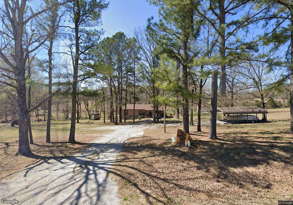
2894 Highway 251 Pocahontas, AR 72455
Estimated Value: $103,000 - $146,000
--
Bed
1
Bath
1,264
Sq Ft
$100/Sq Ft
Est. Value
About This Home
This home is located at 2894 Highway 251, Pocahontas, AR 72455 and is currently estimated at $126,024, approximately $99 per square foot. 2894 Highway 251 is a home located in Randolph County with nearby schools including Maynard Elementary School and Maynard High School.
Ownership History
Date
Name
Owned For
Owner Type
Purchase Details
Closed on
Mar 22, 2014
Sold by
Estate Of Georgie Griggs
Bought by
Dean Johnie and Dean Shannon
Current Estimated Value
Purchase Details
Closed on
Jul 12, 1999
Bought by
Griggs To Griggs
Purchase Details
Closed on
Jun 1, 1994
Bought by
Griggs George Dee and Adda May
Purchase Details
Closed on
Feb 1, 1994
Bought by
Blacker To Blacker
Purchase Details
Closed on
Aug 1, 1991
Bought by
Fears To Blacker
Purchase Details
Closed on
May 1, 1990
Bought by
Hawkins To Fears
Purchase Details
Closed on
Apr 1, 1990
Bought by
Hawkins To Fears
Purchase Details
Closed on
Jan 1, 1978
Bought by
Hawkins To Fears
Create a Home Valuation Report for This Property
The Home Valuation Report is an in-depth analysis detailing your home's value as well as a comparison with similar homes in the area
Home Values in the Area
Average Home Value in this Area
Purchase History
| Date | Buyer | Sale Price | Title Company |
|---|---|---|---|
| Dean Johnie | $56,000 | None Available | |
| Griggs To Griggs | $25,000 | -- | |
| Griggs George Dee | $55,000 | -- | |
| Blacker To Blacker | -- | -- | |
| Fears To Blacker | -- | -- | |
| Hawkins To Fears | -- | -- | |
| Hawkins To Fears | $1,000 | -- | |
| Hawkins To Fears | -- | -- |
Source: Public Records
Tax History Compared to Growth
Tax History
| Year | Tax Paid | Tax Assessment Tax Assessment Total Assessment is a certain percentage of the fair market value that is determined by local assessors to be the total taxable value of land and additions on the property. | Land | Improvement |
|---|---|---|---|---|
| 2024 | $101 | $19,095 | $3,680 | $15,415 |
| 2023 | $151 | $19,095 | $3,680 | $15,415 |
| 2022 | $216 | $19,095 | $3,680 | $15,415 |
| 2021 | $191 | $19,095 | $3,680 | $15,415 |
| 2020 | $124 | $12,260 | $2,210 | $10,050 |
| 2019 | $124 | $12,260 | $2,210 | $10,050 |
| 2018 | $149 | $12,260 | $2,210 | $10,050 |
| 2017 | $99 | $12,705 | $2,210 | $10,495 |
| 2016 | -- | $12,705 | $2,210 | $10,495 |
| 2015 | -- | $12,705 | $2,210 | $10,495 |
| 2014 | -- | $12,705 | $2,210 | $10,495 |
Source: Public Records
Map
Nearby Homes
- TBD Springview Rd
- 268 Bermuda Trail
- TBD Highway 90 W
- 5873 Highway 90 W
- 0 County Road 529
- 175 Country Club Rd
- 901 Cagle Rd
- 771 Red Rock Trail
- Lots 13&14 Shady Hills 2nd
- 808 Shiloh Rd
- 2169 Seagraves Rd
- 2187 Seagraves Rd
- 0 Engelberg Rd Unit MIS25023089
- 1958 Whipperwill Dr
- 2002 Evening Dr
- 2017 Paula St
- 1108 Wilson Dr
- 2014 Dana Dr
- 2004 Rosewood St
- 417 Ridge Rd
- 2917 Highway 251
- 2826 Highway 251
- 2986 Highway 251
- 3021 Highway 251
- 3083 Highway 251
- 3084 Highway 251
- 3166 Highway 251
- 4056 Country Club Rd
- 4018 Country Club Rd
- 2623 Highway 251
- 4105 Country Club Rd
- 3868 Country Club Rd
- 4023 Country Club Rd
- 2508 Highway 251
- 3855 Country Club Rd
- 3879 Country Club Rd
- 3761 Country Club Rd
- 3688 Country Club Rd
- 3717 Country Club Rd
- 2364 Highway 251