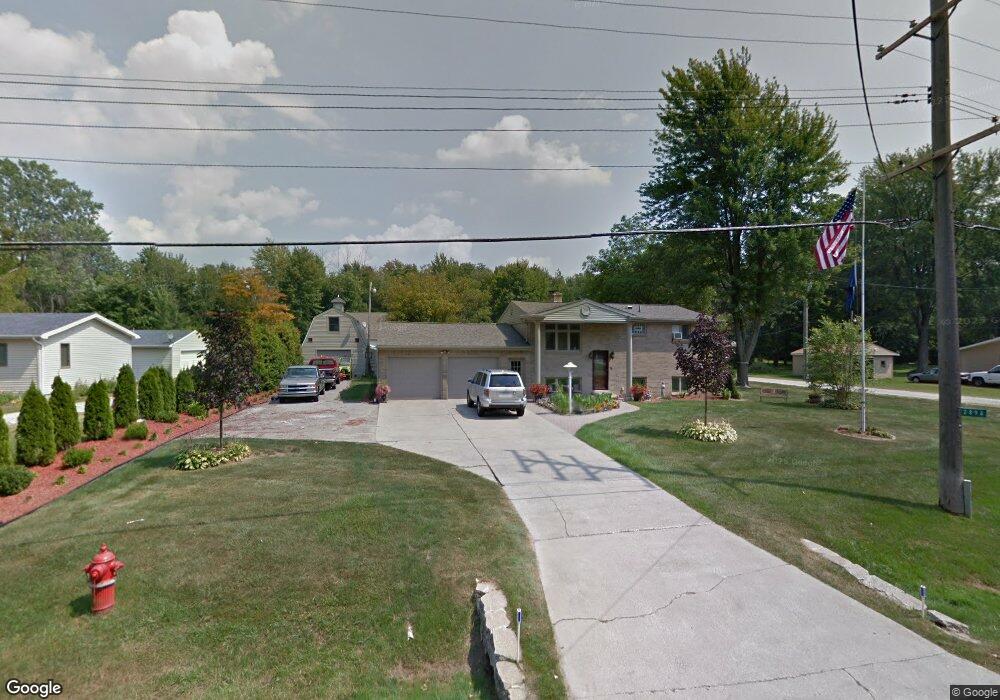
2896 Beach Rd Unit Bldg-Unit Port Huron, MI 48060
Estimated Value: $279,000 - $350,000
--
Bed
2
Baths
1,685
Sq Ft
$194/Sq Ft
Est. Value
About This Home
This home is located at 2896 Beach Rd Unit Bldg-Unit, Port Huron, MI 48060 and is currently estimated at $327,227, approximately $194 per square foot. 2896 Beach Rd Unit Bldg-Unit is a home located in St. Clair County with nearby schools including Michigamme Elementary School, Central Middle School, and Port Huron High School.
Ownership History
Date
Name
Owned For
Owner Type
Purchase Details
Closed on
Jul 6, 2020
Sold by
Curtis Corey and Curtis Elizabeth
Bought by
Willis Michael and Willis Roberte
Current Estimated Value
Home Financials for this Owner
Home Financials are based on the most recent Mortgage that was taken out on this home.
Original Mortgage
$263,000
Outstanding Balance
$233,644
Interest Rate
3.2%
Mortgage Type
VA
Estimated Equity
$93,583
Purchase Details
Closed on
Jan 25, 2018
Sold by
Curtis Corey
Bought by
Curtis Corey and Curtis Elizabeth
Home Financials for this Owner
Home Financials are based on the most recent Mortgage that was taken out on this home.
Original Mortgage
$220,924
Interest Rate
3.75%
Mortgage Type
FHA
Purchase Details
Closed on
Jan 16, 2018
Sold by
Martin Joan G
Bought by
Martin Robert J
Home Financials for this Owner
Home Financials are based on the most recent Mortgage that was taken out on this home.
Original Mortgage
$220,924
Interest Rate
3.75%
Mortgage Type
FHA
Purchase Details
Closed on
Apr 8, 2011
Sold by
Martin Joan G and Martin John W
Bought by
Martin Robert
Purchase Details
Closed on
May 20, 2008
Sold by
Martin John W and Martin Joan
Bought by
Martin Robert
Home Financials for this Owner
Home Financials are based on the most recent Mortgage that was taken out on this home.
Original Mortgage
$140,000
Interest Rate
6.3%
Mortgage Type
Seller Take Back
Create a Home Valuation Report for This Property
The Home Valuation Report is an in-depth analysis detailing your home's value as well as a comparison with similar homes in the area
Home Values in the Area
Average Home Value in this Area
Purchase History
| Date | Buyer | Sale Price | Title Company |
|---|---|---|---|
| Willis Michael | $263,000 | Vanguard Title | |
| Curtis Corey | -- | -- | |
| Curtis Corey | $225,000 | Liberty Title | |
| Martin Robert J | $140,000 | Liberty Title | |
| Martin Robert | -- | None Available | |
| Martin Robert | $140,000 | None Available |
Source: Public Records
Mortgage History
| Date | Status | Borrower | Loan Amount |
|---|---|---|---|
| Open | Willis Michael | $263,000 | |
| Previous Owner | Curtis Corey | $220,924 | |
| Previous Owner | Martin Robert J | $220,924 | |
| Previous Owner | Martin Robert | $140,000 |
Source: Public Records
Tax History Compared to Growth
Tax History
| Year | Tax Paid | Tax Assessment Tax Assessment Total Assessment is a certain percentage of the fair market value that is determined by local assessors to be the total taxable value of land and additions on the property. | Land | Improvement |
|---|---|---|---|---|
| 2025 | $8 | $116,500 | $0 | $0 |
| 2024 | $8 | $116,400 | $0 | $0 |
| 2022 | $1,678 | $96,100 | $0 | $0 |
| 2021 | $2,463 | $89,700 | $0 | $0 |
| 2020 | $2,463 | $80,900 | $80,900 | $0 |
| 2019 | $2,412 | $79,100 | $0 | $0 |
| 2018 | $1,887 | $79,100 | $0 | $0 |
| 2017 | $1,895 | $69,800 | $0 | $0 |
| 2016 | $945 | $69,800 | $0 | $0 |
| 2015 | -- | $56,800 | $56,800 | $0 |
| 2014 | -- | $54,700 | $54,700 | $0 |
| 2013 | -- | $52,400 | $0 | $0 |
Source: Public Records
Map
Nearby Homes
- 2863 Beach Rd
- 0000 W Water St
- 3152 Spruce Dr
- 3115 Spruce Dr
- 2940 Westland Dr
- 4224 Atkins Rd
- 4380 Lapeer Rd
- 3345 Beach Rd
- 3408 N Burwick Dr
- 4361 Peck Rd
- 3230 Range Rd
- 3335 W Water St
- 4608 Huntington Dr
- 3409 Ancient Dr
- 2475 Sharon Ln
- 4460 Cambridge Dr
- 3971 N River Rd
- 3993 N River Rd
- 3228 Turnberry
- 2566 Lewis Dr