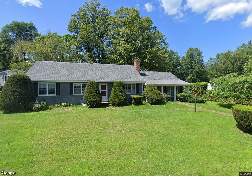
29 Amesbury Rd Contoocook, NH 03229
Contoocook NeighborhoodEstimated Value: $520,000 - $573,000
4
Beds
2
Baths
2,616
Sq Ft
$208/Sq Ft
Est. Value
About This Home
This home is located at 29 Amesbury Rd, Contoocook, NH 03229 and is currently estimated at $543,354, approximately $207 per square foot. 29 Amesbury Rd is a home located in Merrimack County with nearby schools including Harold Martin School, Hopkinton Middle School, and The Contoocook School.
Ownership History
Date
Name
Owned For
Owner Type
Purchase Details
Closed on
May 22, 2013
Sold by
Peters Gwennie M and Peters-Boeckel Stacey A
Bought by
Peters-Boeckel Stacey A and Peters Gwennie M
Current Estimated Value
Create a Home Valuation Report for This Property
The Home Valuation Report is an in-depth analysis detailing your home's value as well as a comparison with similar homes in the area
Home Values in the Area
Average Home Value in this Area
Purchase History
| Date | Buyer | Sale Price | Title Company |
|---|---|---|---|
| Peters-Boeckel Stacey A | -- | -- |
Source: Public Records
Tax History Compared to Growth
Tax History
| Year | Tax Paid | Tax Assessment Tax Assessment Total Assessment is a certain percentage of the fair market value that is determined by local assessors to be the total taxable value of land and additions on the property. | Land | Improvement |
|---|---|---|---|---|
| 2024 | $12,203 | $527,600 | $165,900 | $361,700 |
| 2023 | $11,578 | $315,300 | $99,300 | $216,000 |
| 2022 | $10,676 | $315,300 | $99,300 | $216,000 |
| 2020 | $9,369 | $303,400 | $99,300 | $204,100 |
| 2019 | $9,683 | $314,800 | $99,300 | $215,500 |
| 2018 | $9,604 | $260,700 | $51,300 | $209,400 |
| 2017 | $9,558 | $262,500 | $51,300 | $211,200 |
| 2016 | $8,807 | $262,500 | $51,300 | $211,200 |
| 2015 | $8,825 | $262,500 | $51,300 | $211,200 |
| 2014 | $8,420 | $258,600 | $51,300 | $207,300 |
| 2013 | $8,030 | $279,400 | $89,400 | $190,000 |
Source: Public Records
Map
Nearby Homes
- 104 River Grant Dr
- 108 Maple St
- 38 Woodwells Garrison Rd
- 455 Maple St
- 2 Granite Valley
- 93-1 Pine St
- 0 Pine St Unit 38 5061613
- 0 Pine St Unit 50 5060731
- 356 E Penacook Rd
- 1036 Bound Tree Rd
- 0 Bound Tree Rd Unit 50 5060705
- 656 Dolly Rd
- 105 Clement Hill Rd
- 155 Pamela Dr
- 89 Old Henniker Rd
- 106 Stacey Dr
- 298 Battle St
- 102 Fieldstone Rd
- 00 Deer Meadow Rd Unit 26
- 430 Highland Dr
- 49 Amesbury Rd
- 142 Park Ave
- 11 Amesbury Rd
- 30 Amesbury Rd
- 166 Park Ave
- 108 Park Ln
- 150 Park Ave
- 108 Park Ave
- 108 Park Ave Unit 108 park ave
- 110 Park Ave Unit 110 Park Ave
- 110 Park Ave
- 89 Amesbury Rd
- 174 Park Ave
- 52 Amesbury Rd
- 74 Amesbury Rd
- 98 Park Ave
- 86 Park Ave
- 86 Amesbury Rd
- 105 Park Ave
- 184 Park Ave