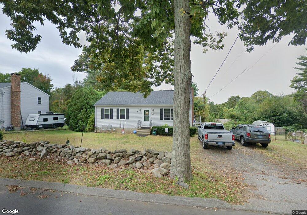
29 Bashan Rd East Haddam, CT 06423
Estimated Value: $332,746 - $365,000
2
Beds
2
Baths
1,040
Sq Ft
$341/Sq Ft
Est. Value
About This Home
This home is located at 29 Bashan Rd, East Haddam, CT 06423 and is currently estimated at $354,187, approximately $340 per square foot. 29 Bashan Rd is a home located in Middlesex County with nearby schools including East Haddam Elementary School, Nathan Hale-Ray Middle School, and Nathan Hale-Ray High School.
Ownership History
Date
Name
Owned For
Owner Type
Purchase Details
Closed on
Mar 16, 1995
Sold by
Boothroyd Debra A
Bought by
Gerhart Andrew S and Gerhart Melinda
Current Estimated Value
Home Financials for this Owner
Home Financials are based on the most recent Mortgage that was taken out on this home.
Original Mortgage
$90,000
Interest Rate
8.89%
Mortgage Type
Unknown
Create a Home Valuation Report for This Property
The Home Valuation Report is an in-depth analysis detailing your home's value as well as a comparison with similar homes in the area
Home Values in the Area
Average Home Value in this Area
Purchase History
| Date | Buyer | Sale Price | Title Company |
|---|---|---|---|
| Gerhart Andrew S | $109,900 | -- |
Source: Public Records
Mortgage History
| Date | Status | Borrower | Loan Amount |
|---|---|---|---|
| Open | Gerhart Andrew S | $25,000 | |
| Open | Gerhart Andrew S | $164,000 | |
| Closed | Gerhart Andrew S | $153,000 | |
| Closed | Gerhart Andrew S | $90,000 |
Source: Public Records
Tax History Compared to Growth
Tax History
| Year | Tax Paid | Tax Assessment Tax Assessment Total Assessment is a certain percentage of the fair market value that is determined by local assessors to be the total taxable value of land and additions on the property. | Land | Improvement |
|---|---|---|---|---|
| 2025 | $4,488 | $159,960 | $65,670 | $94,290 |
| 2024 | $4,281 | $159,960 | $65,670 | $94,290 |
| 2023 | $4,119 | $159,960 | $65,670 | $94,290 |
| 2022 | $4,002 | $125,900 | $45,120 | $80,780 |
| 2021 | $3,832 | $125,900 | $45,120 | $80,780 |
| 2020 | $3,832 | $125,900 | $45,120 | $80,780 |
| 2019 | $3,832 | $125,900 | $45,120 | $80,780 |
| 2018 | $3,734 | $125,900 | $45,120 | $80,780 |
| 2017 | $3,987 | $134,790 | $45,960 | $88,830 |
| 2016 | $3,956 | $134,790 | $45,960 | $88,830 |
| 2015 | $3,866 | $134,790 | $45,960 | $88,830 |
| 2014 | $3,760 | $134,750 | $45,920 | $88,830 |
Source: Public Records
Map
Nearby Homes
- 114 Lakeside Dr
- 0 Lakeside Dr
- 112 Schulman Veslak Rd
- 8 Tom Rd
- 63 Schulman Veslak Rd
- 42 Dogwood Rd
- 45 Alger Rd
- 53 Falls Bashan Rd
- 55 Bogel Rd
- 206 Sheepskin Hollow Rd
- 21 Olmstead Rd
- 23 Olmstead Rd
- 154 Falls Rd
- 53 Shanaghans Rd
- 53 Falls Rd
- 5 Joe Williams Rd
- 2 Acorn Dr
- 80 Orchard Rd
- 331 Tater Hill Rd
- 317 Tater Hill Rd