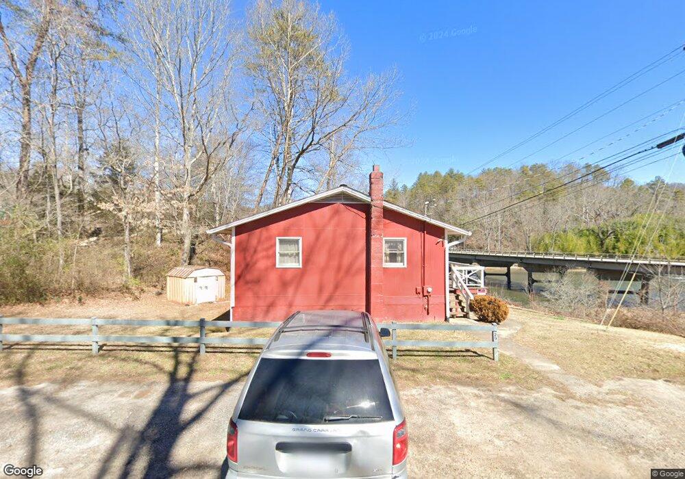
29 Bennett Rd Franklin, NC 28734
Estimated Value: $232,404 - $286,000
4
Beds
2
Baths
832
Sq Ft
$316/Sq Ft
Est. Value
About This Home
This home is located at 29 Bennett Rd, Franklin, NC 28734 and is currently estimated at $262,601, approximately $315 per square foot. 29 Bennett Rd is a home located in Macon County with nearby schools including Iotla Valley Elementary School, Mountain View Intermediate School, and Macon Middle School.
Ownership History
Date
Name
Owned For
Owner Type
Purchase Details
Closed on
Dec 20, 2021
Sold by
Anthony Stewart Larry and Anthony Kathy B
Bought by
Larry Anthony Stewart And Kathy B Stewart Fam and Stewart Kath
Current Estimated Value
Purchase Details
Closed on
May 11, 2021
Sold by
Stewart Faye N
Bought by
Stewart Larry Anthony
Purchase Details
Closed on
Jul 1, 2019
Sold by
Stewart Jay Maurice and Stewart Erin
Bought by
Stewart Larry Anthony
Purchase Details
Closed on
Mar 3, 1997
Sold by
Stewart Faye Larue Life Estate
Bought by
Stewart, Faye Larue Life Estate
Create a Home Valuation Report for This Property
The Home Valuation Report is an in-depth analysis detailing your home's value as well as a comparison with similar homes in the area
Home Values in the Area
Average Home Value in this Area
Purchase History
| Date | Buyer | Sale Price | Title Company |
|---|---|---|---|
| Larry Anthony Stewart And Kathy B Stewart Fam | $2,022 | None Listed On Document | |
| Stewart Larry Anthony | -- | None Available | |
| Stewart Larry Anthony | -- | None Available | |
| Stewart, Faye Larue Life Estate | -- | -- |
Source: Public Records
Tax History
| Year | Tax Paid | Tax Assessment Tax Assessment Total Assessment is a certain percentage of the fair market value that is determined by local assessors to be the total taxable value of land and additions on the property. | Land | Improvement |
|---|---|---|---|---|
| 2025 | $728 | $178,680 | $103,750 | $74,930 |
| 2024 | $728 | $178,680 | $103,750 | $74,930 |
| 2023 | $665 | $178,780 | $103,750 | $75,030 |
| 2022 | $665 | $118,350 | $68,000 | $50,350 |
| 2021 | $646 | $118,450 | $68,000 | $50,450 |
| 2020 | $616 | $118,450 | $68,000 | $50,450 |
| 2018 | $577 | $119,430 | $61,200 | $58,230 |
| 2017 | $577 | $119,430 | $61,200 | $58,230 |
| 2016 | $565 | $119,430 | $61,200 | $58,230 |
| 2015 | $542 | $119,430 | $61,200 | $58,230 |
| 2014 | $574 | $162,460 | $96,000 | $66,460 |
| 2013 | -- | $162,460 | $96,000 | $66,460 |
Source: Public Records
Map
Nearby Homes
- Lot 24 Rivers Edge Trail
- 55 Katydid Ln
- Lot 5 Quail Hollow
- 578 Piney Grove Rd
- 225 Iotla Church Rd
- 1486 Piney Grove Rd
- Lot 4 Piney Grove Rd
- 0 Piney Grove Rd Unit 1 CAR4288689
- 0 Piney Grove Rd Unit 26036767
- 9999 Cowee Woods Dr
- 00 Lot 5 Broken Antler Woods
- 1616 Riverbend Rd
- 153 Breezy Oak Ln
- 381 Parsons Way
- Lot #3 Stonebrook Heights
- 30 Maxies Corner Rd
- 89 Nettie Hurst Rd
- Lot 31 Lyle Knob Rd
- 0 Rose Creek Rd Unit 26040547
- 117 Holly Ln
- 80 Bennett Rd
- 80 Olsen Dr
- 4190 Bryson City Rd
- 105 Olsen Dr
- 44 Olsen Dr
- 59 Olsen Dr
- 59 Rose Creek Rd
- 55 Olsen Dr
- 3085 Sanderstown Rd
- 245 Bennett Rd
- 37 Rolling Meadows Dr
- 4139 Bryson City Rd
- 4135 Bryson City Rd
- 17 Tanasi Landing Place
- 145 Rose Creek Rd
- 0 Rolling Meadows Dr
- 74 Rolling Meadows Dr
- 0 Tanasi Landing Place
- 00 Tanasi Landing Place
- 4615 Bryson City Rd
Your Personal Tour Guide
Ask me questions while you tour the home.