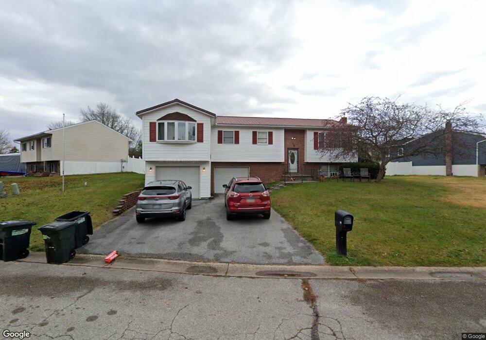
29 Bonniefield Cir Unit 59 Gettysburg, PA 17325
Estimated Value: $266,000 - $308,000
4
Beds
3
Baths
1,468
Sq Ft
$195/Sq Ft
Est. Value
About This Home
This home is located at 29 Bonniefield Cir Unit 59, Gettysburg, PA 17325 and is currently estimated at $286,562, approximately $195 per square foot. 29 Bonniefield Cir Unit 59 is a home located in Adams County with nearby schools including Rolling Acres El School, Maple Avenue Middle School, and Littlestown Senior High School.
Ownership History
Date
Name
Owned For
Owner Type
Purchase Details
Closed on
May 1, 1986
Bought by
Eriksen Michael J and Eriksen Sharlene D
Current Estimated Value
Create a Home Valuation Report for This Property
The Home Valuation Report is an in-depth analysis detailing your home's value as well as a comparison with similar homes in the area
Home Values in the Area
Average Home Value in this Area
Purchase History
| Date | Buyer | Sale Price | Title Company |
|---|---|---|---|
| Eriksen Michael J | $49,500 | -- |
Source: Public Records
Tax History Compared to Growth
Tax History
| Year | Tax Paid | Tax Assessment Tax Assessment Total Assessment is a certain percentage of the fair market value that is determined by local assessors to be the total taxable value of land and additions on the property. | Land | Improvement |
|---|---|---|---|---|
| 2025 | $4,643 | $188,700 | $36,500 | $152,200 |
| 2024 | $3,871 | $188,700 | $36,500 | $152,200 |
| 2023 | $3,756 | $188,700 | $36,500 | $152,200 |
| 2022 | $3,637 | $188,700 | $36,500 | $152,200 |
| 2021 | $3,519 | $188,700 | $36,500 | $152,200 |
| 2020 | $3,691 | $188,700 | $36,500 | $152,200 |
| 2019 | $3,615 | $188,700 | $36,500 | $152,200 |
| 2018 | $3,338 | $188,700 | $36,500 | $152,200 |
| 2017 | $3,244 | $188,700 | $36,500 | $152,200 |
| 2016 | -- | $188,700 | $36,500 | $152,200 |
| 2015 | -- | $188,700 | $36,500 | $152,200 |
| 2014 | -- | $188,700 | $36,500 | $152,200 |
Source: Public Records
Map
Nearby Homes
- 28 Bonniefield Cir Unit 25
- 67 Cedarfield Dr
- 1 Hickory Ave
- 8 Maple St
- 13 N Pine St
- 780 White Hall Rd
- 860 Bon Ox Rd
- 464 Locust Ln
- 549 Grant Dr Unit 549
- 871 Sherman Dr Unit 871
- 948 Heritage Dr Unit 948
- 0 Littlestown Rd
- 4900 Hanover Rd
- 345 Smoketown Rd
- 70 Sells Station Rd
- 80 Sells Station Rd
- 930 Hoffman Rd
- 279 Longstreet Dr Unit 279
- 76 Kohler School Rd
- 157 Linda Dr
- 31 Bonniefield Cir Unit 60
- 27 Bonniefield Cir Unit 58
- 33 Bonniefield Cir Unit 61
- 25 Bonniefield Cir Unit 57
- 40 Bonniefield Cir Unit 74
- 42 Bonniefield Cir Unit 73
- 12 W Bonniefield Dr Unit 75
- 44 Bonniefield Cir Unit 72
- 38 Bonniefield Cir Unit 20
- 35 Bonniefield Cir Unit 62
- 23 Bonniefield Cir Unit 56
- 10 W Bonniefield Dr Unit 76
- 46 Bonniefield Cir Unit 71
- 36 Bonniefield Cir Unit 21
- 37 Bonniefield Cir Unit 63
- 2 Carole Ct Unit 19
- 34 Bonniefield Cir Unit 22
- 8 W Bonniefield Dr Unit 77
- 1 S Bonniefield Dr Unit 70
- 4 Carole Ct Unit 18