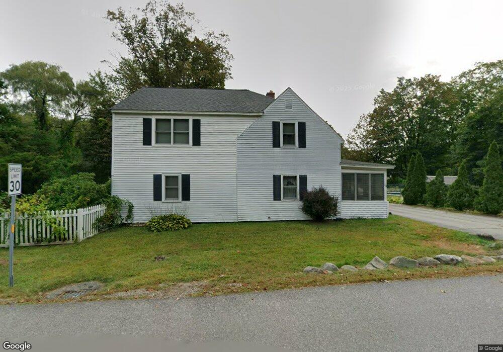
29 Border St Amherst, NH 03031
Estimated Value: $506,393 - $642,000
4
Beds
2
Baths
2,232
Sq Ft
$248/Sq Ft
Est. Value
About This Home
This home is located at 29 Border St, Amherst, NH 03031 and is currently estimated at $554,348, approximately $248 per square foot. 29 Border St is a home located in Hillsborough County with nearby schools including Wilkins Elementary School, Amherst Middle School, and Souhegan Cooperative High School.
Ownership History
Date
Name
Owned For
Owner Type
Purchase Details
Closed on
Apr 17, 2017
Sold by
Tower Dustin and Jameson George T
Bought by
Tower Dustin and Tower Erin
Current Estimated Value
Purchase Details
Closed on
Jun 18, 2015
Sold by
Holt Charles K and Holt Donald K
Bought by
Tower Dustin and Jameson George T
Purchase Details
Closed on
Oct 3, 2011
Sold by
Burke Ian R and Burke Vicki L
Bought by
Tower Dustin and Jameson George T
Home Financials for this Owner
Home Financials are based on the most recent Mortgage that was taken out on this home.
Original Mortgage
$178,263
Interest Rate
4.15%
Mortgage Type
Purchase Money Mortgage
Purchase Details
Closed on
Jun 14, 2006
Sold by
Eisenhauer Peter R and Eisenhauer Mary
Bought by
Burke Ian R and Burke Vicki L
Purchase Details
Closed on
Jun 24, 1999
Sold by
Werner Franklin J and Werner Tina G
Bought by
Eisenhauer Mary and Eisenhauer Peter R
Create a Home Valuation Report for This Property
The Home Valuation Report is an in-depth analysis detailing your home's value as well as a comparison with similar homes in the area
Home Values in the Area
Average Home Value in this Area
Purchase History
| Date | Buyer | Sale Price | Title Company |
|---|---|---|---|
| Tower Dustin | -- | -- | |
| Tower Dustin | $3,200 | -- | |
| Tower Dustin | $182,900 | -- | |
| Burke Ian R | $235,000 | -- | |
| Eisenhauer Mary | $129,900 | -- |
Source: Public Records
Mortgage History
| Date | Status | Borrower | Loan Amount |
|---|---|---|---|
| Previous Owner | Eisenhauer Mary | $178,263 | |
| Previous Owner | Eisenhauer Mary | $215,000 | |
| Previous Owner | Eisenhauer Mary | $21,289 |
Source: Public Records
Tax History Compared to Growth
Tax History
| Year | Tax Paid | Tax Assessment Tax Assessment Total Assessment is a certain percentage of the fair market value that is determined by local assessors to be the total taxable value of land and additions on the property. | Land | Improvement |
|---|---|---|---|---|
| 2024 | $7,622 | $332,400 | $144,500 | $187,900 |
| 2023 | $7,273 | $332,400 | $144,500 | $187,900 |
| 2022 | $7,024 | $332,400 | $144,500 | $187,900 |
| 2021 | $7,083 | $332,400 | $144,500 | $187,900 |
| 2020 | $0 | $246,800 | $115,600 | $131,200 |
| 2019 | $8,304 | $236,000 | $115,600 | $120,400 |
| 2018 | $3,218 | $236,000 | $115,600 | $120,400 |
| 2017 | $6,138 | $236,000 | $115,600 | $120,400 |
| 2016 | $0 | $236,000 | $115,600 | $120,400 |
| 2015 | $5,352 | $202,100 | $124,600 | $77,500 |
| 2014 | $5,388 | $202,100 | $124,600 | $77,500 |
| 2013 | $5,346 | $202,100 | $124,600 | $77,500 |
Source: Public Records
Map
Nearby Homes
- 0 Claude Rd
- 7 Fox Run Rd
- 40 North St
- 377 Nashua St
- 18 Adams St
- 30 Perkins St Unit 1
- 26 Oak St
- 7 Miles Rd
- 57 Patch Hill Ln
- 3 Abby Ln Unit 2
- 25 Atherton Ln
- 7 Corduroy Rd Unit 20
- 24 Spaulding St
- 6 Whittemore Ln
- 229 Mont Vernon Rd
- 44 Osgood Rd
- 135 Amherst St Unit 28
- 33 David Dr
- 9 Northfield Rd
- 61 W Meadow Ct
- 30 Border St
- 24 Merrimack Rd
- 26 Merrimack Rd
- 31 Border St
- 18 Merrimack Rd
- 32 Border St
- 26 Border St
- 26 Border St
- 25 Border St
- 34 Border St
- 24 Border St
- 28 Merrimack Rd
- 22 Border St
- 23 Border St
- 30 Merrimack St Unit 3
- 30 Merrimack St Unit 4
- 30 Merrimack St Unit 1
- 35 Merrimack St
- 3 Merrimack Rd Unit 3
- 27 Merrimack St