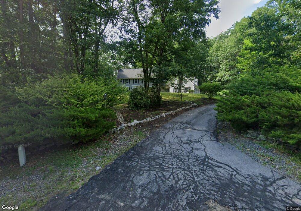
29 Bracken Cir Bedford, NH 03110
Bedford NeighborhoodEstimated Value: $904,269 - $1,106,000
4
Beds
3
Baths
3,882
Sq Ft
$262/Sq Ft
Est. Value
About This Home
This home is located at 29 Bracken Cir, Bedford, NH 03110 and is currently estimated at $1,018,817, approximately $262 per square foot. 29 Bracken Cir is a home located in Hillsborough County with nearby schools including Mckelvie Intermediate School, Ross A. Lurgio Middle School, and Bedford High School.
Ownership History
Date
Name
Owned For
Owner Type
Purchase Details
Closed on
Feb 21, 2024
Sold by
White Dylan C
Bought by
Maguire Lindsay
Current Estimated Value
Purchase Details
Closed on
May 9, 2011
Sold by
Mary P Costello Ret and Costello
Bought by
White Dylan C and Maguire Lindsay M
Home Financials for this Owner
Home Financials are based on the most recent Mortgage that was taken out on this home.
Original Mortgage
$405,000
Interest Rate
4.82%
Mortgage Type
Purchase Money Mortgage
Create a Home Valuation Report for This Property
The Home Valuation Report is an in-depth analysis detailing your home's value as well as a comparison with similar homes in the area
Home Values in the Area
Average Home Value in this Area
Purchase History
| Date | Buyer | Sale Price | Title Company |
|---|---|---|---|
| Maguire Lindsay | -- | None Available | |
| White Dylan C | $450,000 | -- |
Source: Public Records
Mortgage History
| Date | Status | Borrower | Loan Amount |
|---|---|---|---|
| Previous Owner | White Dylan C | $405,000 | |
| Previous Owner | White Dylan C | $100,000 |
Source: Public Records
Tax History
| Year | Tax Paid | Tax Assessment Tax Assessment Total Assessment is a certain percentage of the fair market value that is determined by local assessors to be the total taxable value of land and additions on the property. | Land | Improvement |
|---|---|---|---|---|
| 2024 | $12,895 | $815,600 | $283,400 | $532,200 |
| 2023 | $12,071 | $815,600 | $283,400 | $532,200 |
| 2022 | $10,896 | $619,100 | $210,000 | $409,100 |
| 2021 | $10,611 | $619,100 | $210,000 | $409,100 |
| 2020 | $10,104 | $504,700 | $161,500 | $343,200 |
| 2019 | $9,564 | $504,700 | $161,500 | $343,200 |
| 2018 | $9,761 | $478,500 | $161,500 | $317,000 |
| 2017 | $9,048 | $478,500 | $161,500 | $317,000 |
| 2016 | $9,688 | $433,100 | $123,600 | $309,500 |
| 2015 | $9,857 | $433,100 | $123,600 | $309,500 |
| 2014 | $9,745 | $433,100 | $123,600 | $309,500 |
| 2013 | $9,602 | $433,100 | $123,600 | $309,500 |
Source: Public Records
Map
Nearby Homes
- 27 Beaver Ln
- 301 N Amherst Rd
- 15 Grey Rock Rd
- 258 N Amherst Rd Unit 34
- 7 Amber Ln
- 2 Baxter Ln
- 4 Miriam Rd
- 8 Miriam Rd
- 24 Brook Rd
- 4 Jenkins Rd Unit Lot 4 - Modern Farm
- 65 Jenkins Rd Unit Lot 4 - The Hannah
- 4 Milford St
- 4 McQuade Brook Rd
- 20 Greatstone Dr
- 3 Westview Rd Unit Lot 3 - The Saffron
- 6 Autumn Ln
- 4 Westview Rd Unit Lot 4 - Hannah Floor
- 22 Parker Dr
- 18 Sprague Mill Rd
- 53 Seton Dr
- 4 McAfee Farm Rd
- 4 McAfee Farm Rd
- 31 Bracken Cir
- 8 McAfee Farm Rd
- 30 Bracken Cir
- 35 Bracken Cir
- 12 McAfee Farm Rd
- 3 McAfee Farm Rd
- 62 Bracken Cir
- 14 McAfee Farm Rd
- 38 Bracken Cir
- 37 Bracken Cir
- 18 Old Evergreen Rd
- 56 Bracken Cir
- 7 McAfee Farm Rd
- 15 McAfee Farm Rd
- 15 Old Evergreen Rd
- 61 Bracken Cir
- 20 McAfee Farm Rd
- 17 McAfee Farm Rd
Your Personal Tour Guide
Ask me questions while you tour the home.